Downtown Indianapolis
The evolving heart of the city
By David G. Vanderstel | 2021
The Mile Square, the one-square-mile original plat of Indianapolis that is considered downtown, has been at the core of the growth and development of the Hoosier capital since its founding. Since its platting in 1821, the City of Indianapolis has expanded to nearly 370 square miles and a consolidated city-county population of nearly 1 million. Highways have extended the reach of the city, making it the center of a metropolitan area that spans 11 counties and almost 2 million residents. Nevertheless, the Mile Square remains the physical, economic, political, and cultural center of Indianapolis.
Early 19th Century
The Plat
Following the Indiana General Assembly’s decision to relocate the state capital from Corydon in southern Indiana to the central part of the state, Congress donated four sections of land for the site. Each section equaled 640 acres or one square mile. The Assembly established a commission to plan and lay out the town, appointing Christopher Harrison, James Jones, and Samuel P. Booker for that responsibility. Harrison selected Englishman Elias P. Fordham and Scotsman Alexander Ralston to survey the proposed site. Interestingly, Harrison had met Ralston in Salem, Indiana, where Ralston had relocated after working on Pierre L’Enfant’s plans for laying out the nation’s capital.
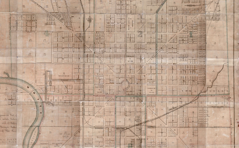
Indianapolis, from its beginning, was a “planned” town, originating with the design developed by Ralston. His design called for a one-mile-square plat located at the center of the four-section Congressional donation. Local lore claims that Ralston placed his design there because he never envisioned the town to become larger, although the commissioners who had selected the capital site along White River anticipated growth in coming years due to its location on what they perceived as a major waterway. In addition, the General Assembly in 1821 began to petition Congress to appropriate funds to extend the planned National Road through the new capital. The route was surveyed in 1827, construction began in 1829 and was completed by 1834. Clearly, the legislature expected the town to grow.
The plat had nine north-south streets and nine east-west streets, all 90 feet wide, thus forming a grid within the square. The main east-west street—later Washington Street—would be 120 feet wide. The four central blocks of the plat were designated as “Governor’s Square.” It featured a raised area with sugar maples for the governor’s residence, surrounded by an 80-foot-wide circular street. Four avenues radiated at 45-degree angles from Governor’s Square. The only alteration to the grid occurred in the southeastern corner of the Mile Square to accommodate Pogue’s Run, a creek that meandered through the survey. North, South, East, and West streets were not present on the original 1821 plat but were added later to provide defined boundaries for the town. Early resident James Blake later suggested that these border streets “would make a pleasant four-mile drive around the city in fifty years or so.”
Within the Mile Square, Ralston set aside specific squares for public use. He designated one square on the east side for a county courthouse and another on the west side for a state house. Close to each public building was a half square reserved for a public market. Ralston appointed squares #12, #19, and #20 “for religious purposes,” which apparently were not used as that designation is absent from the updated 1831 plat. He also designated square #25 as “University Square” and square #29 as “Hospital Square,” clearly indicating his belief that the town would grow.
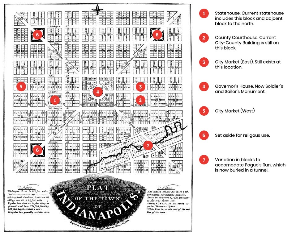
The Indiana State Sentinel of August 11, 1821, announced a public auction of land in the new settlement. “The village is located on a high dry plain which extends for several miles perfectly free of floods, marshes, and ponds… beautiful and fertile… and probably the best land in the state.” Some local observers noted that the “outlots” immediately outside the Mile Square were low and swampy, thus deterring individuals from settling. By spring 1822, however, the Indiana Gazette estimated the local population to be 500 with 400 living within the Mile Square.
Early Growth
Following the initial settlement of early land purchasers, Indianapolis became the working state capital in late fall 1824 when offices were transported from Corydon. The first legislature met in the Marion County Courthouse on January 10, 1825. Two years later, the General Assembly voted to erect a house for the governor in Governor’s Square, appropriating $4000 for its construction (around $104,000 in 2020). Early accounts indicate that it was a two-story yellow brick house with the first floor raised some six feet above ground. According to oral tradition, the wife of Governor James Brown Ray refused to live in the house, appalled that the public would be able to see her weekly laundry. Whatever the case, no governor ever used the house as a residence. Rather, it was used as early state offices, the first state library, and offices for the state bank.
During its first decade, the Mile Square witnessed the emergence of an early business district. General stores, taverns, travelers’ houses, a livery and stables, and assorted artisans’ shops populated the area. Many merchants who advertised themselves as purveyors of dry goods, groceries, and hardware located along Washington Street, thus beginning the street’s long association with business in the city. A saw and grist mill opened outside the square along White River. By the 1840s, most of the original log houses and buildings were gone, replaced by frame and brick buildings.
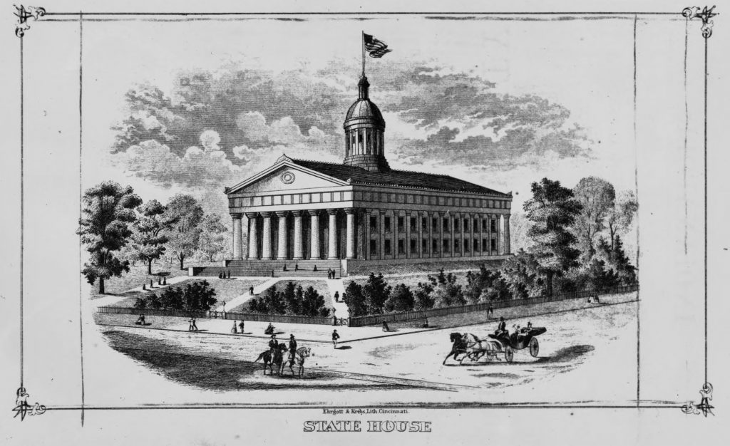
Another sign of Indianapolis’ growth was the General Assembly’s decision in 1830 to construct a separate state house on the square designated in Ralston’s plan. As a result of an architectural competition, the Assembly chose the design by the firm of Town and Davis of New York. The building was a Greek Doric-style temple with an Italian Renaissance dome. Completed in 1835 for $60,000 (around $1.76 million in 2020), the new brick and stucco state house stood at Washington and Tennessee (now Capitol) streets. The first floor housed the governor’s office, assorted legislative rooms, and the Indiana State Library while the second floor housed the House and Senate chambers.
Over the next several decades, the building became overcrowded and began to deteriorate, forcing the General Assembly to construct a new structure in the 1880s. Its most notable non-governmental use was to house the body of Abraham Lincoln, which laid in state on April 30, 1865, on its way to Springfield, Illinois, for burial.
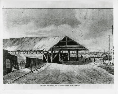
Improved transportation was further stimulus for the growth of Indianapolis. The early 1830s witnessed the construction of the National Road, which passed through Indianapolis by way of Washington Street, thus providing access from the east to the emerging west. At the same time, the General Assembly passed the Mammoth Improvements Bill in 1836. It provided funding for building a network of roads, canals, and railroads throughout the state. The nationwide economic panic of 1837 and Indiana’s subsequent bankruptcy in 1839 halted construction on these improvements and temporarily dashed hopes for improved connections with the wider world.
The arrival of the Madison and Indianapolis Railroad in the fall of 1847 was such a step forward. The Indiana Journal of November 2, 1847, reported that “the completion of the railroad has transformed [the city’s] every feature, and one, looking upon its crowded thoroughfare and listening to the din and confusion of its commerce, could scarce conceive it once had been ‘the sweetest village of the plain.’” This “railroad fever” culminated in the arrival of seven other rail lines by 1855. The rails not only connected the city with more distant markets such as Cincinnati, Chicago, Detroit, Louisville, and St. Louis, but also tied central Indiana farms to Indianapolis as a center for processing and shipping agricultural products. The railroad would remain a key part of the city’s ongoing development well into the 20th century.
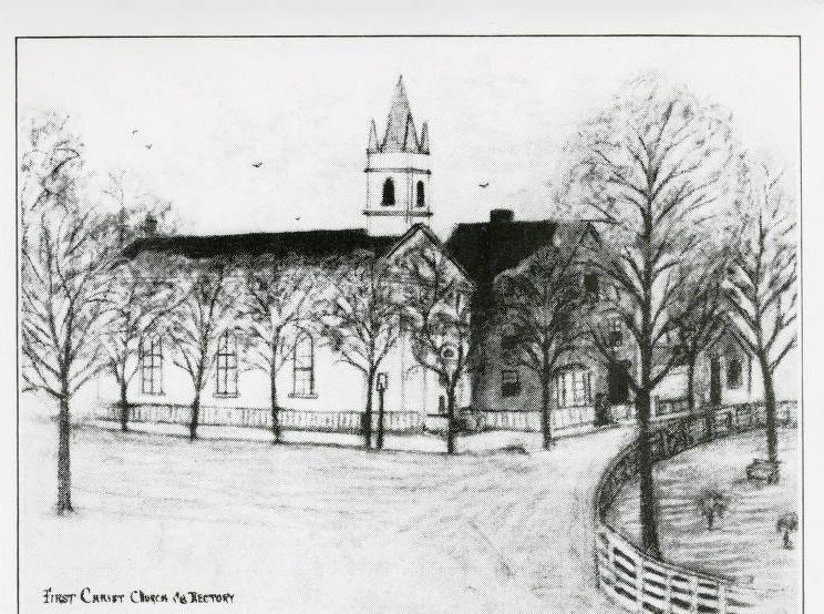
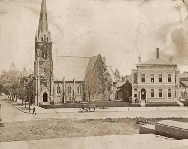
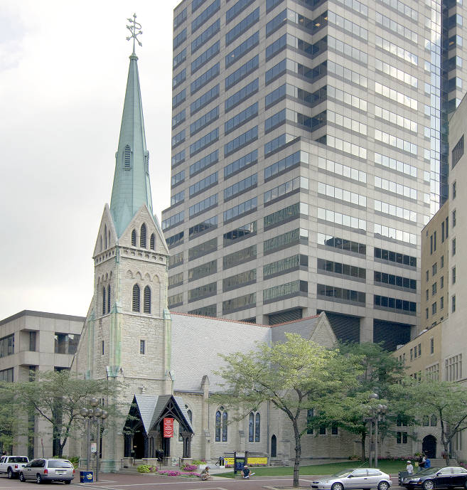
Accompanying the growing population was an emerging cultural landscape. In the earliest years, a log school opened at Washington and Illinois streets. The Indianapolis Thespian Corps (c. 1840) established a small theater and staged Pocahontas by Robert Dale Owen as its first production. The unused Governor’s House became the site of lectures, meetings of benevolent and missionary societies, inaugurations of governors, and even a Washington birthday anniversary ball in 1838. The Circle also became the home to the city’s first religious institutions—Wesley (Methodist) Chapel (1829); First Presbyterian (1840); Second Presbyterian (1841); and Christ Episcopal Church (1838; current building dates to 1858), which remains as the only physical reminder of the city’s earliest years.
Late 19th Century
Modernization
Between 1850 and 1900, the Indianapolis population grew from 8,091 to 169,164, which extended the boundaries of the capital beyond the Mile Square. No longer was it an isolated frontier town. Rather, Indianapolis had developed an increasingly diverse economy that included flour mills, pork packing, blacksmith and machine shops, wagon and wheel works, and assorted other manufactories. This economic development was mostly attributed to railroads, leading city promoters to proclaim Indianapolis to be “a railroad city.”
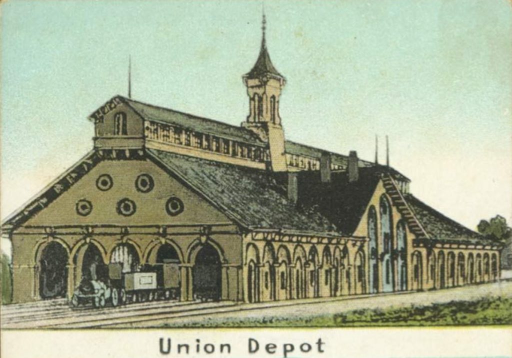
The increased economic activity resulted in a transformation of the original Mile Square. In 1852-1853, a railroad depot was built at the southern edge of the Mile Square, handling a growing number of rail lines and contributing to the expanding economy. The structure designed by Indianapolis-based architect Joseph Curzon was the first union station in the United States. Streetlamps were installed along Washington Street between Meridian and Pennsylvania streets in 1853, allowing merchants to maintain longer business hours.
In April 1857, the house on the Circle once designated as the “governor’s mansion” was demolished after becoming a public eyesore. The Indianapolis Daily Journal had noted as early as August 5, 1851, the “shabby condition” of the building and that:
We hope at no distant day to see the present dilapidated building superseded by a magnificent structure for the accommodation of the United States Officers… or the Circle converted by the beautifying hand of improvement into a Park with all its refreshing concomitants of luxuriant grass, tastefully trimmed shrubs, handsome and shady trees, and perhaps fountains and statues the whole surrounded by a tasteful iron railing.
In 1867, Governor’s Circle was renamed Circle Park. The land was graded and walks and benches were installed.
Two blocks further north, another location became the site of a public “greenspace.” University Square, part of Ralston’s original plan, had been designated for a state university, which was never established there. Instead, the first county seminary stood on the site (1833-1853) which was then replaced by the first Indianapolis High School (1853-1858). After the building’s demolition, the site was used to drill Union troops during the Civil War. In 1876 University Park opened, reflecting the nation’s “urban parks” movement inspired by New York City’s Central Park. The park included walks, grass, and a bandstand. By the late 19th and early 20th centuries, it would become a site for assorted statuary and a fountain.
Other significant changes occurred in the Mile Square during the 1860s and 1870s. There were now about 9 miles of streets and 18 miles of sidewalk graded and leveled. Hundreds of new buildings emerged near the outer perimeter of the Mile Square. A very noticeable change around the Circle occurred when both First Presbyterian and Wesley Chapel relocated their congregations. Wesley Chapel sold its building to the Indiana State Sentinel, a Democratic paper, which later offered upper floor space to the Indianapolis News. First Presbyterian sold its building to the Indianapolis Journal, a Republican newspaper, which demolished the church and erected the five-story Indianapolis Journal Building.
A New Built Environment
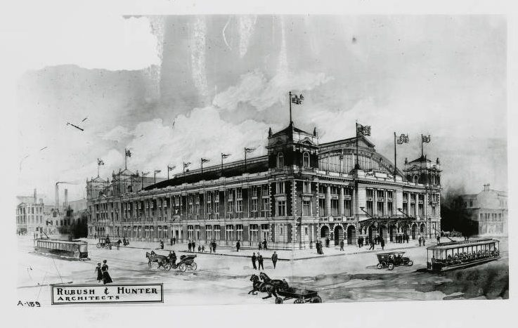
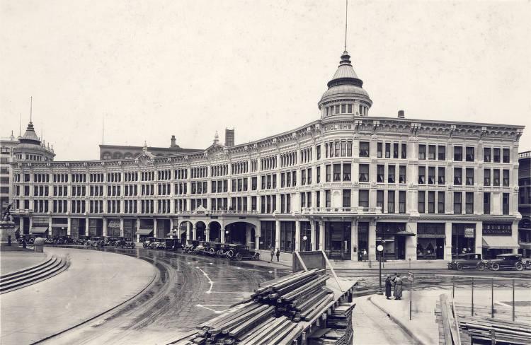
The landscape of the Circle continued to change, especially in the late 1870s and 1880s. Indianapolis businessman and politician William Hayden English acquired several properties, including the former Second Presbyterian building, on the northwest quadrant of the Circle. There, he constructed the English Hotel and Opera House modeled after the New York Grand Opera House. It opened in September 1880. English followed by constructing the English Hotel in two sections (1884 and 1896), incorporating his opera house into the complex. Only blocks away from the Circle, the city opened Tomlinson Hall in 1886 as a public market (first floor) and public meeting space (second floor). The large brick building hosted music performances, expositions, political gatherings, meetings of the Grand Army of the Republic (GAR), a fraternal organization of Union Civil War veterans, and served as a shelter for victims of the devastating 1913 flood.
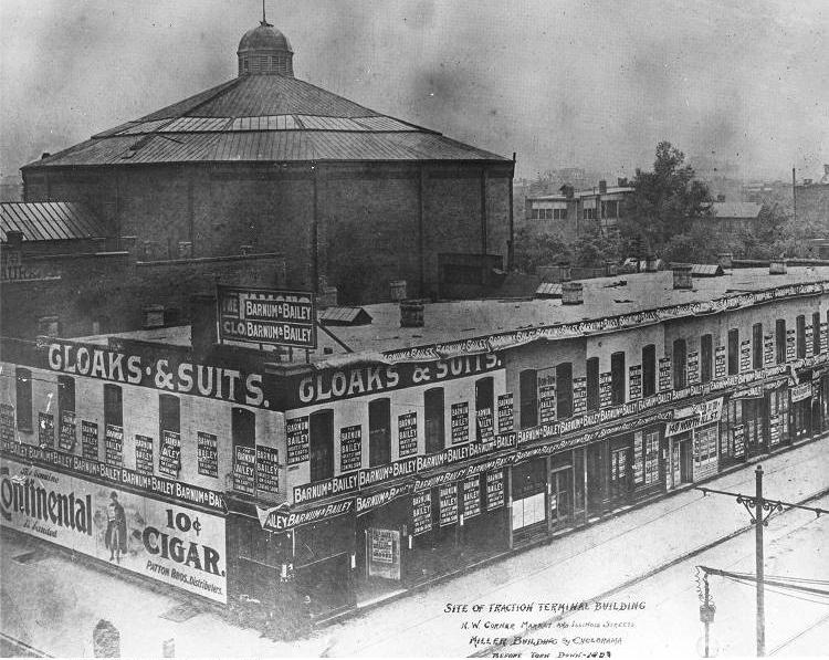
Cyclorama
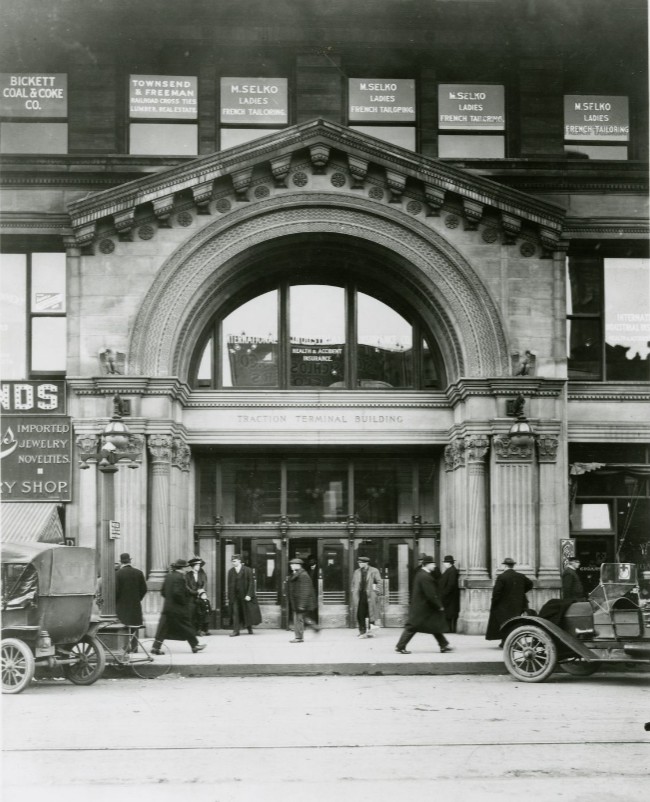
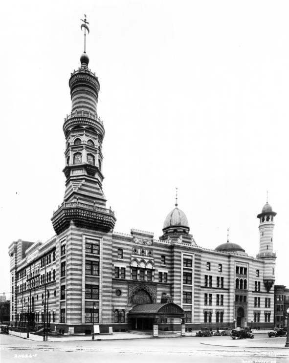
A unique feature of the time was the Cyclorama building on Market Street. The domed structure housed a 50-foot-high by 400-foot-long painted mural of the Battle of Atlanta. The attraction drew thousands of people until the novelty faded by the turn of the century. The Cyclorama later housed an exhibit on “horseless carriages” and a zoo before being demolished in 1903 to make way for the Indianapolis Traction Terminal—the hub of the statewide interurban system.
Credit: Bass Photo Co Collection, Indiana Historical Society View Source
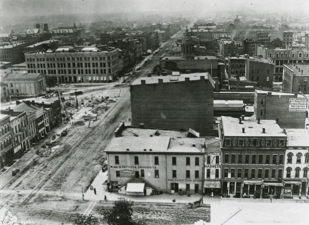
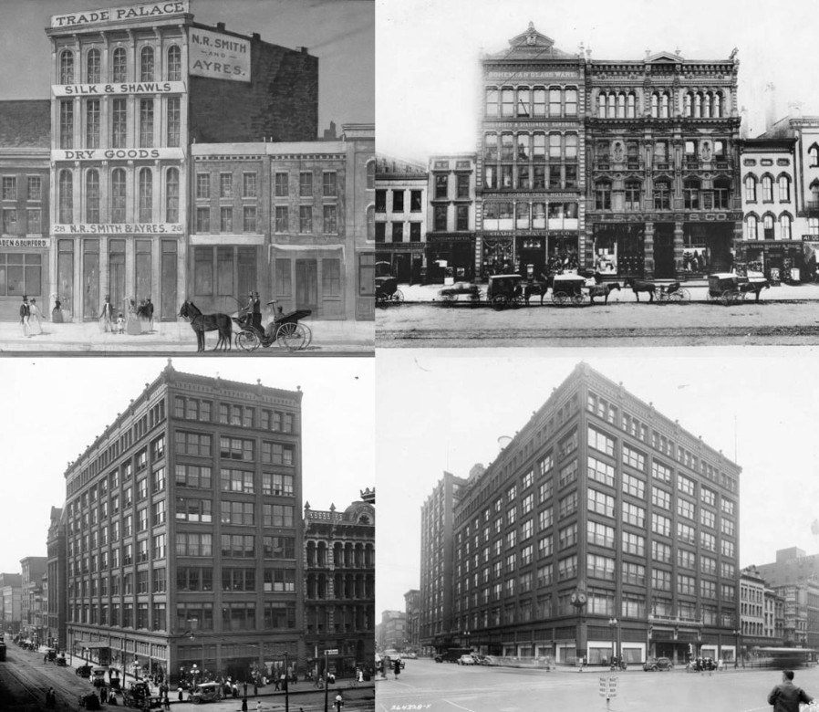
The city’s prosperity was evident in the expanding business district along Washington Street. German native Clemens Vonnegut Sr. opened a hardware store at 8 East Washington Street in 1858. The H. Lieber Company sold picture frames and moldings. Charles Mayer and Company offered fine gifts and imports for sale. Agencies were selling Singer and Wheeler & Wilson sewing machines. In 1872, Lyman S. Ayres purchased a controlling interest in a dry goods store on West Washington Street. He later renamed it L. S. Ayres and Company, which became a long-time retailer in Indianapolis until Macy’s acquired it in 2006.
L. S. Ayres and Company
Lyman S. Ayres’ first location was the Trade Palace at 26-28 West Washington Street (top left). He renamed it L. S. Ayres & Company, and in 1875 moved to 33 West Washington Street (top right). The flagship store opened in 1905 at Washington Street and Meridian Street (bottom left). The store expanded several times, doubling in size in 1915 by adding three more bays of windows to the eight-story building (bottom right).
Credit: Indiana Historical Society
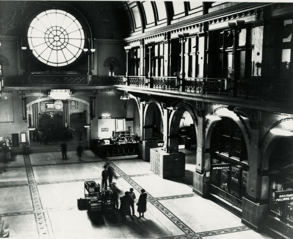
The southern portion of Mile Square also experienced a transformation during this period. A new Union Station, built in 1887-1888, replaced the original 1852-1853 structure to serve the growing railroad industry. This large Romanesque Revival building with its barrel-vaulted, skylit waiting room and multi-story clock tower became a notable symbol of the significance of the railroad in making Indianapolis a major crossroads in the Midwest.
Directly adjacent to the new station was the Wholesale District, which served as a distribution center for local, regional, and national wholesalers. It also housed numerous machinery shops that serviced the rapidly growing railroad industry. To this day, the district contains a large concentration of preserved and repurposed 19th-century commercial buildings that provide yet another link to the early years of Indianapolis.
The “Golden Years”
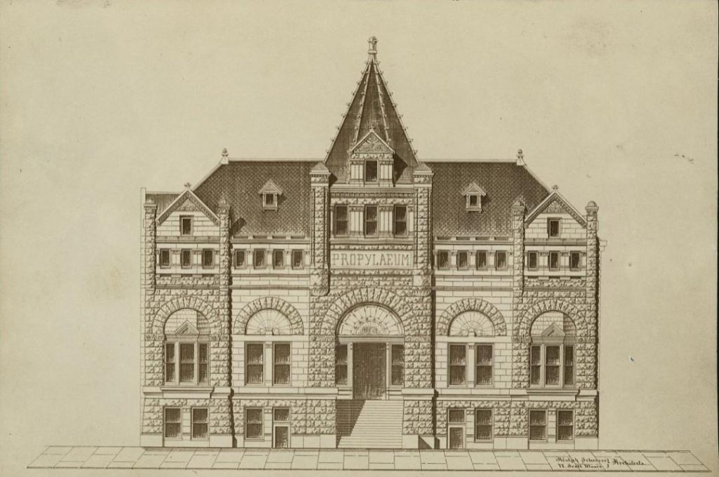
In addition to business and industry, the Mile Square hosted assorted organizations that represented the emergence of a modern city—social, cultural, and business clubs. The Young Men’s Christian Association (YMCA), dedicated to recreational activities and charity work, erected a building at 33-37 North Illinois Street in 1871, later rebuilding in 1887. The Propylaeum, a literary and cultural club for women established in 1888, held its regular meetings at their building located on North Street. The large German and German-American population of the city supported the construction of Das Deutsche Haus (The German House) in 1893-1894 and 1897-1898 to serve as the cultural, educational, and social center for the community. To promote the growing city, local businessmen organized the Commercial Club, a forerunner of today’s Chamber of Commerce, in 1890 and constructed an eight-story stone front building on the southwest corner of Meridian and Pearl streets. The club promoted the city, economic development, and internal improvements, such as good roads and a public park system.
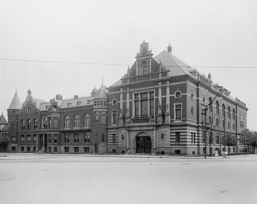
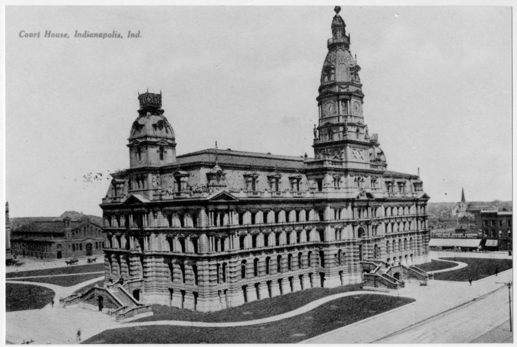
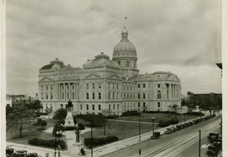
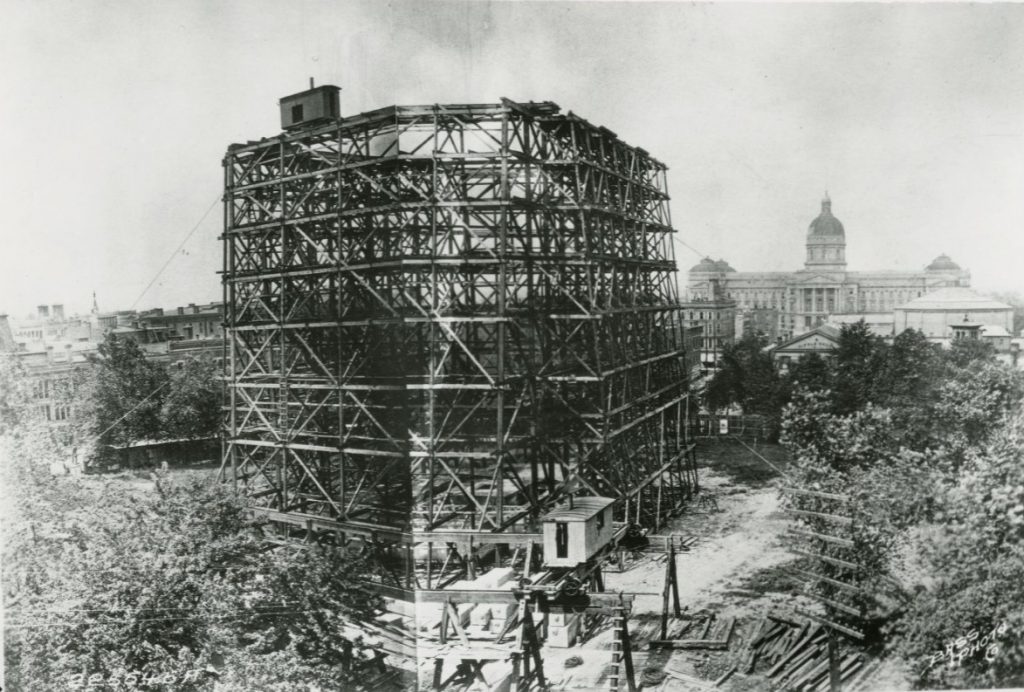
Since the Mile Square has served as the political center of the city, county and state, there were significant changes in the structures that housed government. In 1887-1888, new State House replaced the structure built in 1835 that was short of needed space and deteriorating. The new building housed offices of the governor, the General Assembly, the state Supreme Court, and the state library. Likewise, the county constructed a new Marion County Courthouse in 1876 after using a brick and frame structure originally built in 1825. The ornate Second Empire-style building, located on Washington Street between Delaware and Alabama, was used by county and city officials until the city constructed a new city hall on North Alabama in 1910. Indianapolis had become more recognizably modern during this period often labeled as “the golden years.”
Early 20th Century
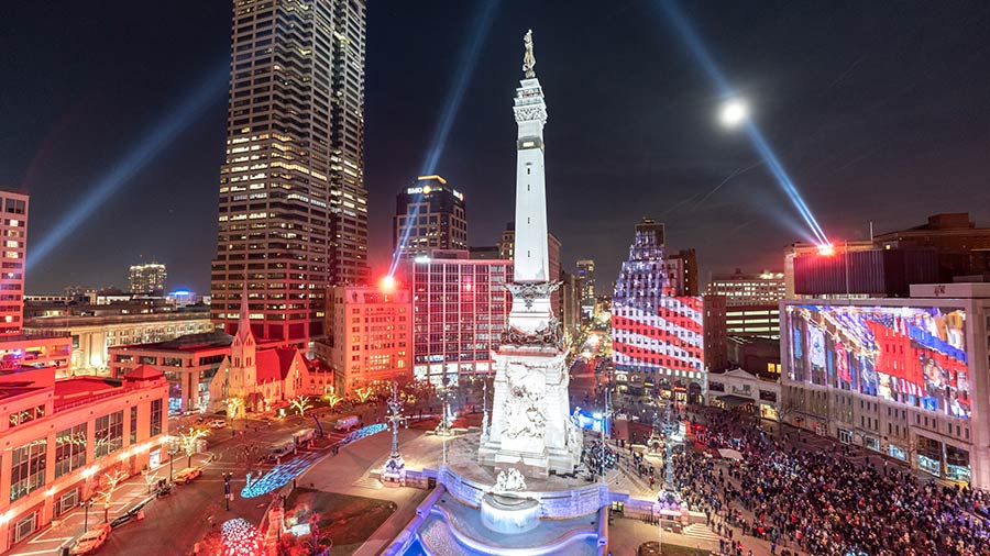
The new century brought notable alterations to the Mile Square. The population of the city was 169,124 in 1900 and grew to 386,972 by 1940 and had extended well beyond the original Mile Square. But the most visible change was the physical appearance and landscape of the Mile Square. The most notable change occurred in Circle Park, the former site of the Governor’s House. After years of discussion, the State of Indiana established a commission to erect a monument to veterans of the Civil War. The Soldiers and Sailors Monument, built between 1888 and 1901, incorporated terraced steps, fountains, pools, an obelisk shaft, and an assortment of statuary. Dedicated in a gala celebration in May 1902 to “all soldiers and sailors of wars,” the Monument has become an iconic symbol of the city as well as a public gathering space for patriotic, celebratory, and holiday events ever since.
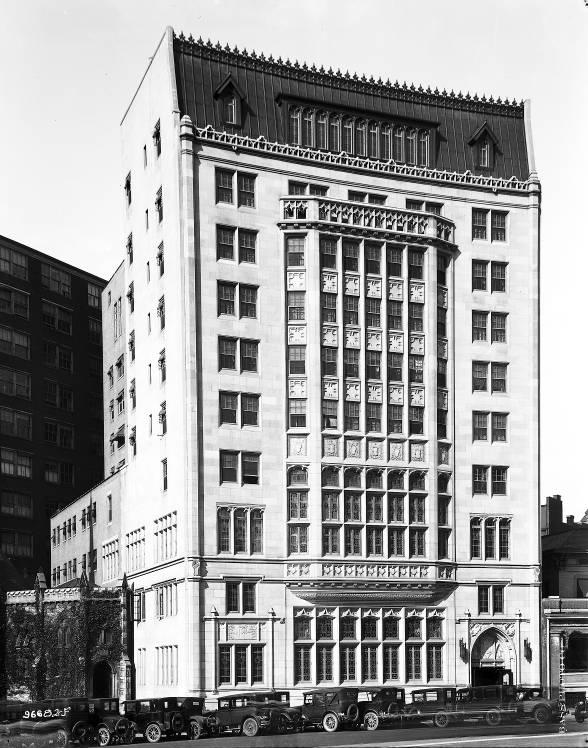
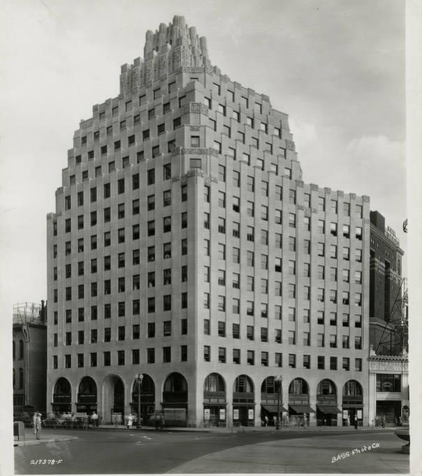
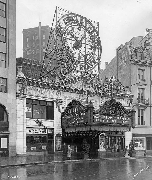
Several important buildings arose around the Circle that changed the face of the Mile Square and demonstrated the city’s transition to a modern urban center. The Columbia Club, established in 1889 to support Benjamin Harrison’s presidential campaign and promote the politics and views of the Republican Party, constructed a new building in 1900, later to be replaced by a 10-story building in 1925. It provided hotel rooms for members, hosted meetings, and offered dining and recreational facilities. Circle Theatre opened in August 1916 as the first building in the city constructed specifically for screening movies. It included a white terra cotta façade and ornate Adams-style plaster moldings in the theater. The 14-story Circle Tower, a unique Art Deco-style office tower designed by Rubush and Hunter and completed in 1930, provided business space in the city’s center. With Art Deco motifs, solid bronze doors, and marble and terrazzo floors, it marked a new elegance in Indianapolis business buildings.
To the east at 202 North Alabama, the city, during the administration of Mayor Charles Bookwalter, constructed a new City Hall instead of continuing to use space in the county courthouse. The neoclassical-style building was brick with Indiana limestone facing and had large double bronze doors. The interior featured two-story columns, colored marble floors, and a central rotunda capped by a 750-square-foot, stained glass dome. Opened in December 1910, City Hall had the latest conveniences including electric passenger elevators, temperature controls, and telephone wiring. The cornerstone bore the inscription “I am myself a citizen of no mean city,” a quote inspired by biblical verse Acts 21:39 to sum up residents’ feelings about Indianapolis.
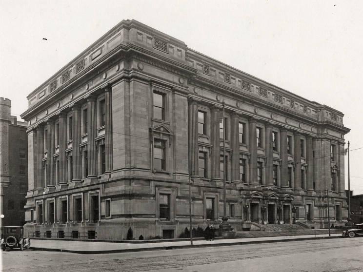
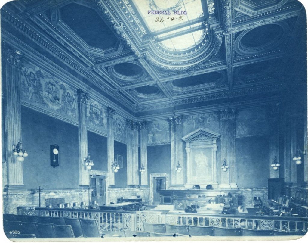
A block to the northwest, a new U.S. Court House and Post Office (renamed the Birch Bayh Federal Building in 2003) arose between 1903-1905. Located along Ohio Street between Meridian and Pennsylvania streets, the large Beaux-Arts classical building served as the headquarters of the federal government, including courts and federal offices. It also served as the city’s main post office until the early 1970s.
A Modern Commercial Center
In the early 20th century, Mile Square solidified its position as the commercial heart of the city. The banking industry represented by American National Bank, Fletcher National Bank, Capital National Bank, and Indiana National Bank was located here. Merchants National Bank constructed a new 17-story office building, designed by famous Chicago architect Daniel Burnham, at the southeast corner of Washington and Meridian streets in 1913; it became the first “skyscraper” in the city. Where religious institutions and newspaper offices once stood, now banks dominated the core of the city.
Other businesses contributed to the increasingly urban landscape of the Mile Square. Frederick M. Ayres, son of Lyman S. Ayres, expanded his father’s retail business L. S. Ayres and Company by building a new department store on the southwest corner of Washington and Meridian streets. William H. Block, a Hungarian immigrant, created the William H. Block Company department store in 1907 and constructed an eight-story building on the southwest corner of West Market and Illinois streets. The Mile Square had become a vibrant center of local commerce.
New modes of transportation contributed to the modern landscape of the city. Mule- and horse-drawn cars had been used on city streets since the 1860s. But, with the arrival of the electric streetcar (also known as the “trolley car”), transportation was revolutionized. Motorized streetcars powered from an overhead electric line now moved along rails throughout the downtown. Several streetcar lines emerged to provide service to points around the growing city.
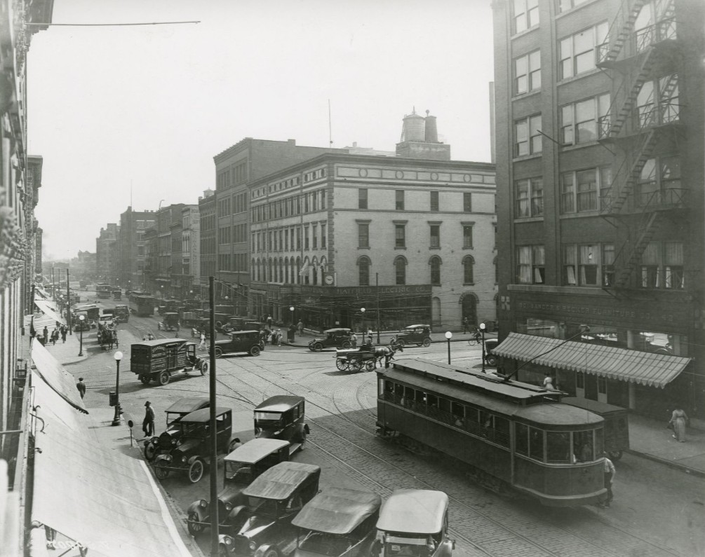
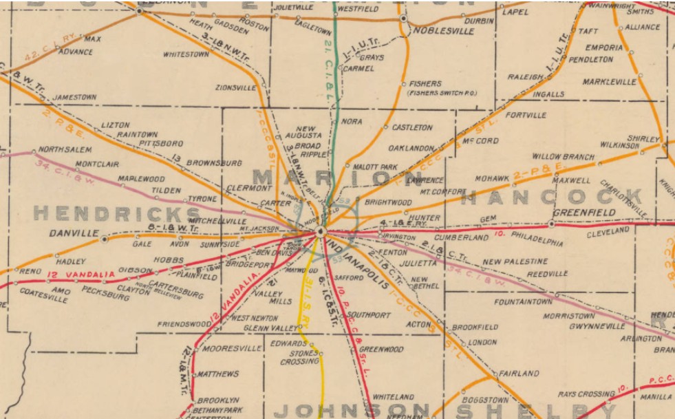
A new chapter in transportation began on January 1, 1900, with an electrified street railcar of the Indianapolis, Greenwood, and Franklin Railroad arriving from Greenwood. The age of interurbans had begun. These railcars operated between several communities, initially including Greenfield as well as Greenwood and Franklin. By 1910, 12 separate interurban companies served the city, carrying passengers and freight to cities within 120 miles of Indianapolis. By 1920, Indianapolis’ streetcar system had a ridership of 126 million, a per capita rate of 400 trips for every resident. In comparison, IndyGo’s 2019 ridership was 9.2 million, about 10 trips per person.
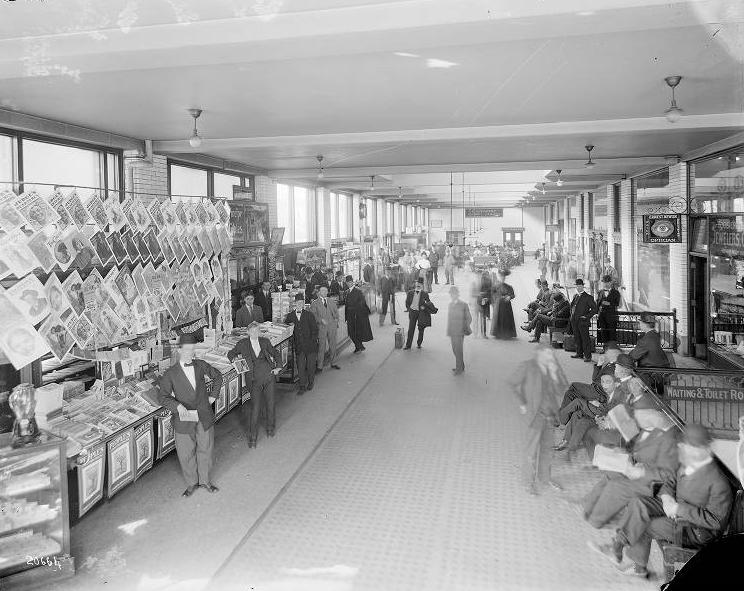
To handle this increased traffic, local businessman Hugh J. McGowan organized the Indianapolis Traction and Terminal Company in 1902 to construct a traction terminal that consolidated all electric transportation under one roof. It opened at Market and Illinois streets, just east of the State House, in September 1904 and was the largest such facility in the world, handling some 200 trains entering and departing the Mile Square each day. With the demise of the streetcar and interurban by mid-century, the terminal became the hub for the city’s bus service.
New Cultural Spaces
The Mile Square also provided new cultural opportunities for the city’s population. In the earliest years of Indianapolis, theater performances were held in hotels, taverns, the county courthouse, and even the state house. By the 1850s, theaters had become an established part of the local landscape. Morrison’s Opera House, the Masonic Hall, and the Metropolitan, for example, offered stage productions, musical performances, and vaudeville, usually presented by traveling troupes. The English Opera House continued to offer high quality theater productions, which featured leading performers of the day.
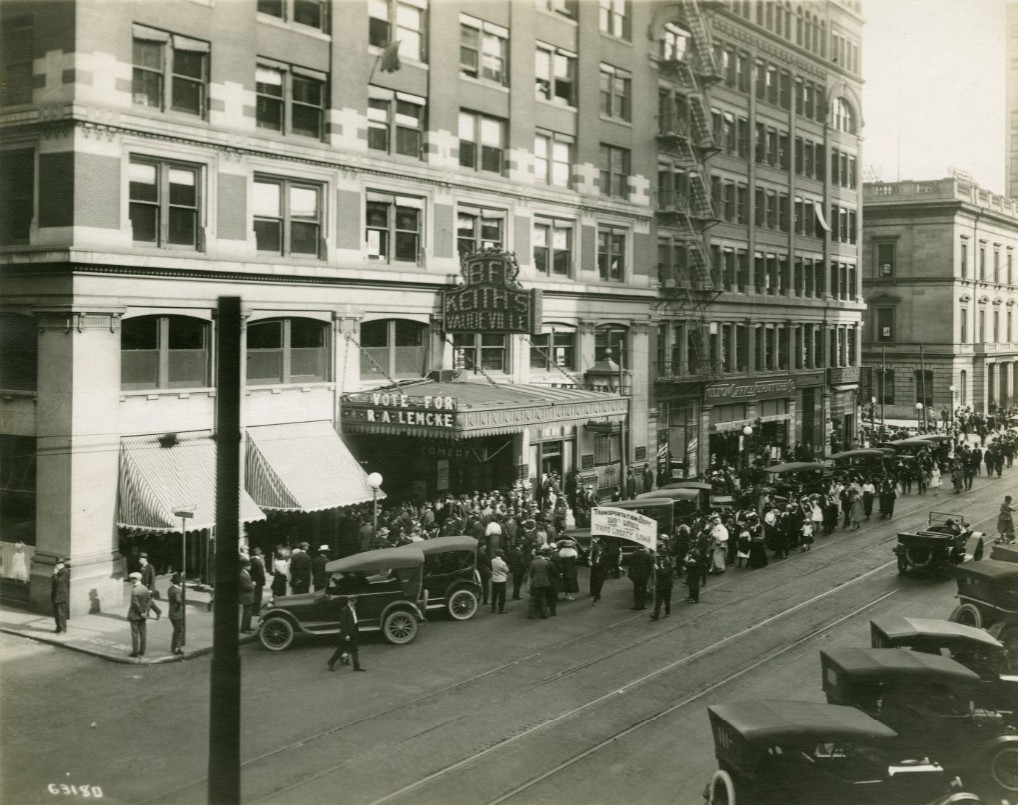
B.F. Keith’s Theater originally opened as Grand Opera House in 1875. It took the new name in 1910. Located at 117 N. Pennsylvania it had a seating capacity of 1,608. It was said to be the first U.S. theater lit by electric lights. The theatre offered “high class” vaudeville and movies. It closed in 1964.
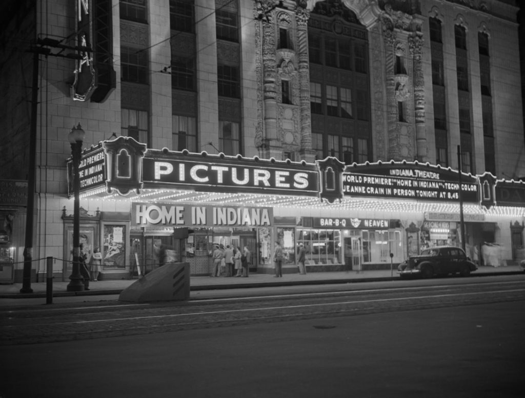
At the turn of 20th century, the advent of motion pictures stimulated a surge in theater construction. Nearly 200 theaters—some specifically designed for screening films—opened throughout the city between 1900 and 1930, with a large number located in the Mile Square. The Bijou, Circle, Colonial, B. F. Keith’s, Indiana, Loews State, Lyric, Murat, and Ohio theaters were popular and attracted residents to the downtown to view the latest films or stage productions. Eventually, these theaters closed as the suburbs grew and shopping malls provided new theaters for movies, leaving the movie plex at Circle Centre Mall and the newly opened theaters in the Bottleworks complex on Massachusetts Avenue to be the only movie theaters in the downtown today. Remnants of the “golden age of theater” remain as the Circle Theatre (1916) is home to the Indianapolis Symphony Orchestra and the Indiana Theatre (1927) on West Washington Street is home to the Indiana Repertory Theater.
The north central area of the Mile Square underwent a meaningful change beginning in 1920. One year earlier, Indiana successfully campaigned to bring the newly formed American Legion’s national headquarters to the city with a plan to build the Indiana World War Memorial Plaza. The design, influenced by the City Beautiful movement, called for the creation of an open grassed mall one block wide and four blocks long (extending two blocks north of North Street). The section immediately north of the Mile Square would house the national and state offices of the American Legion. One block within the Mile Square portion would include a large memorial to the veterans of World War I. The other block would contain a 100-foot obelisk and large fountain.
Mid-to-Late 20th Century
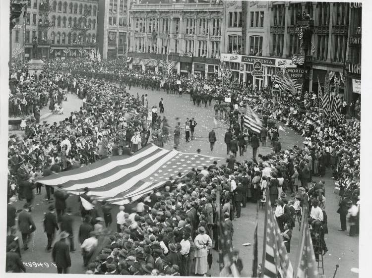
The eras of the two world wars impacted Indianapolis. The industries at the edge of the city were mobilized to support the war efforts, converting normal production lines to produce airplane engines, explosives, and military uniforms. During World War II, Indianapolis industries were filling enough military contracts to place the city in the top-10 American cities in war production and earning it the nickname of “Toolmaker to the Nation.” Two locations within the Mile Square were specifically impacted by the wars. Fort Benjamin Harrison brought thousands of soldiers and military personnel through Union Station on a regular basis. Monument Circle also became a key location for war rallies to collect war funds, sell Liberty Bonds, and welcome home the victorious troops after the wars.
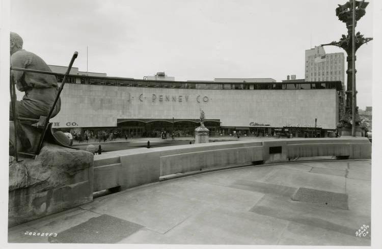
One important action in 1948 changed the physical landscape of Monument Circle. A decision was made to demolish the ornate English Hotel and Opera House due to age, deteriorating condition, and changing tastes in architectural styles. Since the 1880s, the structures had been both a functional and aesthetic part of Indianapolis’ downtown. The move to demolish the buildings and replace them with a sleek new J.C. Penney department store generated considerable public discussion. Historic preservationists still debate the wisdom of this decision.
Impact of Suburbanization
The emergence of the automobile as the dominant mode of transportation created a desire for better roads, more parking, and better traffic control. It also spurred the demise of the large streetcar and interurban systems for which Indianapolis had become known. The automobile also encouraged suburbanization, which ultimately led to the flight of residents and businesses out of the central city and to the gradual deterioration of the downtown area.
With the growth of the surrounding townships in the 1950s and early 1960s, suburban residents began to turn to shopping centers and malls rather than frequent downtown stores. The Mile Square encountered seriously difficult years, resulting in a dramatic decline in economic activity. As early as 1943, Mayor Robert H. Tyndall had appointed a 150-person Committee on Postwar Planning to discuss the postwar agenda for the city, which included concerns about the impact of decentralization and suburbanization on the downtown. By 1958, the Central Business District Report stated that “Indianapolis is in a period of drastic change. Not since the early part of this century have so many of its area undergone such a rapid transformation.” The report did not elaborate on those changes but did mention the planned interstate highway system and the opening of the first suburban shopping malls. Two years later, the Central Business District Report stated that “portions of Indianapolis appear almost as if the city has suffered a major aerial strike.”
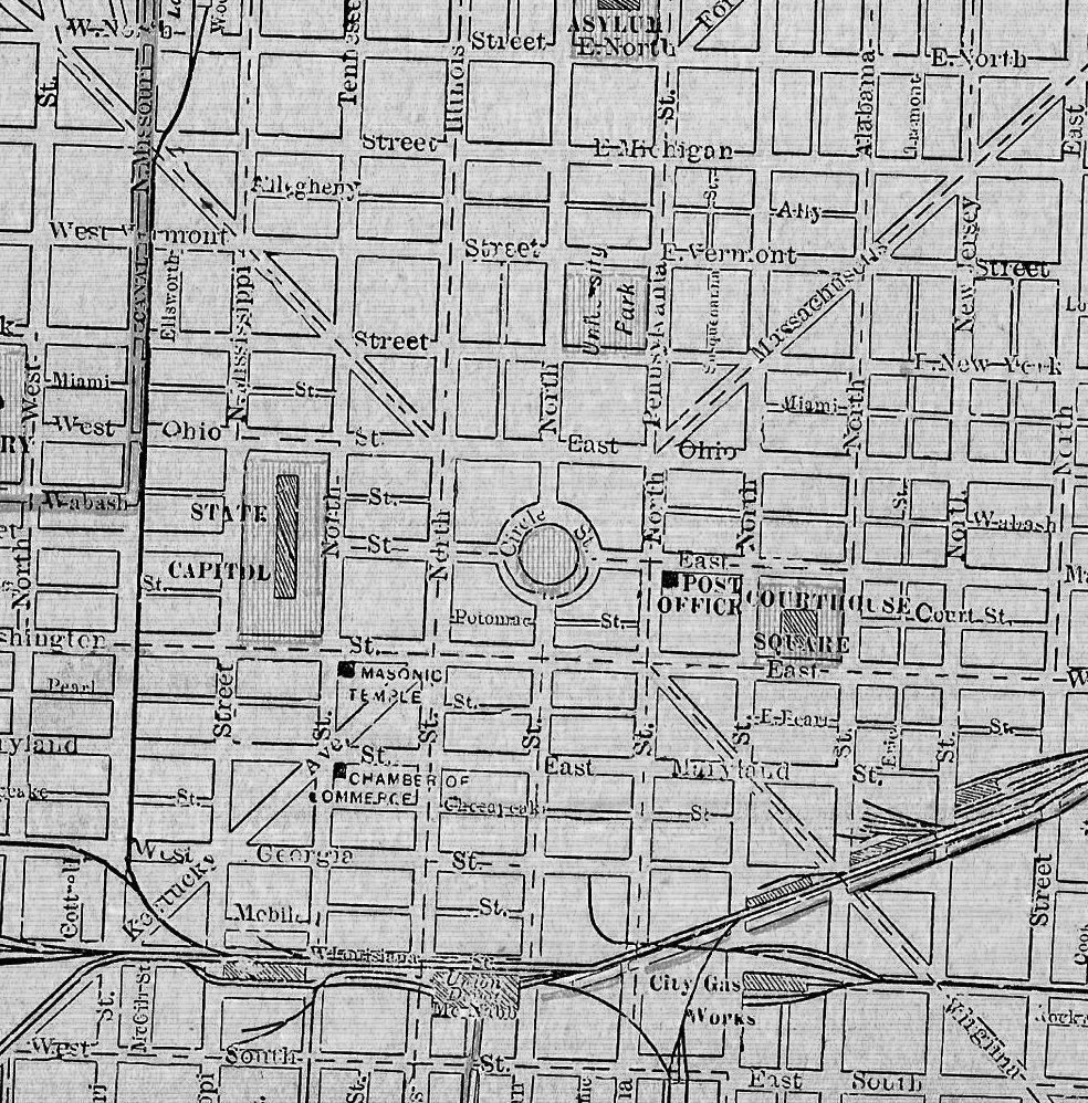
The city’s skyline continued to be altered with the addition of new buildings. In 1962, the city and county governments completed the 28-story City-County Building at the northeast corner of Delaware and Washington streets. The first significant construction project in the Mile Square in years, the government complex offered expanded office and court space for the local governments, though it did result in the demolition of the 1876 county courthouse. One block to the northwest, Indiana National Bank erected a 37-story tower on the northeast corner of Pennsylvania and Ohio streets. The new structure represented the growing corporate identity in the Mile Square. In the process, however, it also covered over part of the northeast diagonal street of Ralston’s original 1821 plan.
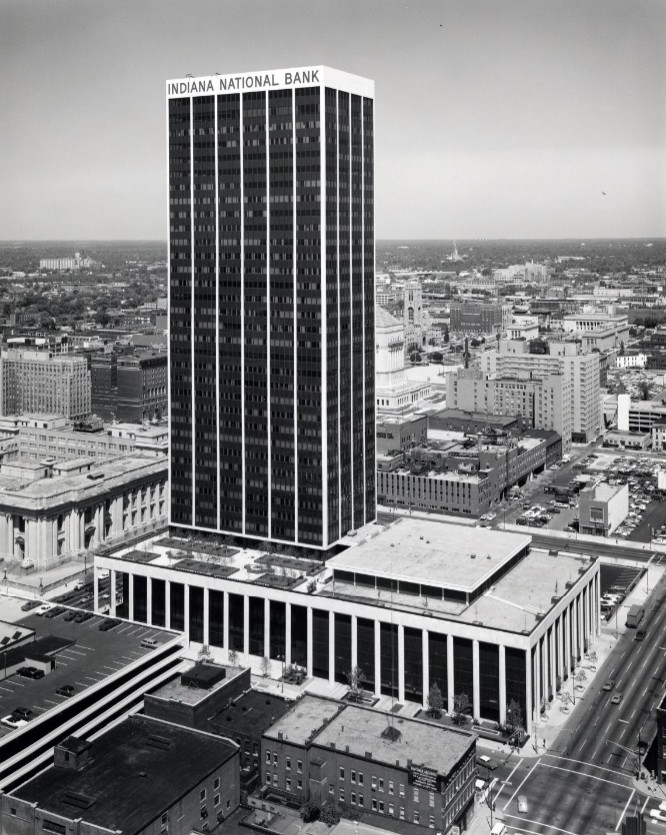
Indiana National Bank’s 37-story tower was the tallest building in Indianapolis when built. New towers including this building, Merchants Plaza, and One America Tower each removed one block of the diagonal streets that were in Ralston’s original Mile Square plan.
A new federal office building, known as the Minton-Capehart Building built at the northeast corner of Pennsylvania and Michigan streets facing the Indiana World War Memorial Plaza, opened in 1975 to provide additional office space for federal agencies. Designed by the local architectural firm of Woollen and Associates, the building is a representation of the modern architectural style of “Brutalism” characterized by stark lines and use of concrete, contrasting with surrounding more traditional architectural styles.
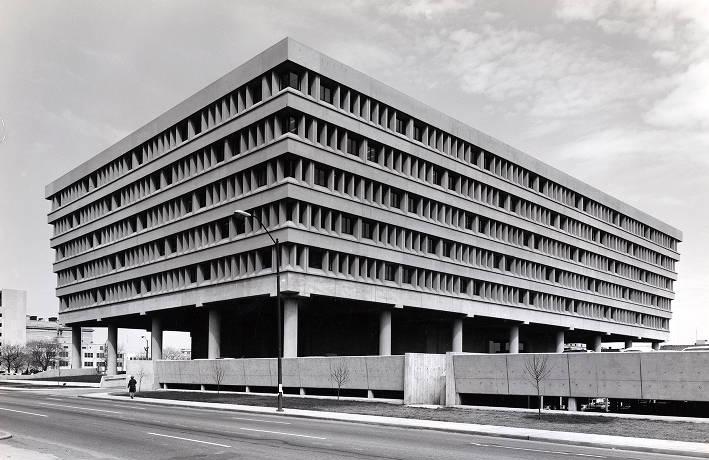
City and business leaders remained concerned as to whether they could reverse the downward economic trends of the 1960s. As they continued to promote the downtown as the center of business and economic activity for the city, they considered the Mile Square a key asset in regional development. In fact, the city’s regional center general plan, adopted in 1982, acknowledged that “Ralston’s Mile Square design survives as a worthy centerpiece for the city, the central Indiana region, and the state. It is the pivot of the Regional Center.”
William H. Block Company, L. S. Ayres and Company, H. P. Wasson and Company, and L. Strauss and Company continued to dominate downtown retailing. Efforts to reinvigorate the downtown led to the opening of several new office towers such as Merchants Plaza (1977, built over one block of Kentucky Avenue from Ralston’s original plan); AUL Tower (1982, 38 stories, built over one block of Indiana Avenue of Ralston’s original plan); Market Tower (1988); and Bank One Tower (1990, 51 stories; now Salesforce Tower). Likewise, there was a new push for more urban living opportunities, which led to the construction of the 30-story Riley Towers complex and the Barton Apartments for the Elderly, both located at the eastern edge of the Square.
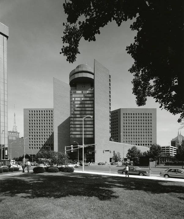
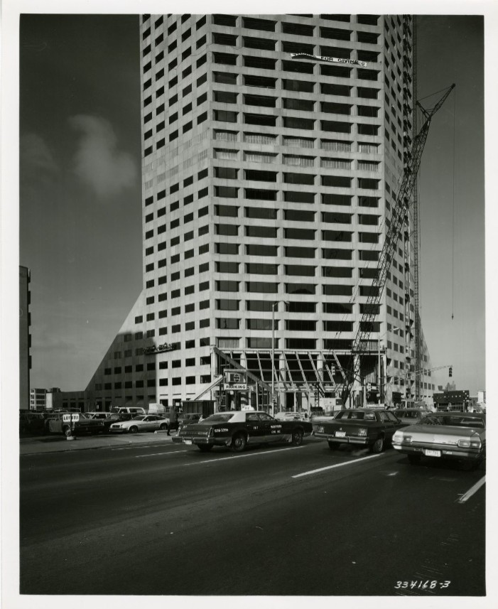
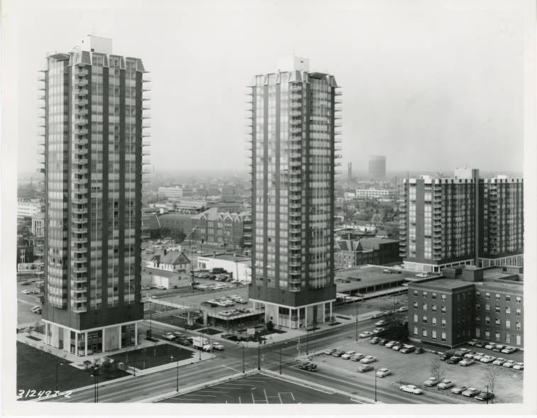
As the area became more heavily populated with commercial and office buildings, industrial and warehousing activities declined and eventually ceased in the southern part of the Mile Square. The city’s downtown plan of 1958 discussed the decline of such activity, explaining that numerous multi-story buildings were ill-suited to carry out industrial and warehousing operations. Those structures were eventually shuttered and sat unused for years. Many were eventually demolished, leaving large swaths of vacant land in this part of the Mile Square. However, some buildings were eventually repurposed for commercial and office space in the city’s effort to redevelop the downtown.
Revitalization
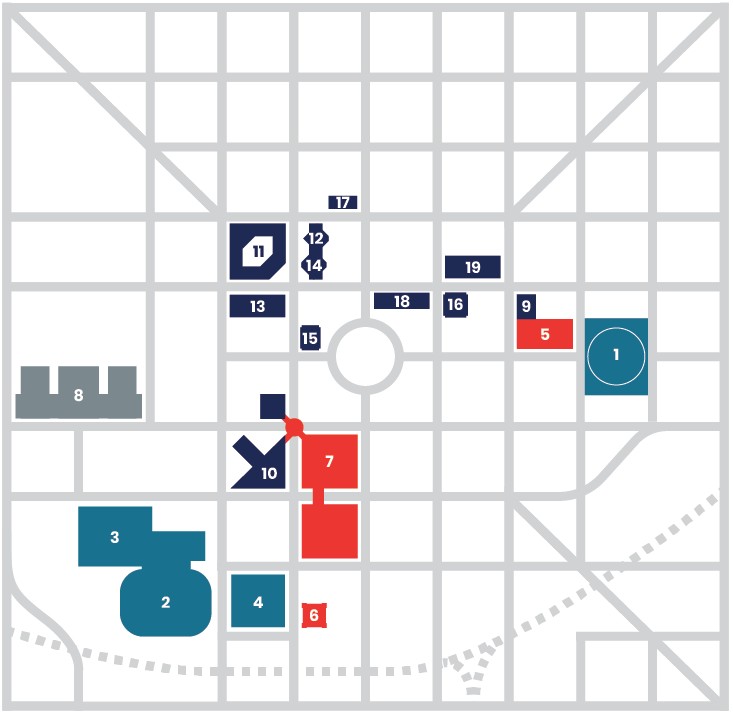
| Sports and Events | Retail | Public | High-rise |
|---|---|---|---|
| 1. Market Square Arena | 5. City Market | 8. Indiana Government Center | 9. Market Square Center |
| 2. Hoosier Dome | 6. Union Station | 10. PNC Center | |
| 3. Indiana Convention Center | 7. Circle Center Mall | 11. AUL Tower (One American Tower) | |
| 4. Pan Am Plaza | 12. Fifth Third Bank Tower | ||
| 13. 101 W. Ohio | |||
| 14. Capital Center South Tower | |||
| 15. Market Plaza | |||
| 16. BMO Plaza | |||
| 17. 300 N. Meridian | |||
| 18. Bank One Tower (Salesforce Tower) | |||
| 19. Indiana National Bank Tower (Regions Towers) |
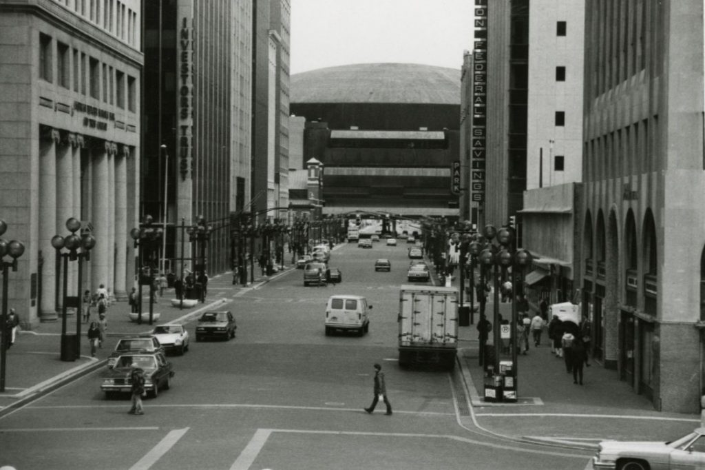
One key strategy to revitalize the downtown adopted in the 1970s and 1980s proved instrumental in reversing the downward turn of the downtown. An aggressive sports initiative that resulted in the construction of new sports facilities and helped to attract numerous national sports governing bodies to relocate their headquarters to the city. Market Square Arena, opened in September 1974, to house the Indiana Pacers, an American Basketball Association basketball team that joined the National Basketball Association (NBA) in 1976. The 17,000-seat domed arena, located near the City Market on the east side of the Mile Square, hosted basketball and hockey games, circuses, and concerts during its 25-year lifetime. In 1999, the city constructed a new arena—Bankers Life Fieldhouse (formerly Conseco)—located at S. Pennsylvania and Georgia streets.
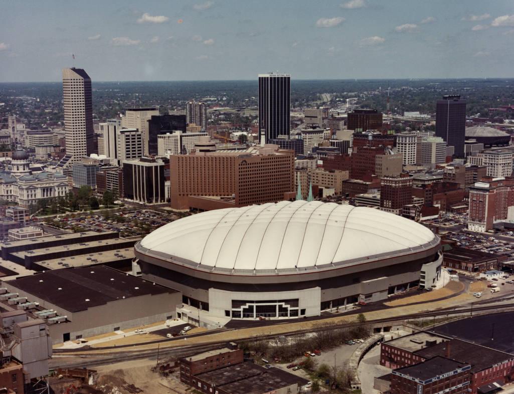
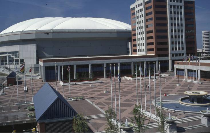
In pursuit of a professional football team, the city erected the Hoosier Dome in 1984 as part of the Indiana Convention Center (1972) in the southwestern corner of the Mile Square. The 61,000-seat domed stadium became the home of the Indianapolis Colts and hosted a wide variety of conventions, concerts, and athletic events. It was replaced by Lucas Oil Stadium, located at South and Illinois streets, in 2008. Rounding out the sports initiative, the city constructed Victory Field (1996) outside the western edge of the Mile Square at West and Maryland streets to house the Indianapolis Indians, a minor league baseball team. These venues have attracted hundreds of thousands of people to the downtown every year and pumped millions of dollars into the local economy.
The Tenth Pan American Games in 1987 was another milestone in downtown redevelopment. This three-week event hosted over 4,400 athletes from 38 nations, drew thousands of spectators, and secured millions of dollars in corporate support as well as thousands of volunteers who contributed to the success of the effort. As a result of this one event, Indianapolis demonstrated its ability to host major athletic events, which has led subsequently to the city hosting National Collegiate Athletic Association (NCAA) tournaments, Olympic trials, and even Super Bowl XLVI in 2012. In 1999, the city also attracted the NCAA headquarters from Kansas City and made it an anchor in the new White River State Park, a new urban civic and cultural space that also housed the Indiana State Museum and an amphitheater.
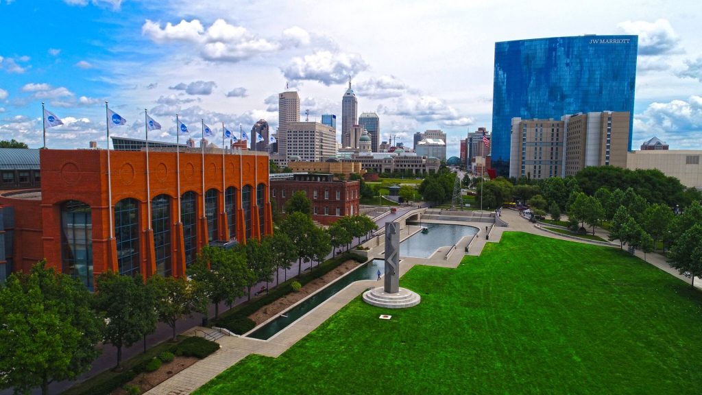
Five other projects sought to reinvigorate the Mile Square district. The restoration of City Market in the 1970s, which occupied the site of the market in Ralston’s plan, included the construction of contemporary flanking wings to house additional market and office space while preserving a building that had stood since the 1880s. Another notable project was the restoration of Union Station, which converted the vacant building into a festival marketplace with retail space, restaurants, offices, and a high-end hotel in the former train sheds.
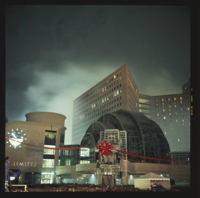
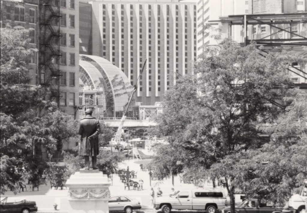
A very ambitious plan by city leaders involved the construction of Circle Centre Mall in the late 1980s-early 1990s. The project involved the demolition of dozens of buildings, many dating back to the late 19th century, in an area bounded by Meridian and Illinois, Washington, and Georgia streets, to construct an enclosed downtown mall. The project proved to be highly controversial because of proposed destruction of historic structures. The resolution was to preserve building facades to enclose the new downtown mall.
Attached to the mall and constructed over the intersection of Washington and Illinois streets was the Indianapolis Artsgarden, a pedestrian corridor as well as a venue for performances and art exhibitions. Finally, the construction of a new Indiana Government Center rejuvenated the area near W. Washington and West streets.
Despite the destruction of historic structures within the Mile Square to make way for modern office and government buildings, the local preservation community worked hard to preserve residential areas at the perimeters of the Mile Square, believing in the importance of preserving the historic fabric of earlier times. One of the first areas to receive designation for the National Register of Historic Places was the Lockerbie Square neighborhood (1973), located just outside the eastern boundary of the Mile Square. Efforts to restore residences and commercial buildings and to maintain the historic fabric of the neighborhood contributed to the stabilization of the neighborhood and making it a highly desirable place to live. Similarly, other nearby neighborhoods such as Chatham Arch, the Old Northside, and Cottage Home—all outside, but adjacent to, the Mile Square—pursued policies that promoted the preservation of historic structures and encouraged downtown living.
For the past several decades, the city has included increasing housing in the downtown and Mile Square as part of its strategic planning. Housing units—both apartments and condominiums–have been constructed in repurposed buildings previously used as industrial facilities, offices, and churches. Since the late 1990s, there has been a steady increase in downtown housing, evidenced by population growth in the census tracts comprising the downtown area as well as by the number of construction projects across the downtown that are evident to this day.
21st Century
In recent years, there has been a surge of development in the Mile Square and adjacent areas, thus demonstrating the vitality of the Indianapolis downtown and the desirability of working and living in the area. This indicates that efforts for downtown redevelopment begun in the 1970s continue to bear fruit, especially with political and civic leaders who are committed to creating a vibrant downtown.
Population is growing much faster in the Mile Square than in Marion County overall
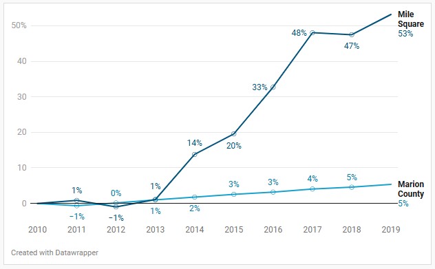
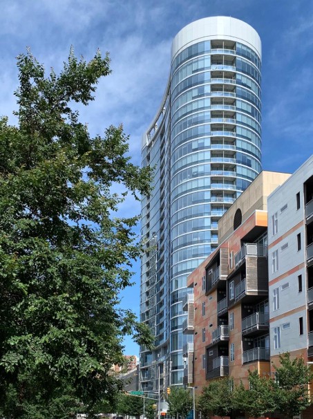
The desirability of downtown living has grown dramatically within the past decade as demonstrated by the conversion of former business buildings into hotels, apartments, and condominiums as well as the new construction of high-density housing on the former Indianapolis Star site, along the Canal on the west side, on the former Market Square Arena site, and elsewhere around the Mile Square.
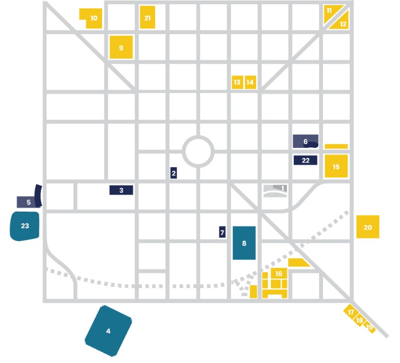
| Sports and events | High-rise | Public | Apartments |
|---|---|---|---|
| 4. Lucas Oil Stadium | 2. Conrad Hotel | 1. Julia M. Carson Transit Center | 9. Axis |
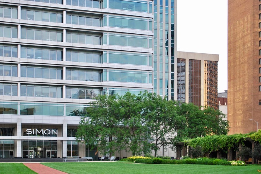
| 8. Conseco Fieldhouse (Bankers Life Fieldhouse) | 3. Simon Headquarters | 10. Cosmopolitan on the Canal | |
| 23. Victory Field | 5. JW Marriot | 11. Millikan on Mass | |
| 6. 360 Market Square | 12. Penrose on Mass | ||
| 7. Hyatt Place | 13. The Whit | ||
| 22. Cummins Distribution Headquarters | 14. Pulliam Square | ||
| 15. Artistry | |||
| 16. City Way | |||
| 17. The Villagio at Page Pointe | |||
| 18. Slate | |||
| 19. Mozzo Apartments | |||
| 20. The Waverly | |||
| 21. Lux on Capital |
Cummins, an Indiana-based manufacturer of gas and diesel engines and other generating systems, constructed a multi-story, energy-efficient distribution headquarters on part of the former Market Square Arena site.
The Conrad Hotel and Condominiums, part of Hilton Hotels & Resorts, opened its 23-story building at the northeast corner of West Washington and Illinois streets in 2006, thus making Indianapolis one of six American cities with one of these luxury hotels.
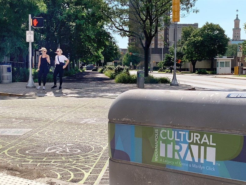
In May 2013, the Indianapolis Cultural Trail opened to the public. Founded by the Central Indiana Community Foundation in partnership with the City of Indianapolis and with significant funds from Eugene and Marilyn Glick, the trail is an 8-mile bike and pedestrian path that covers a good portion of the original Mile Square. It has contributed to a resurgence of neighborhood redevelopment in Fountain Square and the Wholesale District.
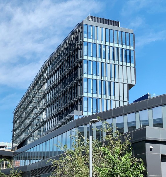
Reflecting efforts to centralize public transportation services a century earlier with the opening of the Traction Terminal, the city constructed the Julia M. Carson Transit Center across from the City-County Building in 2016. This facility serves as the center of IndyGo, the city’s public transportation company.
Downtown Indy, a private nonprofit organization, was founded to promote downtown Indianapolis. Like the Commercial Club of the late 19th century, Downtown Indy assists with civic events and conventions, promotes economic development, supports downtown living, and collaborates with civic and business leaders to ensure the vitality of downtown. They were preceded by the Downtown Merchants Association and the Commission for Downtown.
Continuing Challenges
As online retailing has skyrocketed, shopping malls have experienced a serious downturn of in-person shopping. Consequently, Circle Centre Mall has lost key anchor stores, such as Nordstrom, L. S. Ayres, and Carson’s, and many specialty retailers that had attracted shoppers to the downtown since the mall’s opening in 1995. Space previously occupied by Nordstrom, for example, now is home to the Indianapolis Star media group and the former L. S. Ayres building stands empty.
The COVID-19 pandemic in 2020-2021 also has had a serious impact on the Mile Square. Government officials issued “stay at home/work at home” orders as preventative measures to slow the spread. As a result of those mandates, people did not frequent their offices and downtown businesses and, consequently, restaurants, bars, and retail businesses have suffered from an absence of patronage. Many established businesses closed, with long-term consequences uncertain.
Continue Exploring
Discover related stories and resources in the Encyclopedia of Indianapolis.