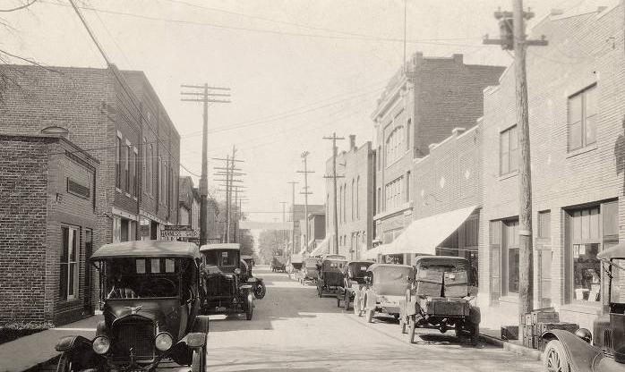
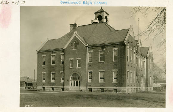
The northernmost city in , located just south of the Marion County line, Greenwood is bounded by Graham Road on the east and S.R. 135 on the west, with additional unincorporated boundaries extending from S.R. 135 on the east to S.R. 37 on the west.

These boundaries reflect Greenwood’s three jurisdictions: Greenwood proper, unincorporated Center Grove, and unincorporated . The area was first settled by Anglo Americans around 1824 when Jacob Smock and the Brewer family took up residence. Initially called Smockton, the settlers later designated their town, Greenfield. In 1832, they changed its name to Greenwood to eliminate confusion with in nearby .
Greenwood, with a population of 300, incorporated under a town board in 1864. By that time it had become an important shipping point on the . In the early 1870s, J. T. Polk opened a canning factory that became the largest cannery west of Baltimore and the town’s biggest employer, bringing in workers who became residents. In 1930, the Stokely Company (later ) purchased the former Polk canning factory and operated it until 1959 when it moved to Indianapolis.

On January 1, 1900, the Indianapolis, Greenwood, and Franklin Railroad sent its first into Indianapolis from its Greenwood shops. The interurbans further facilitated settlement in Greenwood, allowing easy and inexpensive access to Indianapolis jobs for people who chose to live in the smaller town.
For many years, Greenwood remained a small town. In 1960, when it became a 5th -class city, its population was only 7,200. However, following the creation of in 1970, the 1973 court-ordered of Indianapolis schools through busing, and the related flight out of Marion County, Greenwood’s population increased rapidly. Builders throughout the 1970s averaged 400 new home starts per year.
Although that growth slowed somewhat in the following decades, the growth of Indianapolis has led to much suburban residential and commercial development, which has pushed Greenwood’s western boundary to S.R. 37—the I-69 extension to Evansville, Indiana, which includes the unincorporated town of Center Grove and the incorporated town of Bargersville, west of S.R. 135 to S.R. 37 and south of Stones Crossing Road to Whiteland Road; the eastern boundary to I-65, which includes the Amazon distribution center at Graham Road; and the southern boundary to Whiteland Road. In 2010 Greenwood had a population of 49,791 and encompassed over 21 square miles.
Greenwood’s housing stock varies from Victorian homes in “Old Towne” to custom-built homes in excess of one million dollars in new subdivisions and on still agricultural-zoned lots. The city boasts three major hospitals, three school districts, two private schools, the Career Nine development center, and shopping areas ranging from downtown specialty shops to Greenwood Park Mall. Efforts at revitalizing the historic downtown began in the 2010s and continue.
A noteworthy trend has emerged in the southwest corner of Greenwood despite the city’s predominantly white population. Since 2010 a 2.88 square mile tract bounded by Main Street to north, Worthsville Road to the south, I-65 to the east, and the railroad tracks to the west has seen an increase in the Asian population relative to the white population.
This trend gained momentum in 2013 after the announcement of the construction of the Gurdwara Shri Guru Hargobind Sahib Ji temple. Furthermore, the Homecoming at neighborhood, within walking distance of the temple, was home to more than 100 Sikh families as of 2017.
In 2020 Republican Mark W. Meyers, Greenwood’s three-term mayor played a role in securing the Amazon receiving center location on the eastern edge of the city. Amazon employs over 1,000 middle-wage workers. In addition, the largest industries in Greenwood include health care and social assistance, manufacturing, and the retail trade.

Is this your community?
Do you have photos or stories?
Contribute to this page by emailing us your suggestions.