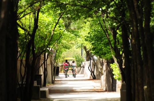
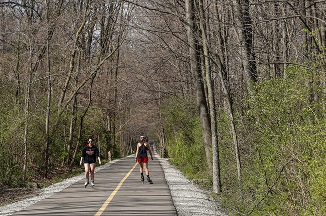
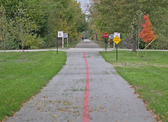
The City of Indianapolis has developed a substantial greenways and trails system. It connects Indianapolis to the surrounding donut counties, over 70 Indianapolis parks, and 11 regional trail systems. The greenways are part of an urban, multi-use trail system that connects people to neighborhoods, commercial districts, schools, parks, cultural features, and historic sites in Indianapolis and throughout . The system has become one of the premier trail networks in the country and set standards for other communities.

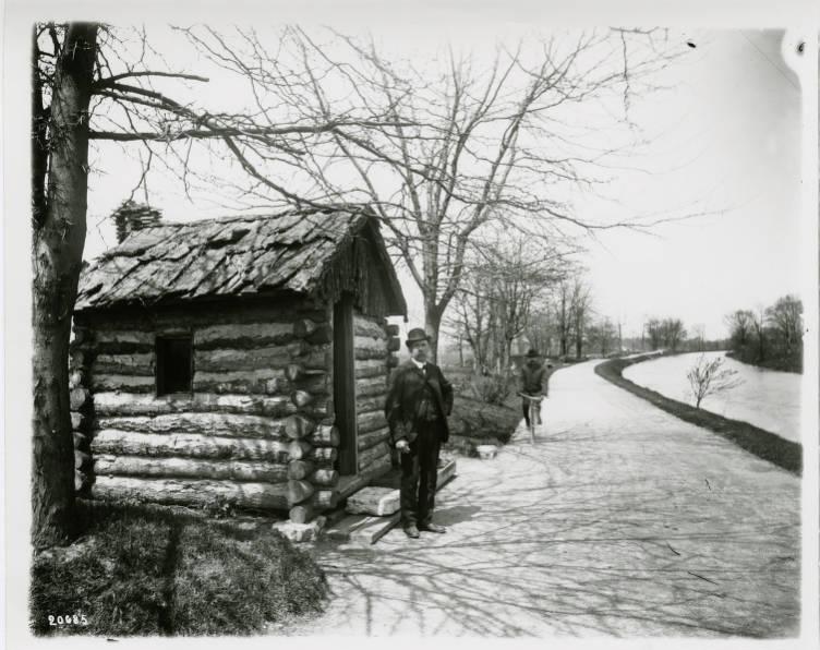
Indianapolis’s greenways and trails have developed and evolved over the course of 100 years. Beginning in 1885, with the formation of the Board of Park Commissioners, each effort has left an indelible mark on the city. Composed of a group of Indianapolis civic leaders, who sought to protect natural areas from development, the first board hired nationally renowned landscape architect John Olmsted to survey the city’s need for parks. Olmsted’s proposal called for the development of parkways along the city’s rivers and streams that would connect a series of planned parks.
Another renowned landscape architect, , updated and implemented Olmsted’s plan when he was retained in 1905. He called for a chain of connected parks extending throughout city neighborhoods using the tree-lined parkways as conduits. expanded upon what became known as the with his 1928 proposal to push its boundaries beyond Indianapolis by following the Little Buck Creek, Little Eagle Creek, and Lick Creek tributaries of Indianapolis’ rivers and streams to include all of Marion County.

In 1929, the Council for Social Agencies and the released the results of their study, the “Leisure Plan of the People,” that called for civic organizations throughout the city and Marion County to promote healthy recreation and better leisure through the development of playgrounds and parks, within newly developed residential areas. Though the commitment to and further development and expansion of these initial initiatives stagnated from 1929 to 1960, a renewed commitment to these earlier endeavors emerged from 1960 to 1992, culminating in the first significant update to the Kessler Plan in 1994.
The (DPR) and the (DMD) initiated the first informal update. Their joint effort established a connection between parks and recreation to neighborhood quality of life. Within Marion County, they developed six county-wide park plans. Most notable was the 1982 proposal named the Indianapolis Parkway System Plan. Here, the vision was to create a county-wide parkway system that would serve as a multi-modal transportation route connecting new residential developments to the Kessler and Sheridan Plans.
An official update to the Kessler Plan came in 1994 with the Indianapolis Greenways Plan. This was the result of three years of planning between the DPR and the DMD with help from the Department of Natural Resources (DNR) and the National Parks System (NPS). Collaboratively, these groups identified areas where public interest for greenways was greatest. They identified 14 corridors that were along 11 rivers and streams, two former rail corridors, and the 1836 towpath. Citizens living within each corridor worked with the four agencies to design and develop the greenways. The final vision outlined over 155 miles of potential greenway routes.
Between 1994 and 2002, the city built 28 miles of trails and made significant progress on other trail-related action items. Two pilot projects were prioritized during the initial build-out of the trails that resulted in the completion of the in 1996 and two-thirds of the by 1999. In 2013, the city gained the , an urban multi-use trail that runs through six cultural districts.

Planning, financing, bidding, and building Indianapolis’ greenways and trails project have become a long-term commitment with evolving priorities and players. Between 2002 and 2014, Indy Parks updated the 1994 Master Plan with a new set of goals arrived at through public response to the 35 miles of greenways and trails that had been constructed during the first plan—the centerpiece being the Monon Trail, fully functional by 2002.
Communities demanded expanded routes; more linkages to churches, schools, and parks; trail loops around parks and lakes; improved stewardship; and an increase in like-minded partners. Specifically, many east side residents clamored for development of the Pennsy Greenway which required utilizing the former Indiana Central Rail corridor that extended from Indianapolis to Richmond. To meet these demands, Indy Greenways was established in Indy Parks to assume the oversight and operations of the greenways and trails system. In 2013, these responsibilities shifted to the .

Of the 155 miles of greenways and trails identified for development in the 1994 plan, 60 were complete by the summer of 2013. saw the majority of development with 24 miles of completed greenways and trails. A 2007 study demonstrated an increase in bike culture in the core city that led to heightened interest in the development of Center Township’s greenways as well as the City of Indianapolis’s response to a demand for on-street bike lanes. In fact, by 2013 over 100 miles of side paths were added in Indianapolis as part of the Rebuild Indianapolis effort.
The final Indy Parks Indy Greenways Full Circle Master Plan was released in the spring of 2014. This plan was the result of a year-long planning process that included extensive public engagement and input, similar to previous years’ methodologies. This version of the long-term comprehensive vision for the greenways and trails development of Indianapolis included projects through 2023. By the time the plan was released, Indianapolis boasted 67 miles within the greenways and trails system. Of the 14 corridors identified in the original 1994 plan, 10 were at least partially completed.
Indianapolis’s transportation demands have changed during the implementation of the Indy Greenways Full Circle Master Plan. Indianapolis’s greenways and trails are just one part of Indianapolis’s strategy to encourage fitness, recreation, commercial growth, and economic development. As such, Indy Parks has found ways to integrate the greenways system within Indianapolis’ new transportation initiative, Indy Connect that aims to connect , Marion County, and through a regional transit system, portions of which overlap onto established greenways.
Indy Parks remains committed to its primary effort of greenway and trail development. One way the department is working with the City of Indianapolis involves identifying how greenways tie into its efforts to rezone Indianapolis and Marion in The Indy Rezone effort. Due to the 1969 legislation, which brought 300 square miles in the Indianapolis-Marion County jurisdiction, a diverse range of development has unfolded, including areas that are still heavily agricultural, newly constructed subdivisions, commercial areas that are suburban in character, and original nodes of commerce that were created in downtown Indianapolis’ streetcar era.
A one-size-fits-all type of zoning has hindered the effort to create a connected city. The collaboration between Indy Parks and The Indy Rezone team will ensure that neighborhoods, commercial districts, and cultural zones achieve a high level of connectivity. Indy Parks and Indy Rezone also recognize that the plans created must address disparities and increase opportunities through expanded mobility choices that improve safety, promote health, enhance environmental sustainability and resilience, and support inclusive economic development for the entire Indianapolis/Marion County area and beyond.
When complete, the Indy Parks Full Circle Master Plan will have 250 miles of greenways and trails throughout the city. There will be a 64-mile continuous circle around the city connecting , , Southeastway Park, and Southwestway Park. Indianapolis’ greenways will connect to over 70 parks and to 11 regional trail systems.
The Indianapolis greenways and trails system has achieved national recognition. Many states have used Indianapolis as a case study for how to leverage resources and dollars and produce a highly successful network of greenways and trails. These parkways, parks, bridges, and boulevards are the backbone of the Kessler Plan and have been recognized by the American Society of Landscape Architects as one of the top 100 most significant works of landscape architecture in America.

Help improve this entry
Contribute information, offer corrections, suggest images.
You can also recommend new entries related to this topic.


