The Central Canal, a fragment of which still runs from to downtown Indianapolis, once promised to place Indianapolis at the center of a statewide transportation network. In the early 1830s, pioneer Hoosiers designed a comprehensive system of canals, , and to improve transportation and to orient the Indiana economy around its hub city, Indianapolis.

Natural waterways, especially the Wabash River and its short portage to Ohio’s Maumee, marked important routes through early Indiana. The larger streams, however, flowed away from the center of the state, drawing commerce into out-of-state markets. By connecting the upper teaches of the Wabash & Erie Canal with the southwestern river town of Evansville, a Whitewater Canal extension near Muncie, a “Cross-Cut” canal running east from Terre Haute to Worthington, a Madison railroad, and the and in Indianapolis, the Central Canal was supposed to transform the disappointing waterway into the “main street” of Indiana commerce.
The Mammoth Internal Improvements Bill of 1836 authorized construction of the Central Canal as part of a $10 million program (around $280 million in 2020) of internal improvements, or infrastructure projects, to be funded with state bonds. Preliminary engineering began at once under the supervision of Chief Engineer Jesse L. Williams, while state canal commissioners Jeremiah Sullivan, Samuel Hanna, and peddled securities in New York. By year’s end, the State Board of Internal Improvements reported the final location of 24 miles of the Central Canal from Broad Ripple south to Port Royal Bluffs and the letting of construction contracts totaling $309,208 ($8.7 million in 2020).

Work progressed on the White River feeder dam, 11 locks, and 50 construction sections, guided by Resident Engineer Thomas A. Morris. On June 27, 1839, some nine miles of finished waterway opened for traffic, but by then fraud, ineptitude, and an international financial panic had undermined the Indiana Mammoth loan. Cost overruns and revenue shortfalls forced the state to default on its interest payments and brought work to a halt on the Indianapolis Division (and most other projects as well).
The finished fragment of the canal provided some water power but it served no important transportation purposes. In 1850 the state sold the Central Canal to private parties as part of a debt retirement program. After passing through several hands, the property in 1871 became the possession of the Water Works Company of Indianapolis, which hoped it would drive their pumps. The open ditch made a better sewer than a source of potable water and faced with an 1873 suit for maintaining a public nuisance, the owners sold the lower portion for sewage removal.
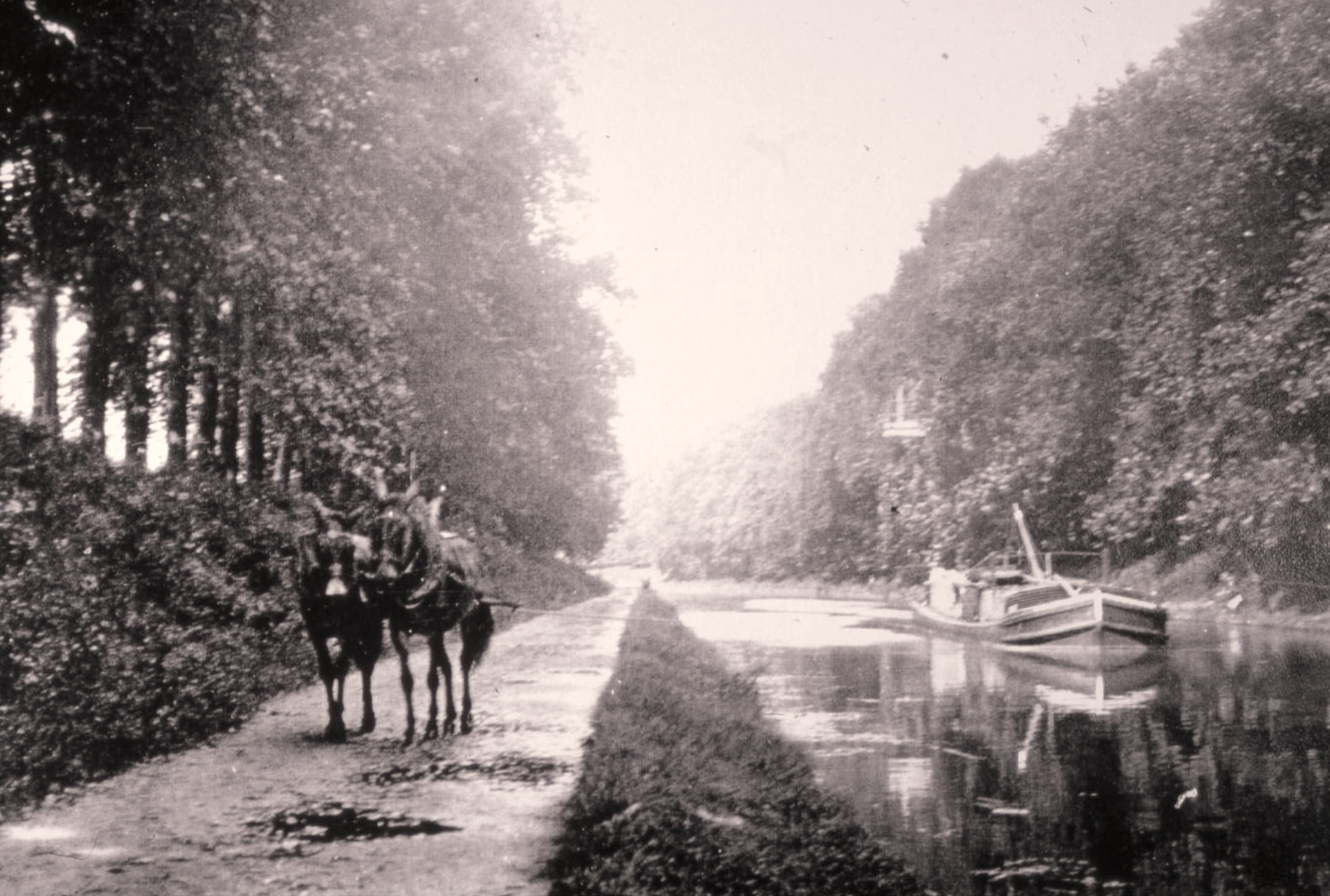
In 1881 the purchased the remaining canal. This firm developed along the canal and doubled the waterway’s usefulness by ferrying picnickers on the steam-powered Cleopatra from the Old Yellow Bridge at Indiana Avenue to .
Off and on during the 20th century (once in 1938, again in 1966), the canal bed attracted the attention of developers seeking thoroughfares in a crowded city. Finally, in 1971, this surviving fragment of a once-grand scheme of Hoosier public works received designation as an American Water Landmark. In 1976 the Indianapolis Water Company deeded the section south of 20th Street to the city, which in the 1980s redesigned the southernmost section into a downtown pedestrian park.

In 1994 an 8.2-mile segment of the canal towpath from the White River in Broad Ripple Village to 10th Street was studied as part of the Indianapolis Greenways Plan. That 8.2-mile segment is part of the greenways loop that connects the White River Wapahani Trail and the Monon Trail, both part of the Indianapolis Greenways Plan. The canal area south of the I-65 interchange in downtown Indianapolis is part of the Canal Walk which extends into White River State Park and terminates at White River (see ).
FURTHER READING
- Bakken, J. Darrell. “Now That Time Has Had Its Say”: A History of the Indianapolis Central Canal, 1835-2002. 2003; 1stBooks Library, 2003. https://archive.org/details/nowthattimehasha0000bakk.
- Fujawa, Ed. “History of the Central Canal .” Class 900 Indy. Accessed April 20, 2026. https://www.class900indy.com/history-of-the-central-canal.
CITE THIS ENTRY
APA:
Larson, J. L. (2021). Central Canal. Encyclopedia of Indianapolis. Retrieved Jul 24, 2026, from https://indyencyclopedia.org/central-canal/.
MLA:
Larson, John Lauritz. “Central Canal.” Encyclopedia of Indianapolis, 2021, https://indyencyclopedia.org/central-canal/. Accessed 24 Jul 2026.
Chicago:
Larson, John Lauritz. “Central Canal.” Encyclopedia of Indianapolis, 2021. Accessed Jul 24, 2026. https://indyencyclopedia.org/central-canal/.

Help improve this entry
Contribute information, offer corrections, suggest images.
You can also recommend new entries related to this topic.