Venerable Flackville The Flackville Neighborhood Association is a neighborhood organization bounded by 38th Street to the north, 16th Street to the south,… Read More »Venerable Flackville
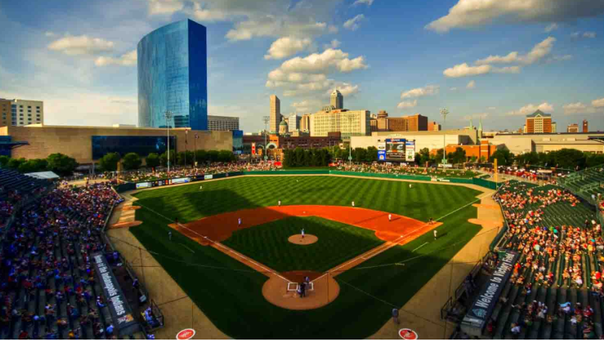
Victory Field From 1930 to 1996, , located on West 16th Street, was home to the Triple-A . In 1992, Major League… Read More »Victory Field
Village of West Clay Exhibiting the architectural theme of New Urbanism, a neighborhood design characterized by elements harkening back to pre-World II small towns,… Read More »Village of West Clay
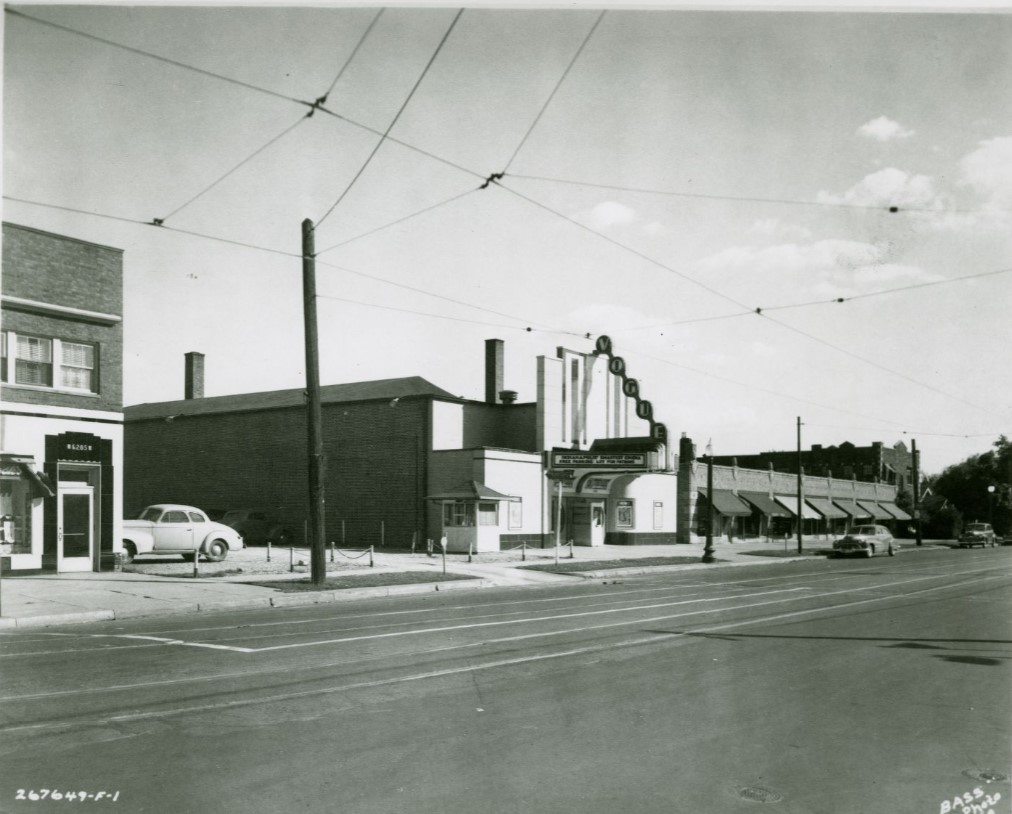
The Vogue A landmark for the neighborhood, located at 6259 North College Avenue, the Vogue opened in 1938 as an upscale movie… Read More »The Vogue
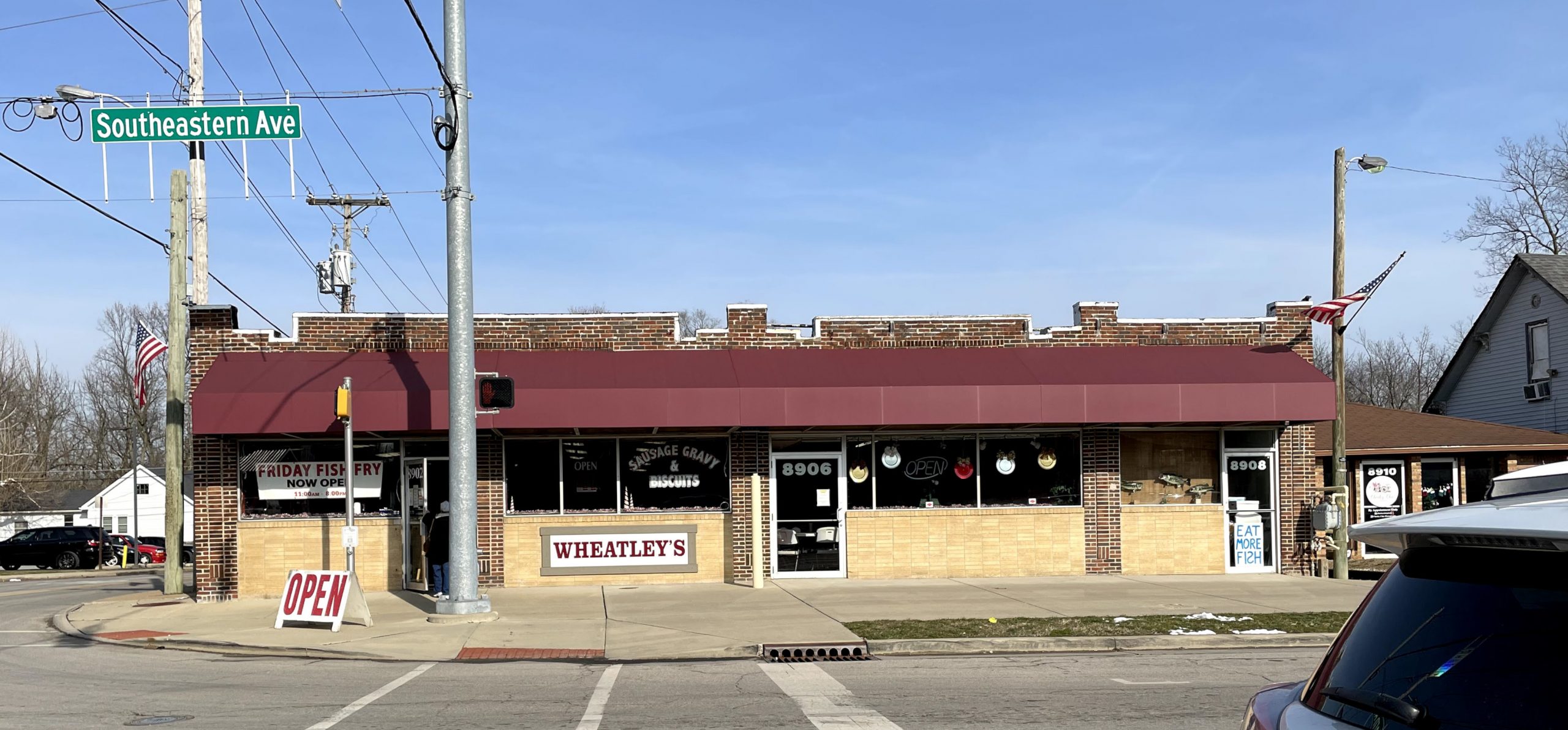
Wanamaker Wanamaker is a Franklin Township community centered at the intersection of Southeastern Avenue and South Post Road. In the 1820s,… Read More »Wanamaker
Warfleigh Warfleigh Neighborhood Association is a neighborhood organization bounded by the White River to the north and west, Westfield Boulevard to… Read More »Warfleigh
Warren Park Warren Park is a eastside bordered by 16th Street, Shadeland Avenue, 10th Street, and Perry Drive. It was a small… Read More »Warren Park
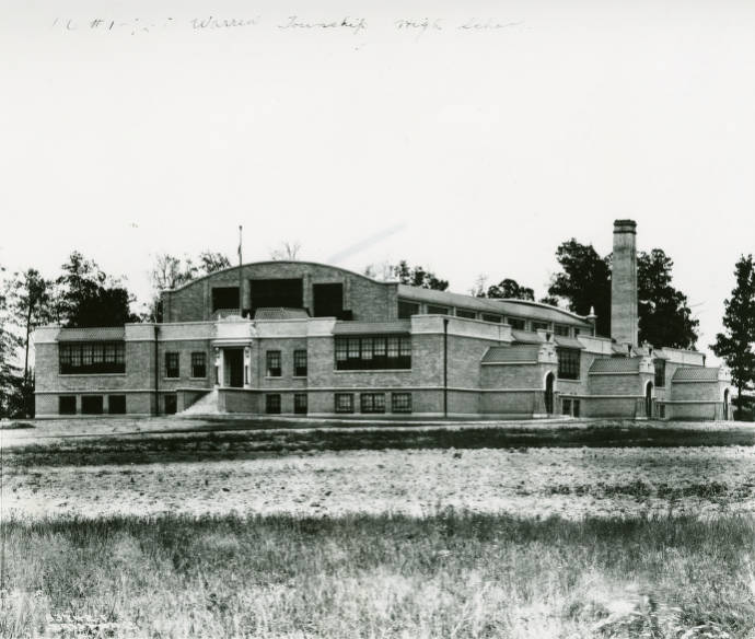
Warren Township Warren Township is located in the eastern portion of Marion County. When township boundaries were defined in 1822, commissioners named… Read More »Warren Township
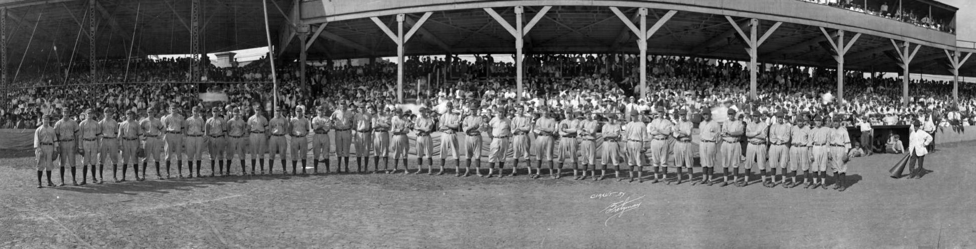
Washington Park Washington Park served as home field for a number of professional baseball organizations and local teams in the city in… Read More »Washington Park
Washington Place Washington Place Neighborhood Association is a neighborhood organization bounded by East 10th Street to the north, East Washington Street to… Read More »Washington Place