Northeast neighborhood bounded by 30th Street, 21st Street/Massachusetts Avenue/10th Street, Sherman Drive, and the , the Martindale-Brightwood neighborhood encompasses two previously independent settlements.
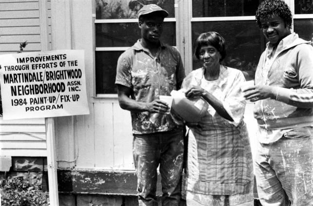
Brightwood, the eastern section of the neighborhood, was first platted in 1872 and amended in 1874. Railroad workers on the “Bee Line” were the first to settle the area, which soon became the railroad center of Indianapolis.
Possibly named in honor of local railroad figure John Bright, Brightwood was incorporated in 1876. The following year, the “Bee Line” opened a major yard and machine shop in the area. For the next two decades, the town developed autonomously until it was annexed by Indianapolis in 1897.
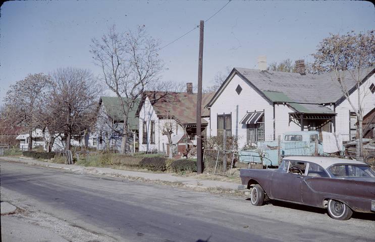
Martindale, the western section of the neighborhood, was settled by Frederick Ruschaupt and Gustave Zschech in 1874. Never an incorporated town, Martindale originally developed around Indianapolis Car Works, a railroad machinery factory established by Ruschaupt and Zschech in 1872. After two years in operation, Indianapolis Car Works went out of business, and the property was converted to Atlas Works in 1874. It was reorganized again as in 1878.
Like Brightwood, Martindale’s industrial growth was supported by neighboring railroad lines, including the and the . It was also heavily supported by manufacturing.
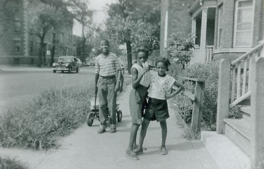
Before the turn of the 20th century, the blue-collar population of Martindale and Brightwood included a mix of African Americans as well as a growing proportion of foreign-born or first-generation European Americans. African Americans largely resided in Martindale, particularly around the industrial center of Beeler Street (renamed Martindale Avenue in 1895). Brightwood, meanwhile, mostly attracted white residents, predominantly of German, Irish, and British ancestry. These residents developed the town’s business district and commercial center at Station Street.
Martindale and Brightwood continued to prosper into the early part of the 20th century thanks to thriving railroads and increased industrialization in the area. During this period, major employers in Martindale included Indianapolis Gas Works, Wm. Eggles Field Lumberyard, Hoosier Sweat Collier Factory, the , the Monon Railroad yards, and Ertel Manufacturing Corporation (opened at the old Atlas Engine Works site in 1917). Major employers in Brightwood, meanwhile, included Laycock Manufacturing Company, Topp Hygienic Milk and Ice Company, George F. Neher & Sons, and the Big Four Railroads (Cleveland, Cincinnati, Chicago & St. Louis), which had merged with the “Bee Line” in 1889.
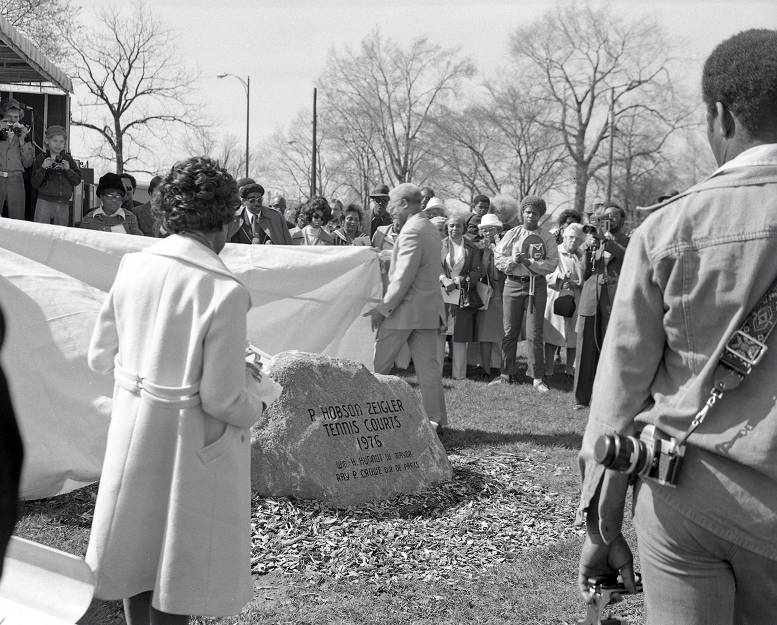
Residential and communal properties grew during this time as well, and each neighborhood had its own schools, parks, and community centers. In Brightwood, these institutions included IPS School 51/James Russell Lowell School (1900), Brightwood Public Library (1901), Brightwood YMCA (ca. 1905), Brightwood Commercial Club (1911), and Brightwood Community Center (1935). In Martindale, they included IPS School 38/John James Audubon School (ca. 1897), IPS School 56/ Frances W. Parker School (1902), and (1921), which was originally designated as Indianapolis’ African American park.
By the 1940s, most of Brightwood’s original railroad businesses had relocated to other towns. One of the earliest moves was by the “Big Four,” which opened its in 1908. After experiencing a gradual decline in rail activity, Brightwood’s railroad station was razed in 1944. Its last railroad connection was lost when (successor to the “Big Four”) moved its operations to in 1960.
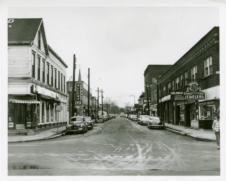
With the loss of the railroad industry, Brightwood went through a period of transition. White residents began to relocate to Indianapolis’ newly built suburbs. This out-migration left behind a surplus of housing, which was mostly acquired by lower-income African Americans.
Throughout this same period, Martindale remained an African American center of small working-class homes intermixed with industry, such as Major Tool and Machine (opened in 1946). New housing developments, including Douglass Park and Kingsley Terrace, were advertised to black families in publications such as the . The Recorder made its own move to Martindale in 1975.
During the 1970s, Martindale and Brightwood experienced another major change: the creation of Interstate 70. To construct this highway, several homes and businesses in the area were demolished. In response to these losses, many residents relocated to other parts of the city.
The population and economic changes of the postwar period resulted in an increase in poverty and crime throughout Martindale and Brightwood. Efforts to address these issues were often led by churches and community centers that had long histories in the area, including New Bethel Missionary Baptist Church (1875), St. John A.M.E. Church (1898), (1919), Trinity C.M.E. Church (1924), St. John’s Missionary Baptist Church (1926) (Martindale Avenue was renamed Dr. Andrew J. Brown Avenue in 1987 in honor of St. John’s longtime pastor Rev. ), (1941), Kingsley Terrace Church of Christ (1963), Wheeler-Dowe (1972), and , which relocated to the former campus of St. Francis de Sales Catholic Church in Brightwood in 1987.
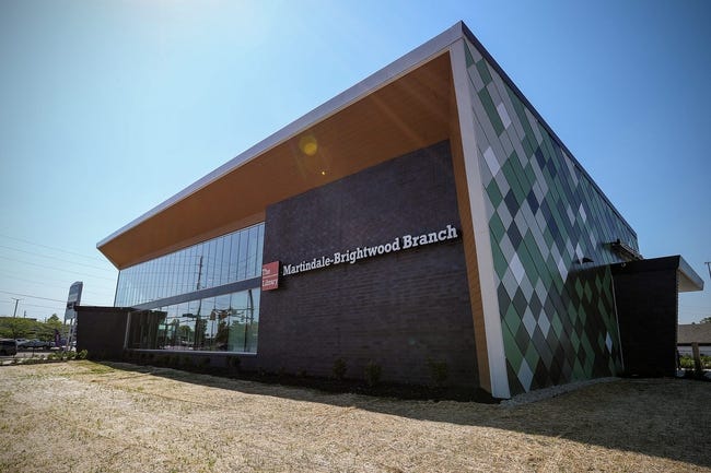
In 1992, the Martindale-Brightwood Community Development Corporation (MBCDC) was established to address residential needs and to serve as a catalyst for economic growth and development. MBCDC also served as the formal unification of the Martindale and Brightwood neighborhoods.
Since its founding, MBCDC has worked with its stakeholders to improve the neighborhood, which consists of residential homes, schools, churches, community centers, and industry. Recent additions to the area include Keystone Enterprise Park (2002), Felege Hiywot Center (2004), RecycleForce (2008), and KIPP Indy Public Charter Schools (2004, 2014, 2019) (see ).
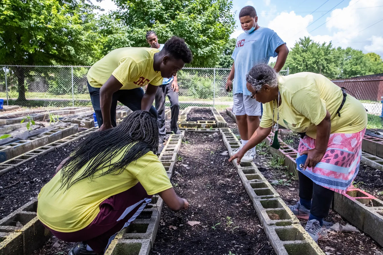
Major neighborhood revitalization projects include MB7 (Martindale-Brightwood 7), a quality-of-life initiative overseen by the Edna Martin Christian Center and PACE (Public Advocates in Community re-Entry), and Monon16, a neighborhood redevelopment effort centered around the Monon Trail.

Help improve this entry
Contribute information, offer corrections, suggest images.
You can also recommend new entries related to this topic.