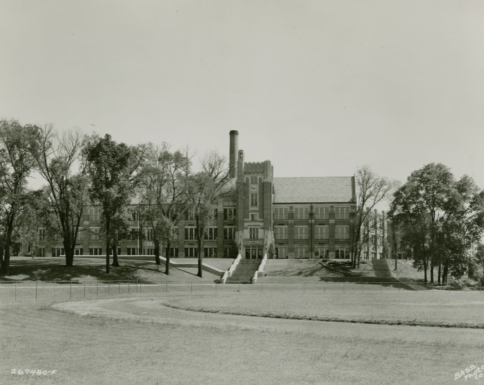
Thomas Carr Howe High School Thomas Carr Howe High School opened in the fall of 1938, marking the culmination of years of struggle by the… Read More »Thomas Carr Howe High School
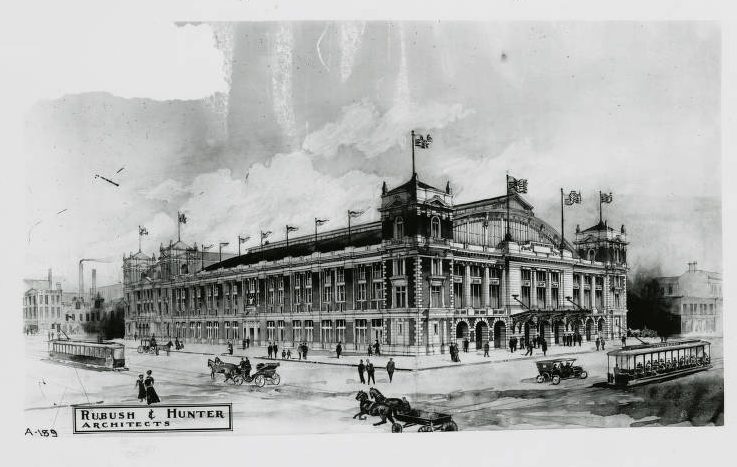
Tomlinson Hall Local druggist Stephen D. Tomlinson died in November 1870, leaving his estate to his wife, Mary. His will stipulated that… Read More »Tomlinson Hall
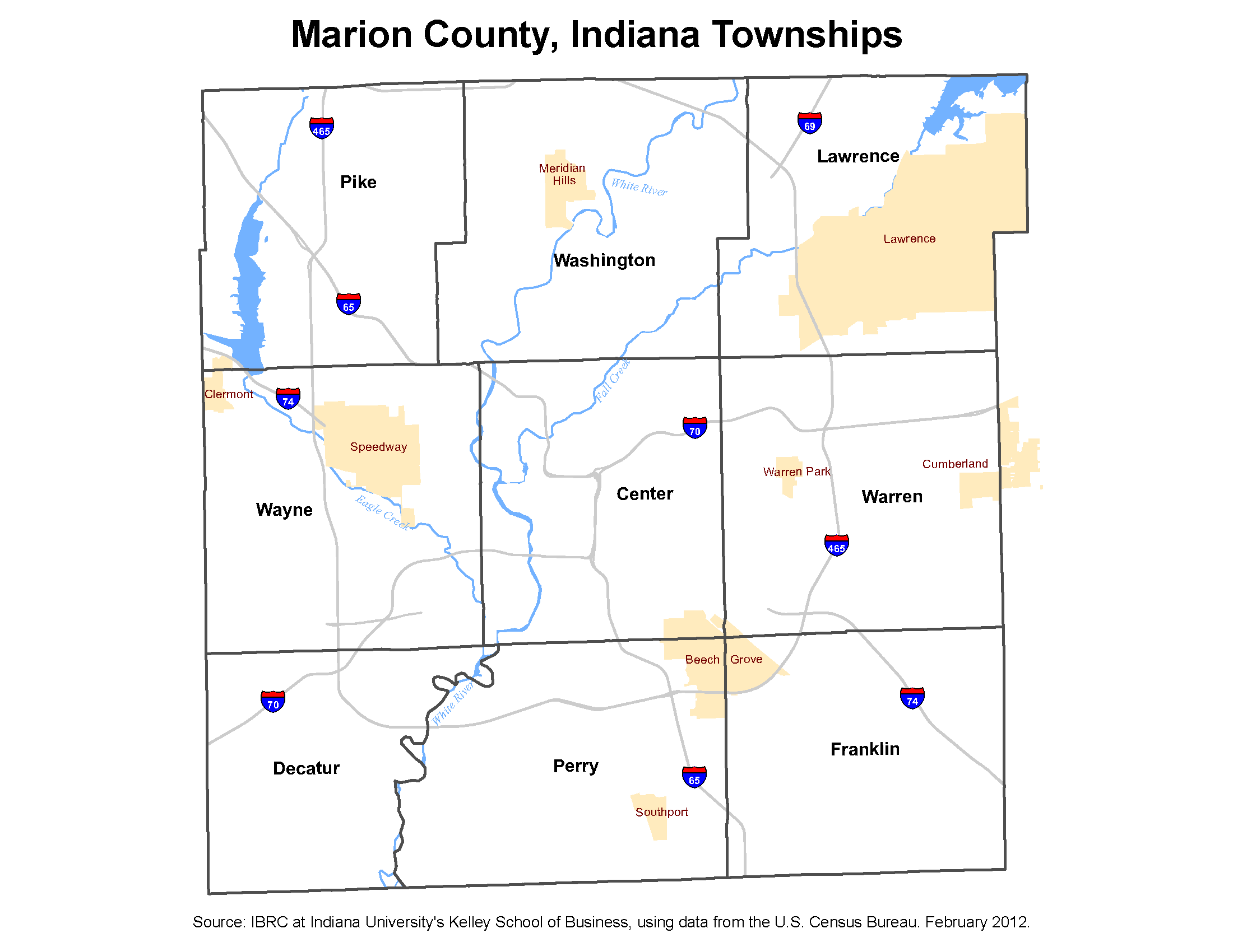
Townships The Indiana Constitution provides for the existence of townships, and successive state laws have instituted township government and its officers.… Read More »Townships
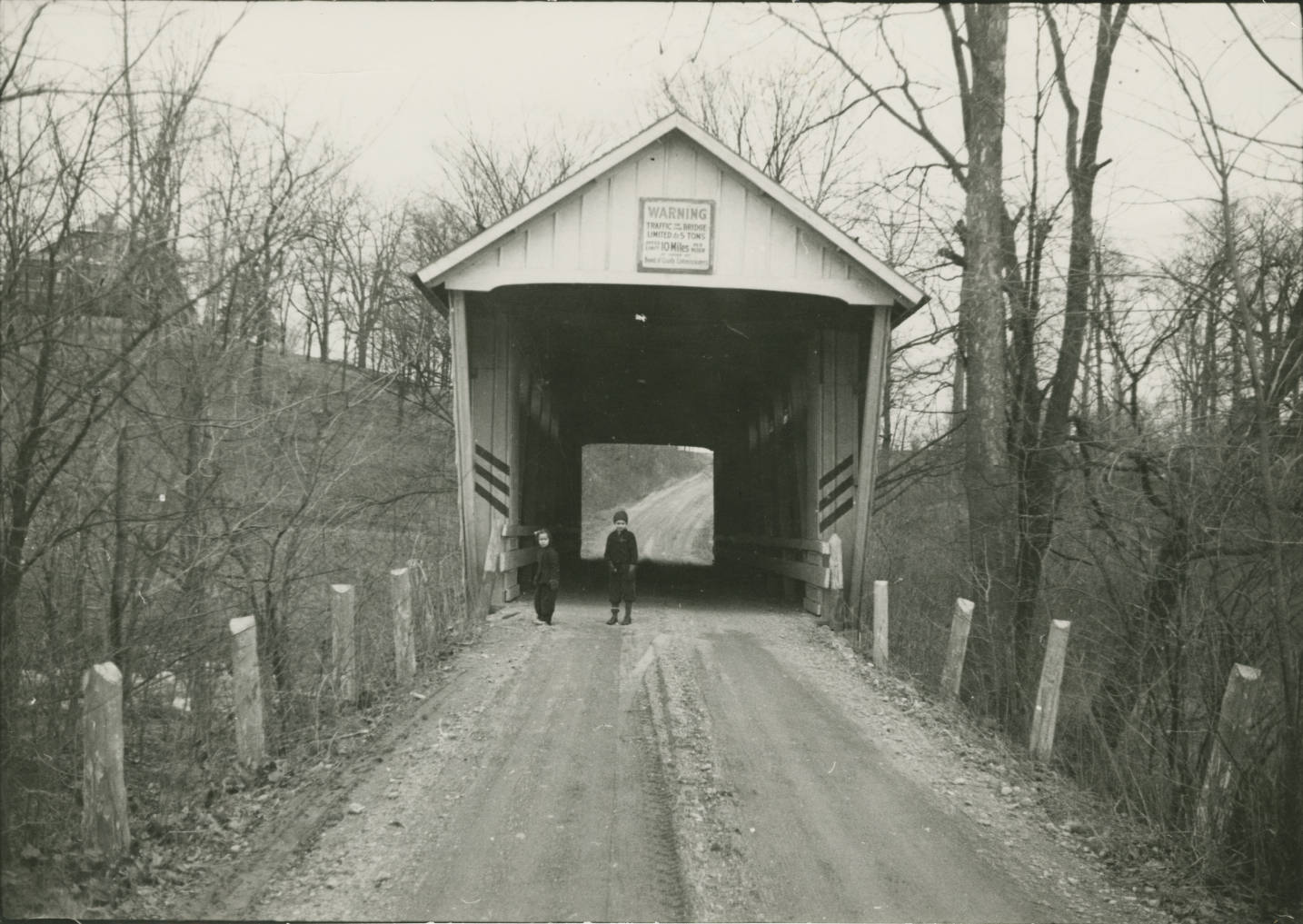
Traders Point Traders Point is a residential area located on Lafayette Road, north of 71st Street, in northwest Marion County. In 1864,… Read More »Traders Point
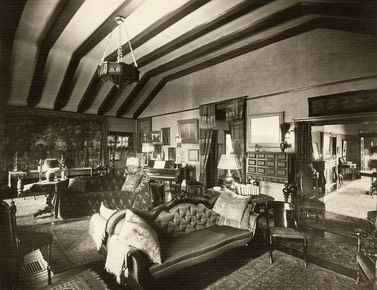
Tuckaway Built in 1906, “tucked away” among mature trees in the neighborhood, the affectionately-named house represents one of the earliest examples… Read More »Tuckaway
Tuxedo Park and Grace Tuxedo Park These neighborhoods are bounded by 10th Street, Linwood Avenue, Sherman Avenue, and Washington Street. The area north of Michigan Street… Read More »Tuxedo Park and Grace Tuxedo Park
Twin Aire Twin Aire is a neighborhood bounded roughly by CSX tracks to the north, Prospect Street to the south, CSX tracks… Read More »Twin Aire
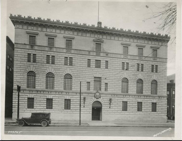
Tyndall Armory In 1921, following service in World War I, regiments of the began to organize again throughout the state. For the… Read More »Tyndall Armory
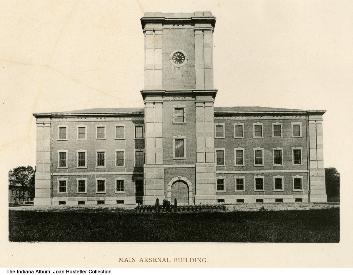
U.S. Arsenal Governor established a state arsenal in 1861 at the beginning of the Civil War to provide Indiana troops with munitions,… Read More »U.S. Arsenal
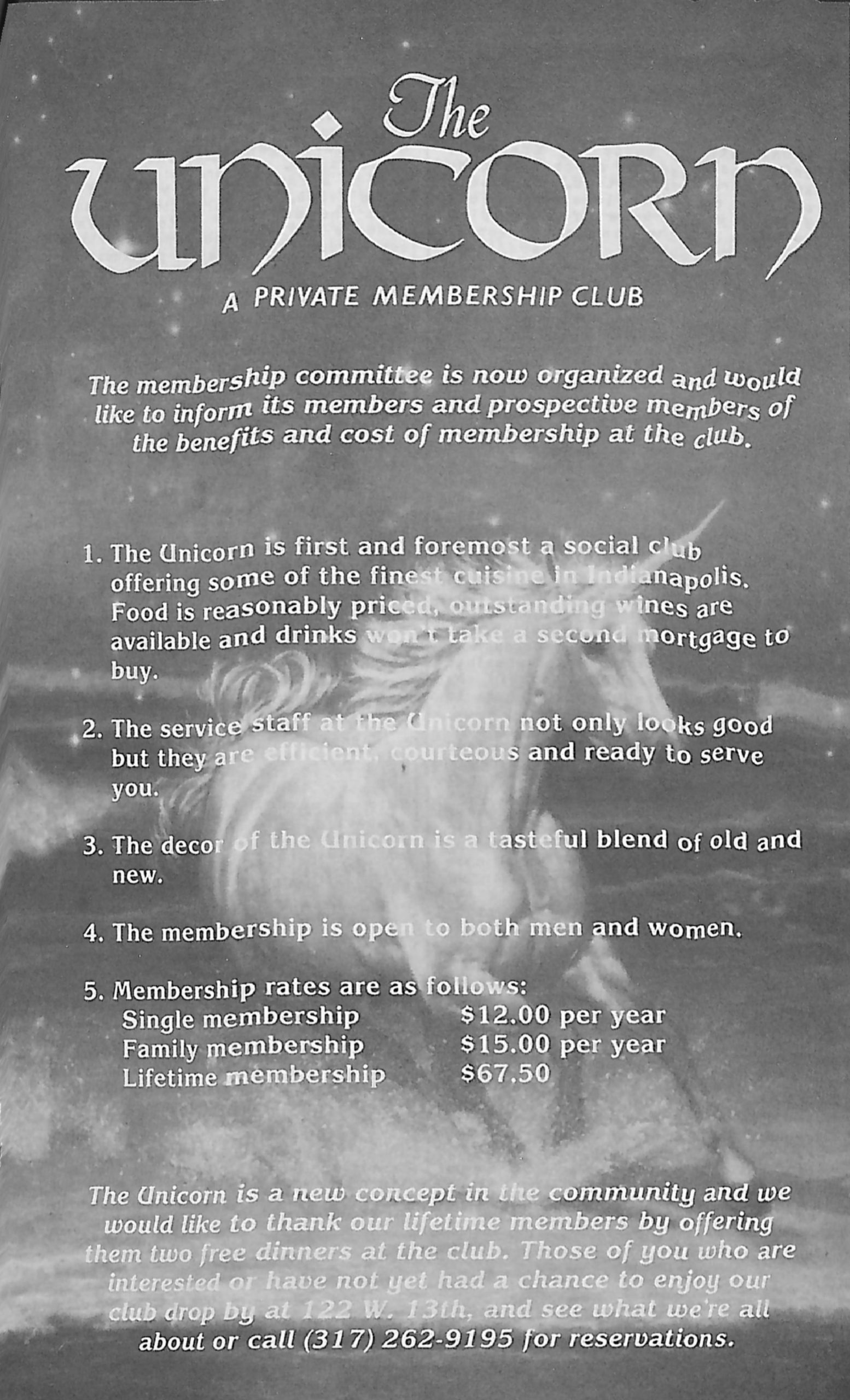
The Unicorn Club The Unicorn Club was a male strip club, catering primarily to gay male customers, located at 122 West 13th Street… Read More »The Unicorn Club