Meridian Highland Meridian Highland Neighborhood Association is a neighborhood organization bounded by Fall Creek Parkway South Drive to the north, 16th Street… Read More »Meridian Highland
Meridian Hills Located just north of the White River, Meridian Hills, bounded by Williams Creek, College Avenue, 71st and 64th streets, and… Read More »Meridian Hills
Meridian Park Meridian Park is an early-20th -century residential neighborhood sitting three miles north of Monument Circle. It is bounded by 30th… Read More »Meridian Park
Meridian Raymond Neighborhood Association Meridian Raymond Neighborhood Association is a neighborhood organization bounded by railroad tracks north of Frank Street to the north, Raymond… Read More »Meridian Raymond Neighborhood Association
Meridian-Kessler The Meridian-Kessler neighborhood derives its name from its western and northern boundaries—Kessler Boulevard and Meridian Street, respectively. The former Monon… Read More »Meridian-Kessler
Michigan Road Early in the state’s history, the Michigan Road linked the Ohio River to Lake Michigan. Using federal funds earmarked for… Read More »Michigan Road
Mickleyville Neighborhood Association Mickleyville Neighborhood Association is a neighborhood organization bounded by Oliver Avenue to the north, Minnesota Street to the south, Lynhurst… Read More »Mickleyville Neighborhood Association
Midtown The neighborhood colloquially known as Midtown is a historically African American neighborhood bounded by 16th Street, Dr. Martin Luther King… Read More »Midtown
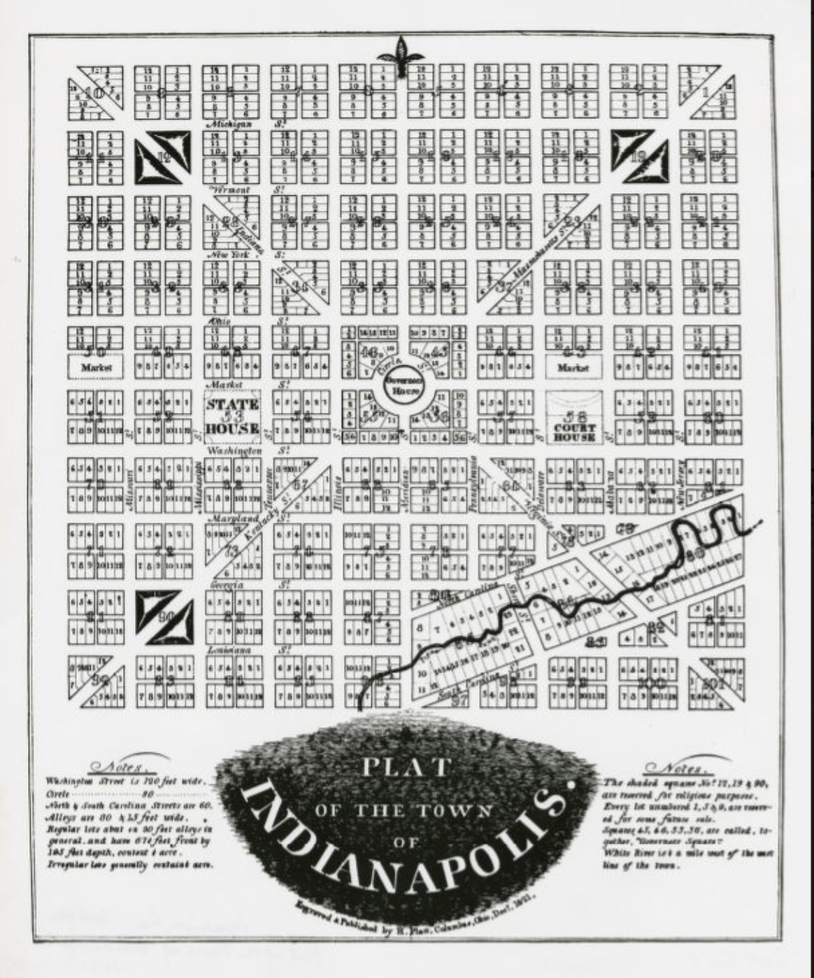
Mile Square The Mile Square encompasses the area comprising Indianapolis’ original plat created in 1821 by surveyor , who worked under Pierre… Read More »Mile Square
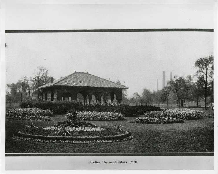
Military Park Bounded by West, New York, and Blackford streets and the , the 14-acre park is the oldest in the city.… Read More »Military Park