Brendonwood is a historic residential subdivision situated between Fall Creek and East 56th Street at roughly the 5700-6300 blocks. The name comes from the old English “bryndon” or “brendon” for hills combined with “wood,” reflecting the natural woodland of the area. It is a unique 350-acre self-regulated, nonprofit, country-styled residential park, eight miles northeast of downtown Indianapolis. An approximately 2-mile stretch of forms the west and north boundary, and 56th Street borders the property to the south. The eastern border runs straight north from the corner of Brendon Forest Road to Fall Creek.

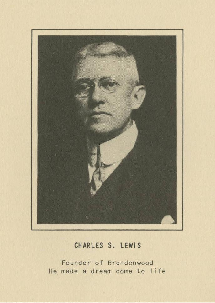
Charles Lewis established Brendonwood Common, Inc., in 1917. Earlier Lewis had developed the neighborhood, located along a section of Riverview Drive and College Avenue. He began acquiring property in the Fall Creek Valley, which he characterized as the most picturesque in Marion County, in 1909. Initially, he bought Mt. Nebo and adjacent bluffs over Fall Creek that had been popular 19th-century picnic spots. At the time 56th Street was a dirt lane called Military Road that led to .
In 1914 and 1915, Lewis purchased nine different plots of land to complete the 350-acre parcel. Creating home sites proved no simple task. The property included varied terrain—farmland, ravines, and hills. The thick underbrush covered much of it. There were no preexisting roads or lanes. Lewis hired A. H. Moore, a civil engineer with Indianapolis firm Jeup and Moore, to complete a topographical map as a starting point for development.

From fall 1914 through spring 1916, noted landscape architect and planner joined the project to prepare a road plan for Brendonwood. Kessler and Moore oversaw land clearance, grading, road construction, and utility installation.
Kessler provided the design and layout of a road plan to create the residential enclave. The design also called for 110 single-family home plots on 250 acres and common areas for the remaining 100, all enhanced by their natural environments and plantings.

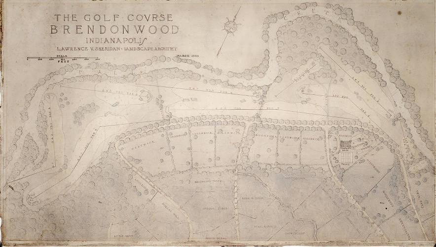
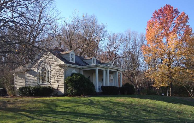
When Kessler left to serve in the U.S. Army during World War I, Laurence Sheridan, another landscape architect who later became Secretary of the Indianapolis Planning Commission, worked closely with Kessler and Moore and took over for Kessler when he left to design encampments for the U.S. Army. Sheridan designed the golf course in Brendonwood in 1923. The golf course became a victory garden during World War II but then was rehabilitated as a private PGA-rated nine-hole golf course. T. E. Hibben designed the Common House, which was built in 1924.
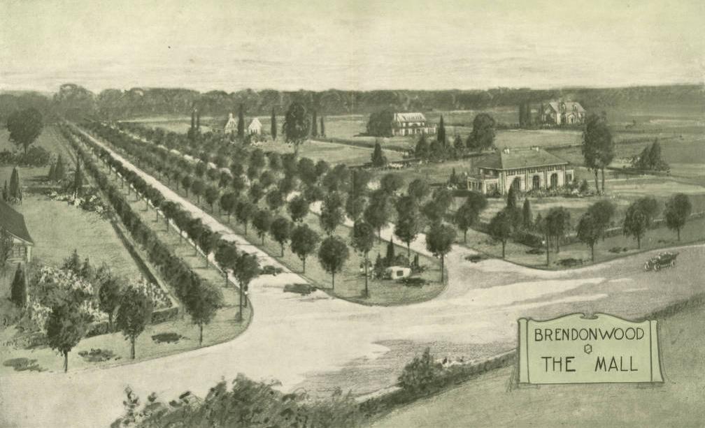
The curvilinear streets and scenic vistas of Kessler’s plan reflect a suburban expression of the City Beautiful movement of the early 20th century. Initially, George U. Davis supervised field reforestation, special shrubbery plantings, and installed a nursery for seedlings. The main entry, a double-laned formal drive, is called the Mall. Originally seven rows of elm lined it, creating an impressive introduction to the neighborhood. When the elms fell victim to Dutch Elm disease during the 1940s and 1950s, scarlet maples replaced them. The neighborhood also includes a white oak tree that the Purdue University Department of Forestry identified as one of the oldest such trees in the nation (about 400 years old). The plantings, through time, have grown more beautiful.

Lewis established protective guidelines concerning membership, a board of directors, assessments, and common and residential area maintenance while creating the park setting. For a time, an island in Fall Creek provided children with a private recreation area.
Residential plots and roads have names reflecting indigenous characteristics, like “Cloverhill.” Architectural styles vary from tudor to ranch. No business can be established in the residential community. Roads, and recreational facilities such as the pool, tennis courts, and Common House, are owned by all residents for their private use.
In 2004, Brendonwood was placed on both the Indiana Register of Historic Sites and Structures and the National Register of Historic Places.
FURTHER READING
- Brendonwood Common Board. “History of Brendonwood.” https://www.brendonwood.org/.
- Indiana Historical Society. “Brendonwood Collection.” https://images.indianahistory.org/digital/collection/p16797coll40.
- Rowland, Sallie. “Brendonwood Historic District.” National Register of Historic Places Inventory/Nomination Form. Indiana Department of Natural Resources, 2004. https://secure.in.gov/apps/dnr/shaard/r/24770/N/Brendonwood_HD_Marion_CO_Nom.pdf.
CITE THIS ENTRY
APA:
Walker, J. T. and Van Allen, E. J. (2021). Brendonwood. Encyclopedia of Indianapolis. Retrieved Feb 15, 2026, from https://indyencyclopedia.org/brendonwood/.
MLA:
Walker, Jane T. and Elizabeth J. Van Allen. “Brendonwood.” Encyclopedia of Indianapolis, 2021, https://indyencyclopedia.org/brendonwood/. Accessed 15 Feb 2026.
Chicago:
Walker, Jane T. and Elizabeth J. Van Allen. “Brendonwood.” Encyclopedia of Indianapolis, 2021. Accessed Feb 15, 2026. https://indyencyclopedia.org/brendonwood/.

Help improve this entry
Contribute information, offer corrections, suggest images.
You can also recommend new entries related to this topic.