Boone County’s proximity to the capital has been an important factor in the area’s growth and development over the years. Transportation routes between Indianapolis and the northern part of the state spurred early settlement. In 1828 the state legislature authorized the construction of the from Indianapolis to Lake Michigan. It passed through the eastern part of Boone County and became one of the most traveled highways in the state.
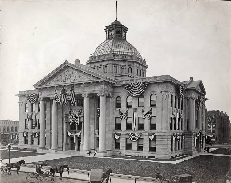
White settlement began in the 1820s, though the area around Thorntown was the site of a Native American settlement and French trading post in the 18th and early 19th centuries. The Eel River tribe of the Miami Indians resided there before the federal government forced their removal in the 1830s.
The county was organized in 1830 with 600 residents and named after Daniel Boone, the Kentucky pioneer. A site in the area’s geographic center, , became the county seat in 1832.
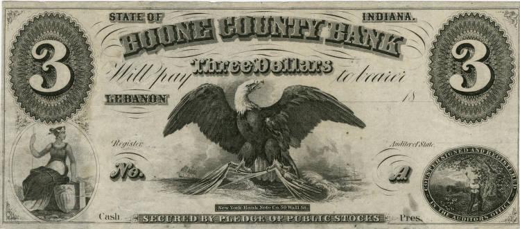
Railroad development in the 1850s boosted Boone County towns. The first line, the Indianapolis, Cincinnati, and Lafayette Railroad was completed in 1852. and sprang up along its route, and Lebanon prospered.
By 1875, Boone County listed 30,000 residents and 150 manufacturing establishments, in addition to a thriving agricultural economy. In the early 1900s tracks crisscrossed the county as part of the Indianapolis-Lafayette-Crawfordsville lines. Lebanon was the hub of a traction network, though the lines proved unprofitable by the late 1920s.
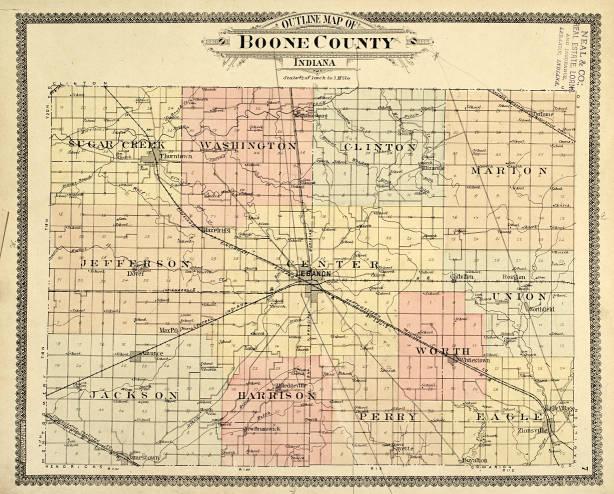
In 1929 Lebanon native Henry Ulen brought his east coast construction firm to Lebanon and incorporated the eponymous town north of the city. At just 0.06 square miles of land, Ulen features elegant homes, boulevard lighting, and a country club. The town, listed on the National Register of Historic Places in 2015 is surrounded by Lebanon and had a population of 117 people counted in the 2010 census.
Interstate 65 has catalyzed development in Boone County since the 1980s. Service establishments, including hotels and restaurants, continue to open along the route, while commuters enjoy direct access to Indianapolis. Boone County development officials predicted steady growth in the area, hoping for new high-tech manufacturing facilities and satellite industries from Lafayette’s Subaru-Isuzu automotive plant. They also planned for additional residential development as Indianapolis commuters are lured by the small-town ambiance.
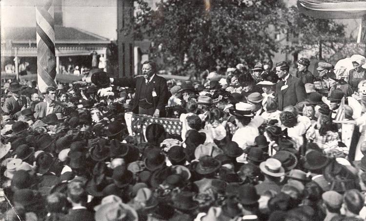
The county has a total area of 423.25 square miles (268,800 acres) and, according to the latest population estimates (2020), a population of 56,640 people, which is 95 percent white. It is bounded on the north by Clinton County, on the east by Hamilton County, on the southeast by Marion County, on the south by Hendricks County, and on the west by Montgomery County.
Boone County is divided into 12 civil townships and 29 unincorporated towns. The seven major cities and towns in Boone County are Advance, Jamestown, Lebanon, Thorntown, Ulen, Whitestown, and Zionsville which are served by three public school systems: Lebanon Community Schools, Zionsville Community Schools, and Western Boone County Community Schools.
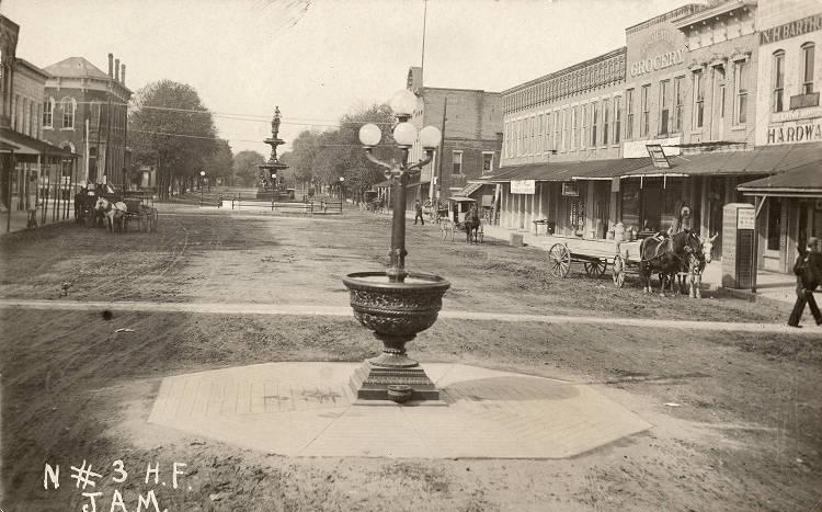
The county government is a constitutional body whose specific powers are granted by the Constitution of Indiana and by the Indiana Code. A county council serves as the legislative branch with representatives elected from county districts each serving a four-year term. A board of commissioners serves as the executive body.
Commissioners are elected county-wide, in staggered terms, and each serves a four-year term. The county maintains a small claims court with an elected judge serving a four-year term. The judge must be a member of the Indiana Bar Association and has a constable, who is also elected to serve a four-year term, as his/her assistant. Several other elected officers include a sheriff, coroner, auditor, treasurer, recorder, surveyor, and circuit court clerk. Boone County is part of Indiana’s 4th and 5th congressional districts, Indiana Senate districts 21 and 23, ad Indiana House of Representatives districts 28, 38, and 87. Before 1940, Boone County was decidedly a Democratic-leaning swing county. Since 1940 it has become a Republic stronghold.
Agriculture is a major component of the Boone County economy. During the 19th and early 20th centuries, Boone County was a prime producer of dairy products for the Indianapolis market. In the 21st century, the farming tradition remains strong. The total agricultural acreage of Boone County is 270,000 acres with nearly 75 percent of the county’s farmland used in alternating-year row crop production of corn and soybeans.
According to the Boone County Chamber of Commerce, the major employment sectors include distribution and logistics, education, healthcare, information technology, and manufacturing.
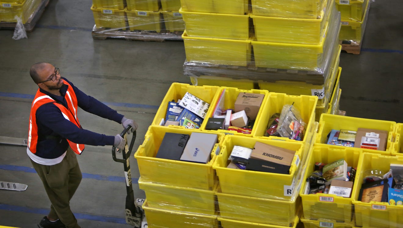
Notably, at the intersection of I-65 and State Road 267 in Whitestown, the Amazon distribution warehouse built in 2008 and opened the following year has become one of Boone County’s largest private employers, with more than 2,000 full-time employees. It boosted the establishment of similar warehouse and distribution operations companies nearby, notably General Nutrition Centers and Express Scripts.
Amazon’s presence also nudged the Central Indiana Regional Transportation Association (CIRTA) to establish a Whitestown Connector bus service, which runs between several Whitestown employers. The bus line helped local Whitestown businesses connect with a larger pool of potential workers. also established a bus line between Whitestown and a bus stop in the Traders Point area on Indianapolis’ northwest side.
FURTHER READING
- Boone County Historical Society. “Boone County History.” https://www.boonecountyhistorical.org/boone-county-history.html.
CITE THIS ENTRY
APA:
Donnelly, Cathleen F. & Verderame, J. A. (2021). Boone County. Encyclopedia of Indianapolis. Retrieved Feb 20, 2026, from https://indyencyclopedia.org/boone-county/.
MLA:
Donnelly, Cathleen F. and Jyoti A. Verderame. “Boone County.” Encyclopedia of Indianapolis, 2021, https://indyencyclopedia.org/boone-county/. Accessed 20 Feb 2026.
Chicago:
Donnelly, Cathleen F. and Jyoti A. Verderame. “Boone County.” Encyclopedia of Indianapolis, 2021. Accessed Feb 20, 2026. https://indyencyclopedia.org/boone-county/.

Is this your community?
Do you have photos or stories?
Contribute to this page by emailing us your suggestions.