Marion County was organized into nine townships in 1822. Within three years, selected the fledgling settlement in Center Township as the site for the new one-square-mile state capital.
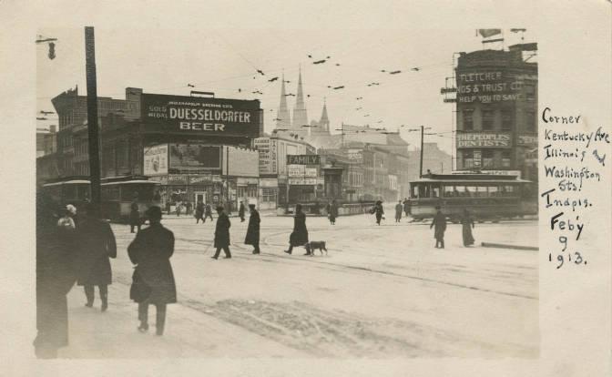
Early growth was slow, despite the relocation of state government offices from Corydon in 1825 and the construction of the and the in the 1830s. Completion of rail lines to the city in the late 1840s and 1850s spurred intensive commercial and residential development. Packing houses, factories, and mills sprang up along the railroads, particularly to the south and west of the Circle. A thriving retail and commercial business district developed along Washington Street. The city continued to expand and grow through the Civil War and up to the early 1870s when 48,000 residents were counted.
The Panic of 1873 put a temporary halt to development, but 10 years later Indianapolis and Center Township were once again booming. The , constructed in the late 1870s, successfully channeled a number of rail lines south and west of the city to . The on the city’s south side expanded, while commercial and retail buildings were constructed north of the Washington Street corridor.
Residential neighborhoods known today as the , , , , , and grew and prospered as the demand for housing increased. Industrial neighborhoods such as , , and housed employees of nearby railroads, packing plants, and foundries. The census counted nearly 81,000 township residents in 1880; by 1890, over 117,000.
In the early 20th century, the city grew to the boundaries of Center Township and beyond. The development of streetcar lines and, later, a network of bridges and paved roads for automobiles, ensured residents access to developing suburbs. Between 1900 and 1950, the township population increased from 168,000 to just over 337,000.
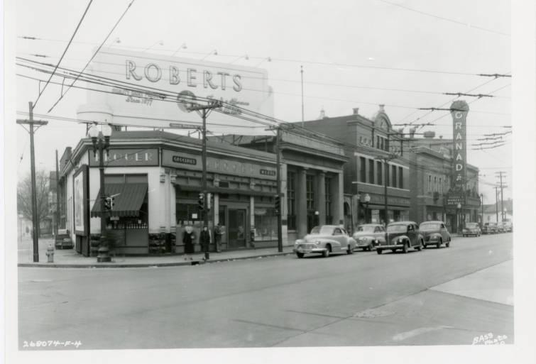
A congested Center Township began to lose residents in the post-World War II years as the demand for new housing created explosive growth in outlying townships. Between 1960 and 1970, the population dropped from 333,000 to 274,000. Commercial, retail, and manufacturing firms also began to abandon the center city for the suburbs, lured by lower taxes, cheap land, and accessibility to interstate highways.
Efforts to reverse this trend began as early as the 1950s with the Central Business District Plan, then intensified in 1964 with the creation of the (GIPC). Planners, policymakers, and city leaders began to focus their attention on downtown revitalization. IN 1981 I was adopted, calling for joint public-private investment, growth in office space, a rejuvenated retail core, and a comprehensive transportation system. This plan aimed to stem the exodus of downtown residents to the suburbs, whereas the 1990 Regional Center Plan more determinedly aimed to double the downtown population and increase the housing inventory five-fold by the year 2020.
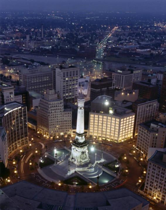
Six million square feet of new office space and $63.8 million in new amateur sports facilities were constructed between 1980 and 1988.
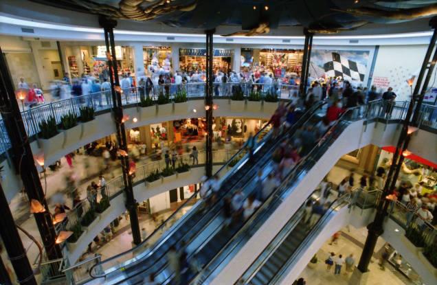
More ambitiously, between 1996 and 2008 , , and were built to replace older sports facilities housing the Indianapolis Indians, the Indiana Pacers, and the Indianapolis Colts, respectively. The rehabilitation and conversion of Union Station into a Festival Marketplace in 1986 and the opening of in 1995 added hundreds of new jobs and more than one million square feet of retail space.
Center Township continues to be an employment center. The largest employers include Fortune 500 firms such as , , , and . Hospital giant , federal, state, and county governments, banks, and (IUPUI) complete the list of major downtown employers.
Downtown Indianapolis offers more than 350 acres of parks, waterways, trails, and green spaces. The 1.5-mile Canal Walk provides an urban pathway that brings tourists and locals within close proximity of major downtown venues such as the , museums, the and White River Gardens, sports facilities, the Georgia Street boardwalk, and 7,514 hotel rooms. A climate-controlled skywalk system links the hotel rooms and businesses to the , , and Lucas Oil Stadium. The winding downtown 8-mile connects pedestrians and cyclists from numerous historic neighborhoods to the businesses, restaurants, cultural and recreational venues, and grocery stores in the city center.
Indianapolis Public Schools serves Center Township and a few portions of surrounding townships. Incorporated in 1853, the school system is the largest in the capital and in the state with a 2019-2020 enrollment of 31,885 students in 70 schools. As an alternative, charter schools have opened in Center Township. These schools offer more flexibility than traditional public schools and typically have higher accountability standards, however, many charter schools have lost students and have been marked by low test scores. Post-secondary schools in Center Township include and IUPUI.
The Red Line opened in the summer of 2019 with seven downtown bus stations connecting riders from downtown to , Fountain Square, and the University of Indianapolis.
When a seven-block stretch of gained recognition on the National Register of Historic Places in 1982, Tax Increment Financing-style tax breaks made available to developers encouraged the revitalization of the street. An initial influx of art galleries in the 1980s paved the way for the high-end restaurants and eclectic mix of independently owned retail shops that line the street.
The —the ambitious redevelopment of the former Coca-Cola Bottling Plant at the north end of the street—aimed at enticing tourists and locals to Massachusetts Avenue with a boutique hotel, food hall, and a market complex complete with office space and housing. Similarly, the transformation of the Fountain Square neighborhood was sparked by an art collective, . Urban pioneers like Big Car led the effort to redevelop the blighted area into what has become Indianapolis’ center of music and film. The Cultural Trail links the city center to Fountain Square’s craft breweries, art galleries, bike shops, and high-end local produce stores. In 2020 the rapid transformation of Fountain Square from a run-down ghost town to a thriving cultural hub has elevated property values for long-time homeowners and the artists who spurred the resurgence of Fountain Square.
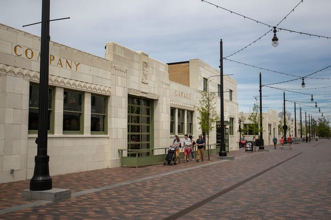
The movement back to Center Township largely stemmed from two age groups—empty-nesters who abandoned the suburbs for the newly invigorated downtown and young professionals drawn by employment opportunities in the Mile Square. The population grew from 142,787 in 2010 to 153,549 in 2020. This figure represents a population growth of 7.5 percent, the first population increase for any census since 1960.
One controversial result of these changes was the claim that gentrification was displacing downtown residents who could not afford to live in revitalized but increasingly expensive Center Township neighborhoods. A growing population of homeless individuals also caused concern.
City officials sought to encourage diversity among housing stock that would be suitable for various income levels, but it was unclear by 2020 whether these efforts would succeed or even whether the COVID-19 pandemic had blunted the dynamics that made the central city a newly desirable place to live.

Is this your community?
Do you have photos or stories?
Contribute to this page by emailing us your suggestions.