Carson Heights Carson Heights is a neighborhood on the south side of Indianapolis. While the boundaries of the neighborhood are not clearly… Read More »Carson Heights
Carson Square Carson Square is a neighborhood located south of the University of Indianapolis and east of University Heights. The neighborhood is… Read More »Carson Square
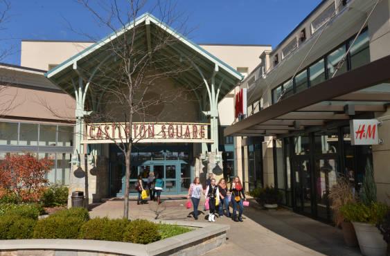
Castleton Castleton is a northeast side neighborhood located on East 82nd Street in Lawrence Township. The congested commercial district of Castleton… Read More »Castleton
Center Township Marion County was organized into nine townships in 1822. Within three years, selected the fledgling settlement in Center Township as… Read More »Center Township
Chapel Hill Chapel Hill is bounded by 10th Street to the north, Westlake Road to the south, Interstate 465 to the east,… Read More »Chapel Hill
Chatham Arch Located on the northeastside of downtown Indianapolis, bounded by I-65, College Avenue, East Street, and North Street, Chatham Arch is… Read More »Chatham Arch
Christian Park Christian Park is a neighborhood bounded by Washington Street to the north, railroad tracks to the south, Emerson Avenue to… Read More »Christian Park
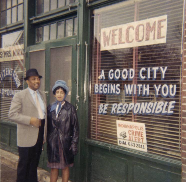
Citizens Forum Begun as a citizens’ group in July 1964, the organizational meeting was coordinated by city councilmen Rufus Kuykendall, Rev. ,… Read More »Citizens Forum
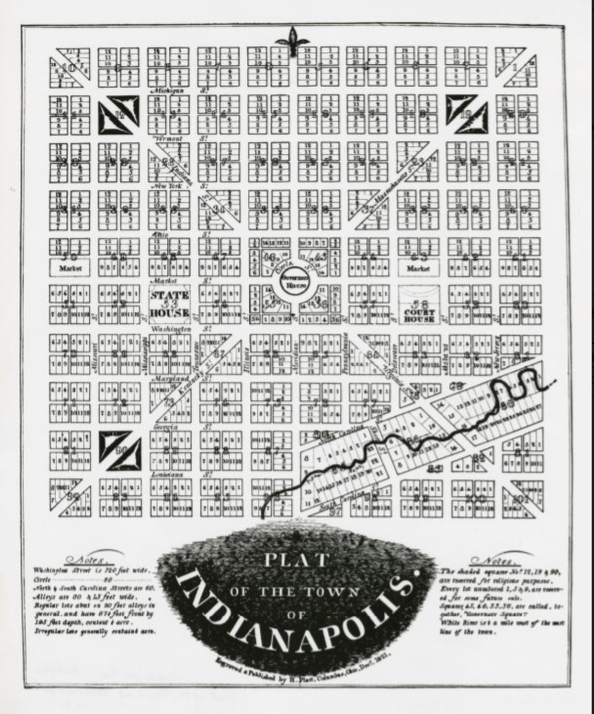
City Planning The history of city planning in Indianapolis began with the founders’ plat. As the plan for the capital city of… Read More »City Planning
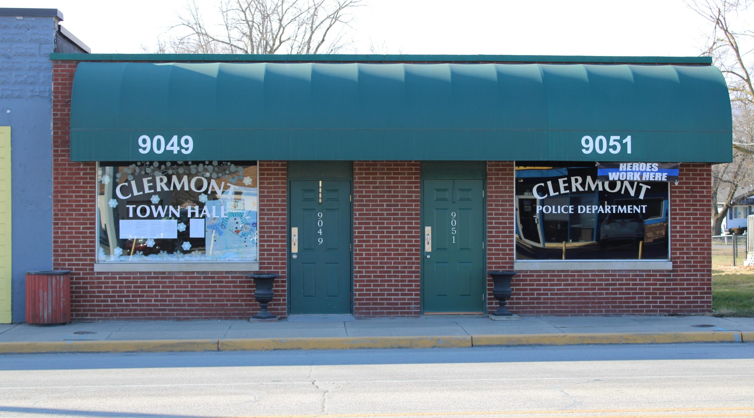
Clermont Clermont is a northwest town located along Crawfordsville Road (U.S. Highway 136) at the Marion County line. In April 1849,… Read More »Clermont