Early History
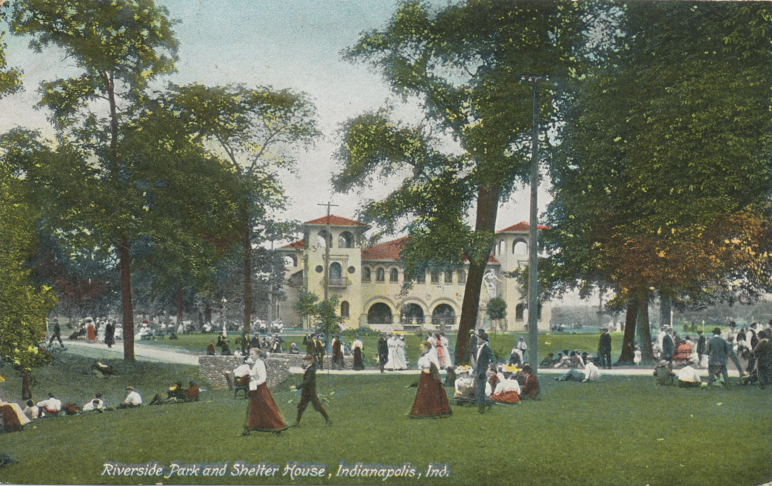
The area now occupied by Riverside Park was developed for agricultural use beginning in the 1820s. Although it was comparatively close to Indianapolis, little development occurred in this area until the 1870s. The area along the became a popular recreation space during the last half of the 19th century and several privately owned parks opened along this corridor.
Design and Development
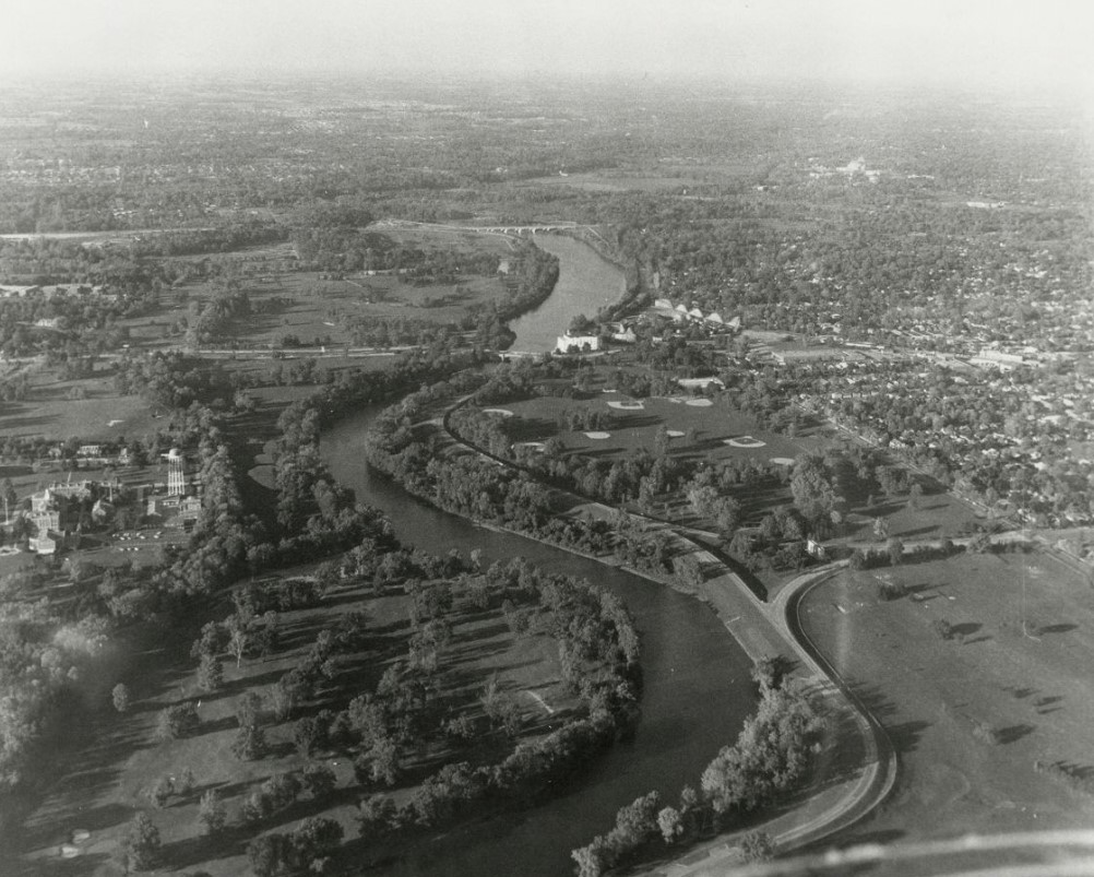
In 1898, the Board of Park Commissioners and Mayor negotiated the purchase of large tracts of land around Indianapolis to form new park and parkway systems in the northwest and northeast parts of the city. The largest was the 953-acre tract along the White River that would become Riverside Park. When it opened in 1899, Riverside Park was one of the largest municipal parks in the United States. It would remain the largest park in until the creation of in 1962. Investment in Riverside Park declined after , and many facilities were demolished and never replaced, while others suffered decades of neglect. Interstate 65 was built through the park in the 1960s, destroying some of its popular recreational spaces. Riverside Park was listed in the National Register of Historic Places in 2003 as a part of the Historic District.
Key Designers
Park Superintendent J. Clyde Power defined the design of Riverside Park. Enhancements and subsequent improvements came under the direction of landscape architect . H. W. Klausmann designed the park’s two landmark bridges, and landscape architect continued Kessler’s work and designed new planting schemes for specific sections of the park.
Historic Core
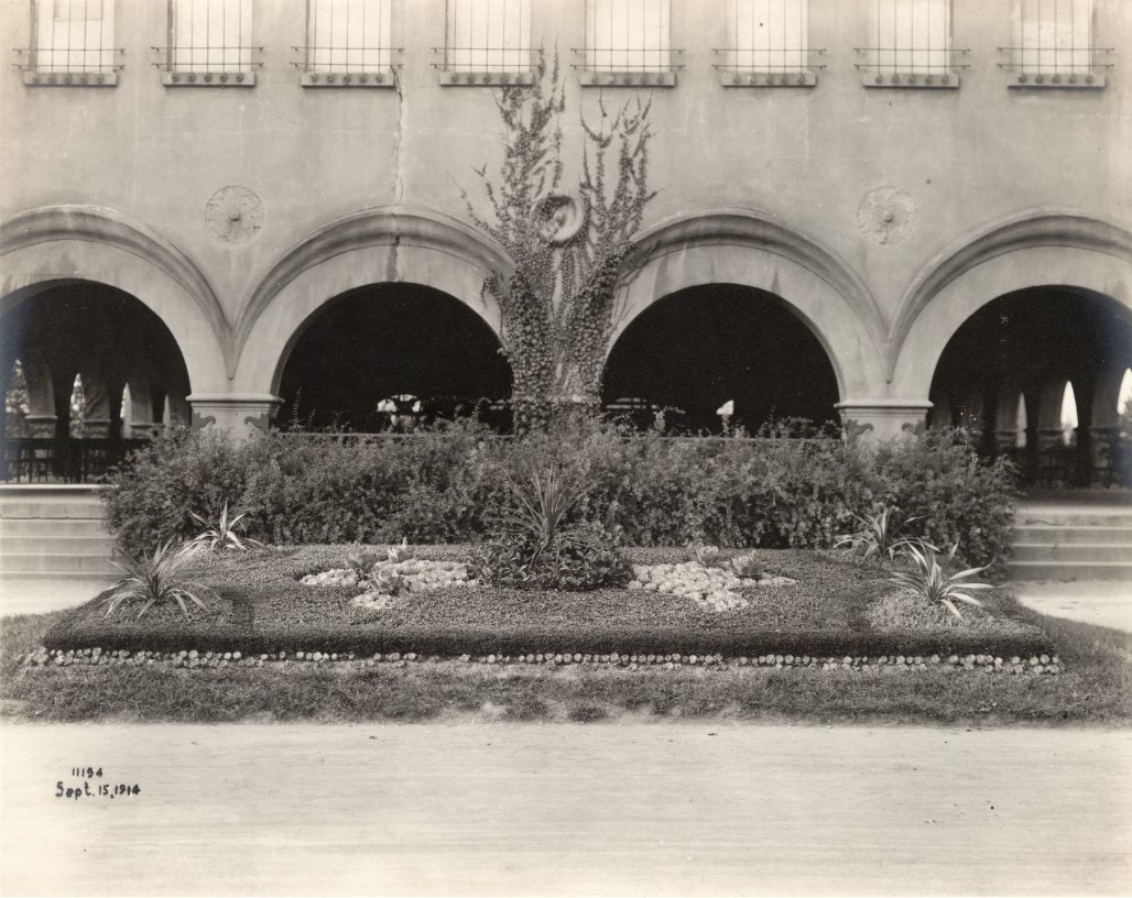
The historic core of Riverside Park was at the northwest corner of the White River and 30th Street. This area developed between 1898 and the 1910s, at the termination of the streetcar lineThis area developed between 1898 and the 1910s, at the termination of the streetcar line (see ), and included a large shelter house, zoological department, playgrounds, and boat houses. The historic core includes the following:
- Riverside Park Shelter House (Casino)
- Zoological Department
- Memorial Soap Box Derby Hill
- Riverside Marina
- Wacker House / Iron Skillet Restaurant
- Riverside Park “Proper”
The area that now regards as Riverside Park “proper” served as the main entrance to Riverside Park and contained mainly unprogrammed open space during much of the park’s history. The drive extending from Burdsal Parkway was planned as the main driving entrance, and the Taggart Memorial was later built on the median as a key landmark of the park. The electric streetcar terminus for Riverside Park included a turnaround loop in the triangular area between East Riverside Drive and 29th and 30th streets, offering easy access to the core of the park and to the adjacent .

Following the Great Flood of 1913, earthen levees were built along the east bank of the White River, cutting off most views of the river and the City Beautiful bridges that had been built to enhance the corridor. This section of the park now contains the primary programmed areas aside from the golf courses. The primary programmed areas included:
- Riverside Amusement Park
- Thomas Taggart Memorial
- Riverside Family Recreation & Aquatic Center
- Athletic Facilities
- Riverside Nursery
- Riverside State Fish Hatchery
- Lake Reginald Sullivan
- Indianapolis Canoe Club / Casino Gardens /
- McClamrock’s Woods / Camp Robinson Memorial / Memorial Grove
- Bridges & Dams
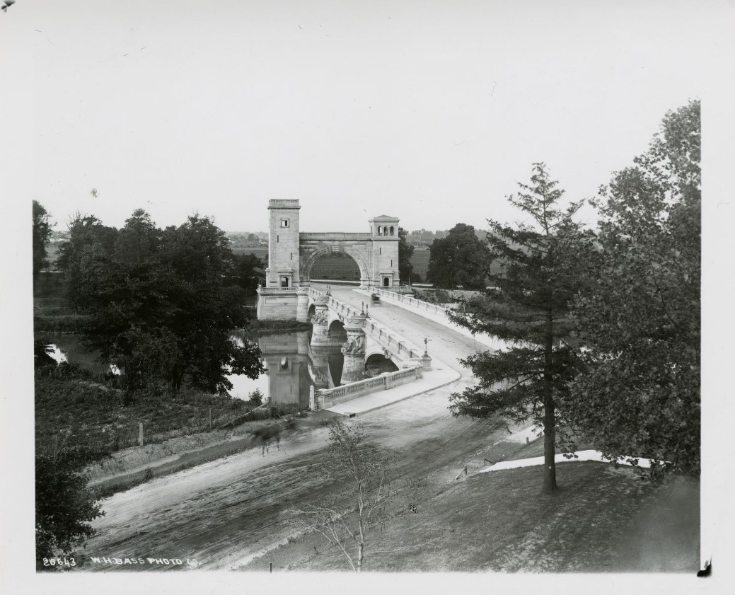
Riverside Park contains several historic bridges and one historic dam. At the time Riverside Park was created, the property contained existing iron truss bridges at 16th and 30th streets. George Kessler and park superintendent J. Clyde Power felt that these bridges were inconsistent with their natural settings and planned for new concrete arch bridges following the principles of the City Beautiful movement and including Beaux-Arts neoclassical limestone cladding and ornamental lampposts. The historic bridges and dam include:
- Emrichsville Bridge / 16th Street Bridge
- Emrichsville Dam
- 30th Street Bridge
- Big Four Bridge
- Suspension Bridges
- Cold Spring Road Bridge
- Crooked Creek Bridge (Lake Reginald Sullivan)
- Golf Courses
Riverside Park’s three golf courses, Riverside Golf Course, South Grove Golf Course, and Highland Golf Club/Charles E. Coffin Golf Course initially opened between 1900 and 1903. Golf became a popular new sport for wealthy Americans during the 1880s and 1890s. In 1897, the first golf course in Indianapolis was built adjacent to the Indianapolis Country Club, now the Woodstock Club’s golf course (see ). The plan for Riverside Park included municipal golf courses, meeting demand for the popular sport among those who could not afford to join private country clubs. Golf grew rapidly in popularity during the 1910s and all municipal golf courses required intense maintenance and improvements to keep up with demand. All three golf courses appear to have undergone at least one major redesign during the 20th century.
21st Century
In 2017, Indy Parks received broad support from the communities bordering Riverside Park, the Indy Parks Board, and the to develop a master plan for the rebranded Riverside Regional Park. The master plan resulted in a projected $120 million project to be completed in 20 years.
Golf Courses
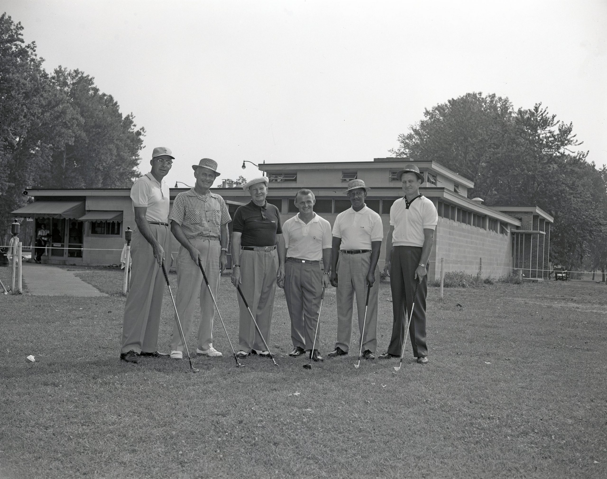
After much research into whether golf courses should occupy a large portion of Riverside Regional Park, Indy Parks made the decision to keep one of the three courses in the park. South Grove Golf Course will be used as part of a pedestrian promenade, new baseball facility, tennis center, unprogrammed green space and multiuse playfields. Riverside Golf Course’s new use will include an ecology-based adventure park, featuring constructed wetlands and a canopy walk, cyclocross and mountain bike courses, and a bike park, urban farm, disc golf course and nature center. Coffin Golf Course will remain an 18-hole course with improvements to include a new clubhouse and other amenities. The Riverside Golf Academy will also remain and be improved as an instructional venue and potential home for the Indiana Golf Association.
Riverside Promenade
The Master Plan envisioned the Promenade to be a unique pedestrian corridor that would run the length of Riverside Park along Riverside Drive from 16th Street at the south to 30th Street to the north. Composed of six “nodes,” the wide pedestrian trail would also include lighting, seating areas, new street trees, and signage/graphics that could highlight important events and/or individuals from Riverside’s storied history. Each node will have a mini-plaza that will pay homage to the surrounding community’s history, traditions, and achievements. The promenade will anchor two cycling and pedestrian paths, the White River Trail, and the Central Canal Trail. Most importantly, because of the sheer size of the Riverside Regional Park, the promenade will unite what feels like a fragmented greenspace.
Thomas Taggart Memorial
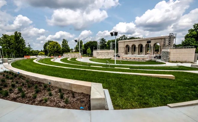
Restoration of the Thomas Taggart Memorial as an outdoor amphitheater was another component of the master plan. The $10 million project, partially funded through a grant from the aimed to draw people to the venue for live theater, musical concerts, and movies. With its opening in 2020, the terraced seating theater provides seating for 650 with additional lawn seating. The Indianapolis Shakespeare Company became the venue’s permanent tenant.
The Riverside Regional Master Plan contains detailed information on the various features, including but not limited to the historic core, the programmed areas, the historic bridges and dam, and the three golf courses. View the master plan: Riverside Regional Master Plan.

Help improve this entry
Contribute information, offer corrections, suggest images.
You can also recommend new entries related to this topic.


