Dubarry Dubarry Determined is a neighborhood organization bounded by 38th Street to the north, 30th Street to the south, Post Road… Read More »Dubarry
Eagle Valley Eagle Valley Neighborhood Organization is a neighborhood organization bounded by Vermont Avenue to the north, Washington Street to the south,… Read More »Eagle Valley
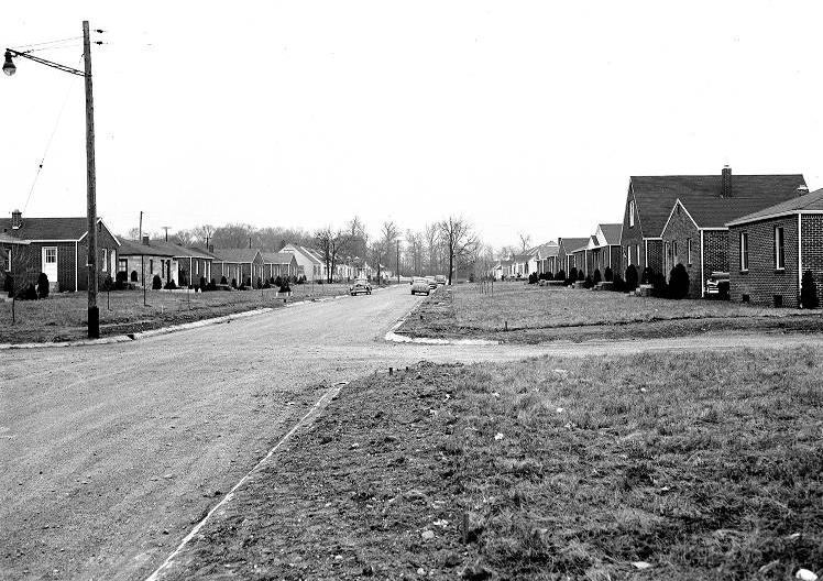
Eagledale Eagledale is a post-World War II neighborhood centered near the intersection of 34th Street and Georgetown Road. In the 1950s,… Read More »Eagledale
Fairfax Fairfax Neighborhood Association is a neighborhood organization bounded by 10th Street to the north, Vermont Street to the south, Tibbs… Read More »Fairfax
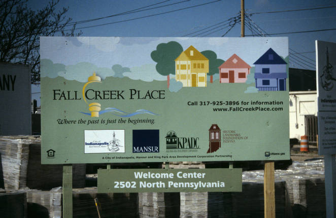
Fall Creek Place Located two miles north of Downtown between 22nd Street and Fall Creek, east of Pennsylvania Street and west of College… Read More »Fall Creek Place
Far Eastside Far Eastside Neighborhood Association is a neighborhood organization bounded by East 30th Street to the north, 10th Street to Post… Read More »Far Eastside
Fayette Street Situated along the Indianapolis upper canal area, bounded by 9th , 10th , Martin Luther King Jr., and North Missouri… Read More »Fayette Street
Fletcher-Lippencott Neighborhood Association The Fletcher-Lippencott Neighborhood Association is a neighborhood organization bounded by Massachusetts Avenue and East 21st Street to the north, Brookside… Read More »Fletcher-Lippencott Neighborhood Association
Fox Hill Manor Fox Hill Manor Civic Association is a neighborhood organization bounded by 62nd Street to the north, Kessler Boulevard West Drive… Read More »Fox Hill Manor
Frederick Douglass Park Formerly known as Douglass Park, Frederick Douglass Park sits on 43 acres of land between 25th and 30th streets and… Read More »Frederick Douglass Park