Westminster/St. Philip Neri Neighborhood Westminster/St. Philip Neri Neighborhood is a neighborhood organization bounded by Michigan Street to the north, railroad tracks to the south,… Read More »Westminster/St. Philip Neri Neighborhood
Westmore Heights Westmore Heights is a neighborhood organization bounded by 65th Street to the north, 62nd Street to the south, Oakland Street… Read More »Westmore Heights
Westside Neighborhood Association Westside Neighborhood Association is a neighborhood organization bounded by 22nd Street to the north, 10th Street to the south, Lafayette… Read More »Westside Neighborhood Association
Westview Westview Neighborhood Association is a neighborhood organization bounded by 38th Street to the north, 30th Street to the south, Guion… Read More »Westview
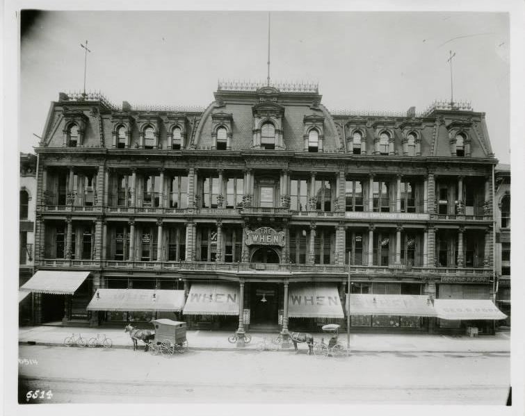
The When Store came to Indianapolis in the mid-1870s from New York City to open a branch store for clothing wholesaler, Owen, Pixley… Read More »The When Store
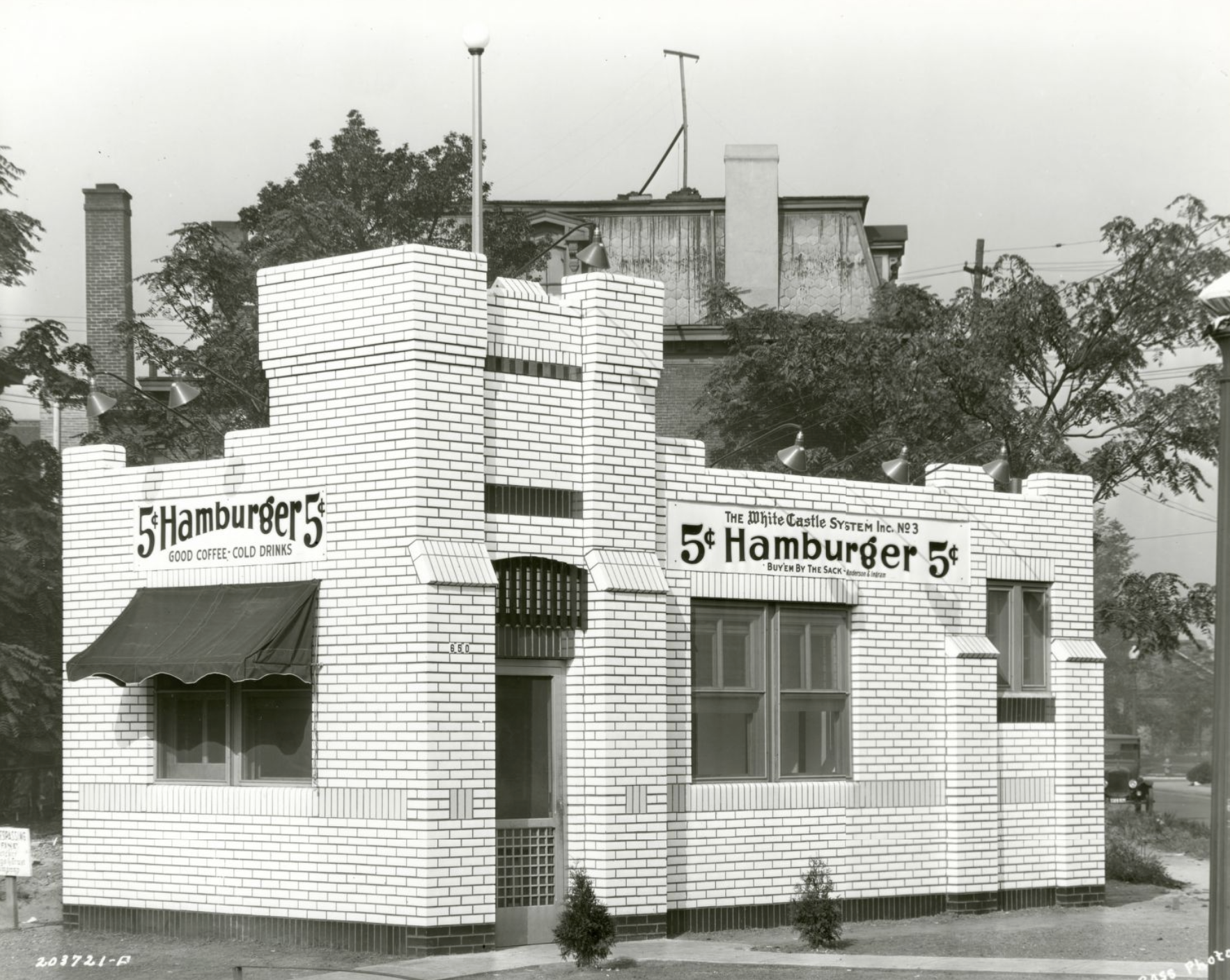
White Castle #3 Indianapolis White Castle #3 opened in 1927. Located at 660 Fort Wayne Avenue, the 600-square-foot square restaurant was a simple… Read More »White Castle #3
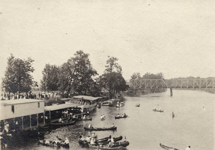
White River The White River begins in Randolph County and flows through 362 miles of Central and Southern Indiana before meeting up… Read More »White River
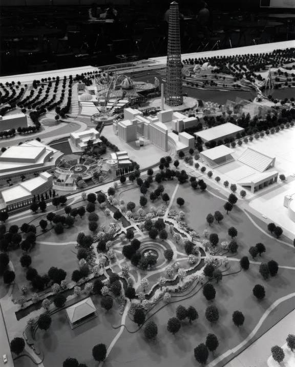
White River State Park In 1979, Indianapolis civic leaders set out to create a new state park to celebrate Indiana and the Hoosier spirit.… Read More »White River State Park
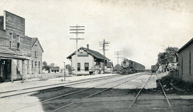
Whitestown Whitestown is a community in southeast corner of in Worth Township, approximately 22 miles northwest of Indianapolis. Whitestown was organized… Read More »Whitestown
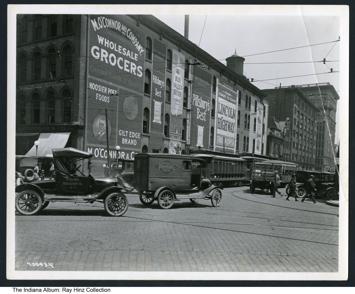
Wholesale District Bounded by Maryland, Delaware, and South streets and Capitol Avenue, the Wholesale District grew up around . Its proximity to… Read More »Wholesale District