Sylvan Ridge Neighborhood Organization Sylvan Ridge Neighborhood Organization is a neighborhood organization bounded by 75th street to the north, 71st Street to the south,… Read More »Sylvan Ridge Neighborhood Organization
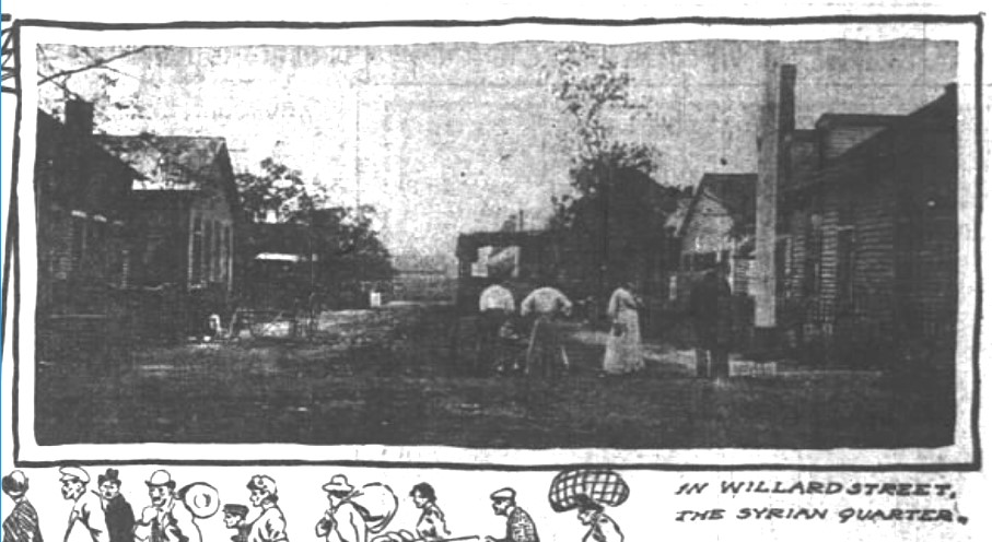
Syrian Quarter Located in northern section of , the Syrian Quarter, also called the Syrian Colony, was the first Arabic-speaking neighborhood in… Read More »Syrian Quarter
Tanglewood Tanglewood Neighborhood Association is a neighborhood organization bounded by 70th Street to the north, 65th Street to the south, railroad… Read More »Tanglewood
Terra Vista Terra Vista is a neighborhood organization bounded by East 71st Street to the north, East 65th Street to the south,… Read More »Terra Vista
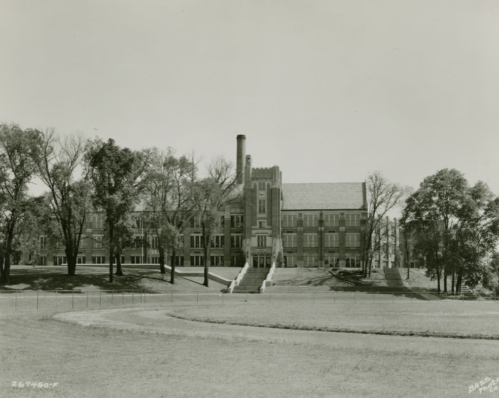
Thomas Carr Howe High School Thomas Carr Howe High School opened in the fall of 1938, marking the culmination of years of struggle by the… Read More »Thomas Carr Howe High School
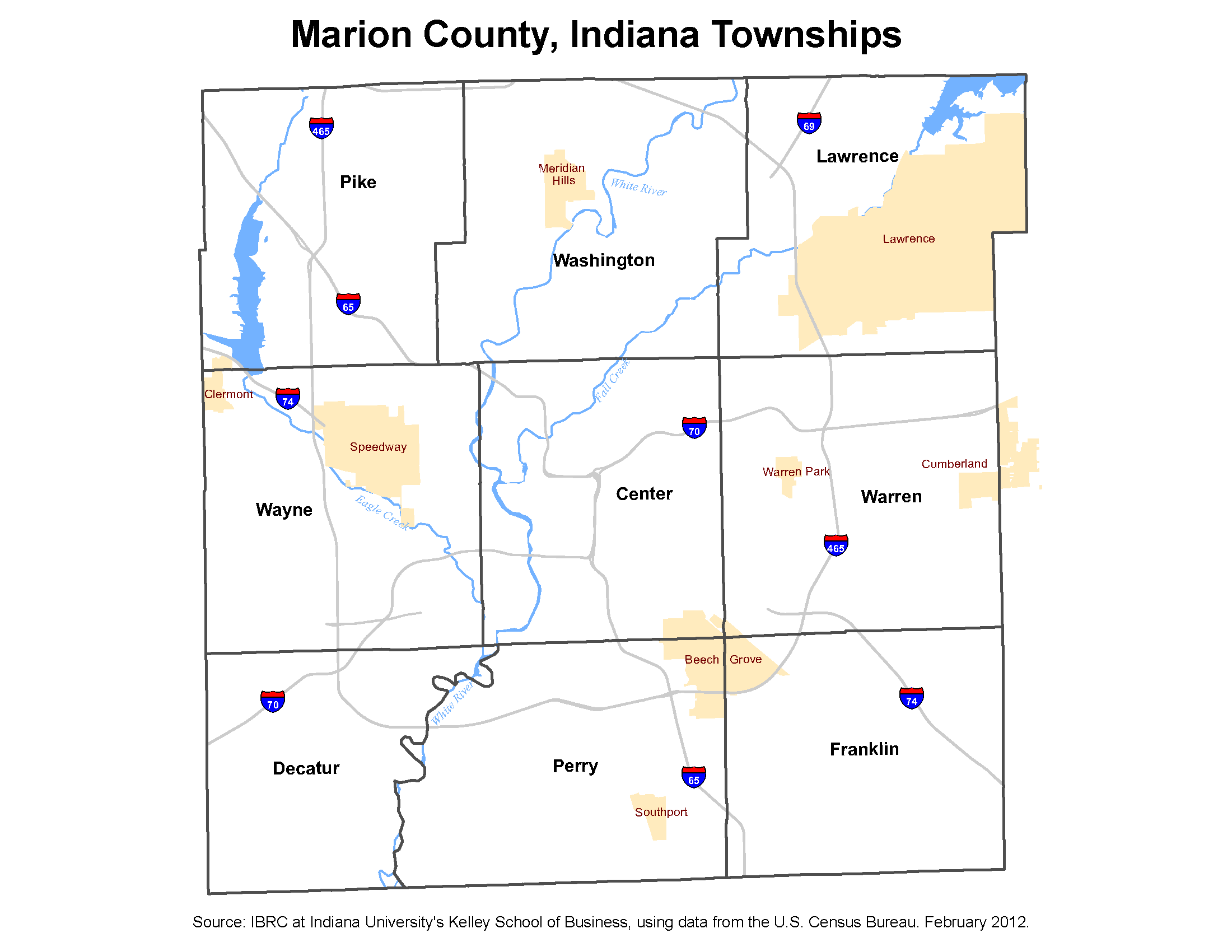
Townships The Indiana Constitution provides for the existence of townships, and successive state laws have instituted township government and its officers.… Read More »Townships
Traders Point Traders Point is a residential area located on Lafayette Road, north of 71st Street, in northwest Marion County. In 1864,… Read More »Traders Point
Tuxedo Park and Grace Tuxedo Park These neighborhoods are bounded by 10th Street, Linwood Avenue, Sherman Avenue, and Washington Street. The area north of Michigan Street… Read More »Tuxedo Park and Grace Tuxedo Park
Twin Aire Twin Aire is a neighborhood bounded roughly by CSX tracks to the north, Prospect Street to the south, CSX tracks… Read More »Twin Aire
United Northwest Area The United Northwest Area (UNWA) is located in what was once a large, unincorporated area known as . It is… Read More »United Northwest Area