Sharp-Springmill-Hoover Sharp-Springmill-Hoover is a neighborhood organization bounded by 73rd Street to the north, 64th Street to the south, Springmill Road to… Read More »Sharp-Springmill-Hoover
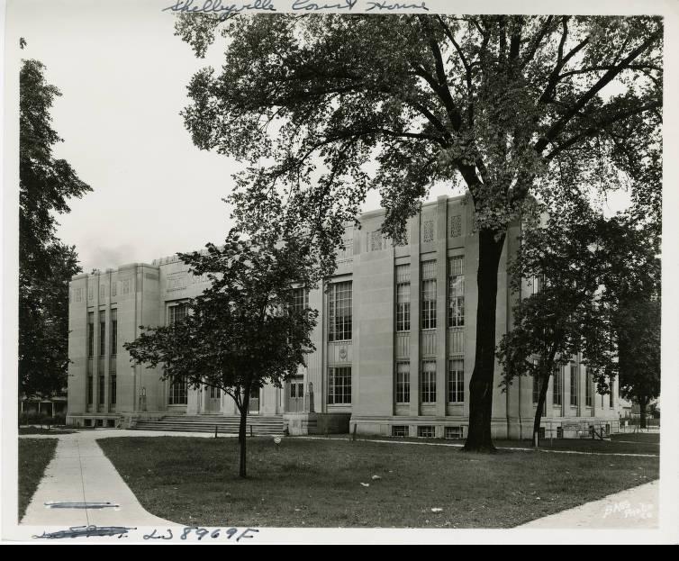
Shelby County Shelby County is adjacent to Indianapolis-Marion County to the southeast and part of the . James Wilson was the first… Read More »Shelby County
Sheridan Heights Sheridan Heights Association for Neighborhood Enhancement (SHANE) is a neighborhood organization bounded by Meadowlark Drive to the north, 38th Street… Read More »Sheridan Heights
Sherwood Forest Sherwood Forest Civic Association is a neighborhood organization bounded by 96th Street to the north, 91st Street to the south,… Read More »Sherwood Forest
Shirley’s One Way Shirley’s Place was a bar and restaurant in the neighborhood of Indianapolis from October 1983 to May 1994. At the… Read More »Shirley’s One Way
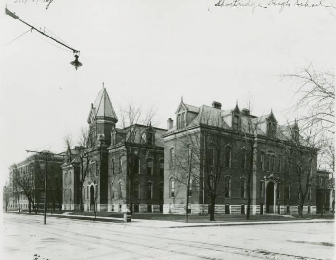
Shortridge High School Although Indianapolis was served by several private academies in the first half of the 19th century, public funding for a… Read More »Shortridge High School
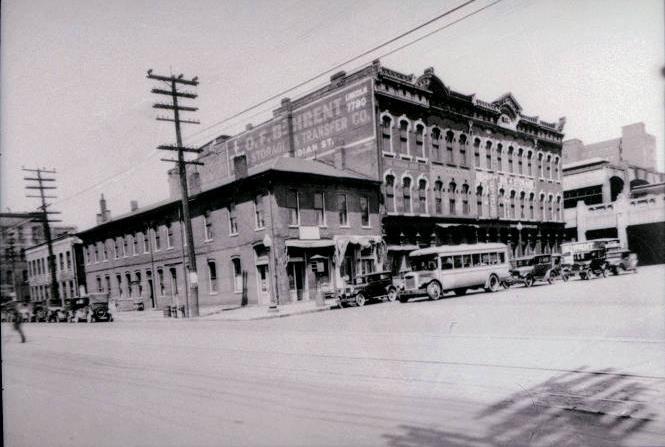
Slippery Noodle Inn “The Noodle,” located on the corner of South and Meridian streets is the oldest standing commercial building in the metropolitan… Read More »Slippery Noodle Inn
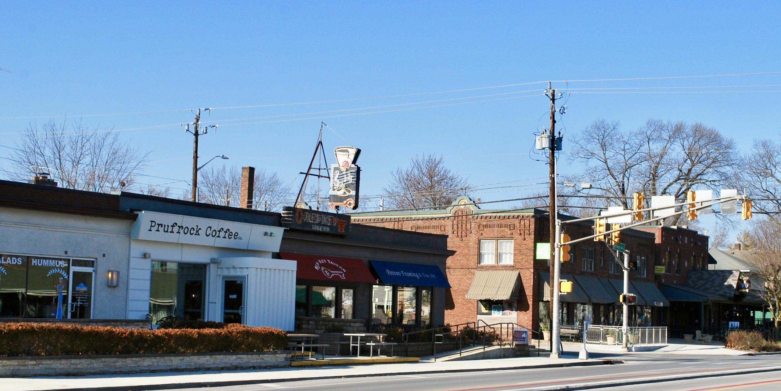
SoBro While the specific area that constitutes South Broad Ripple (SoBro) is disputed, its boundaries can roughly be considered Kessler Boulevard… Read More »SoBro
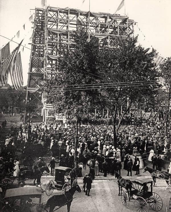
Soldiers and Sailors Monument The Soldiers and Sailors Monument is Indianapolis’ “signature” structure, located in the center of the city’s original plat. Conceived, designed,… Read More »Soldiers and Sailors Monument
South Eastwood South Eastwood Neighbors is a neighborhood organization bounded by I-465 to the north, Thompson Road to the south, South Emerson… Read More »South Eastwood