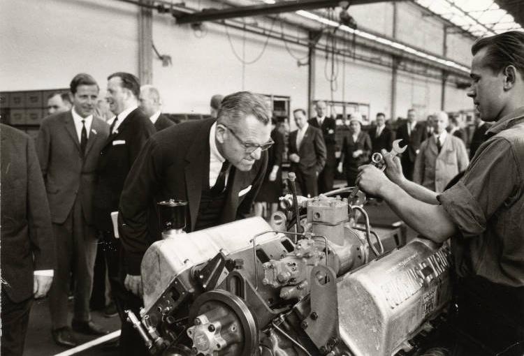
Cummins Indianapolis Distribution Headquarters Founded in 1919, Cummins, Inc. is a global power technology leader based in Columbus, Indiana. The company is organized into… Read More »Cummins Indianapolis Distribution Headquarters
Cunningham Park Neighborhood Association Cunningham Park Neighborhood Association is a neighborhood organization bounded by Buick Drive to the north, Cadillac Drive to the south… Read More »Cunningham Park Neighborhood Association
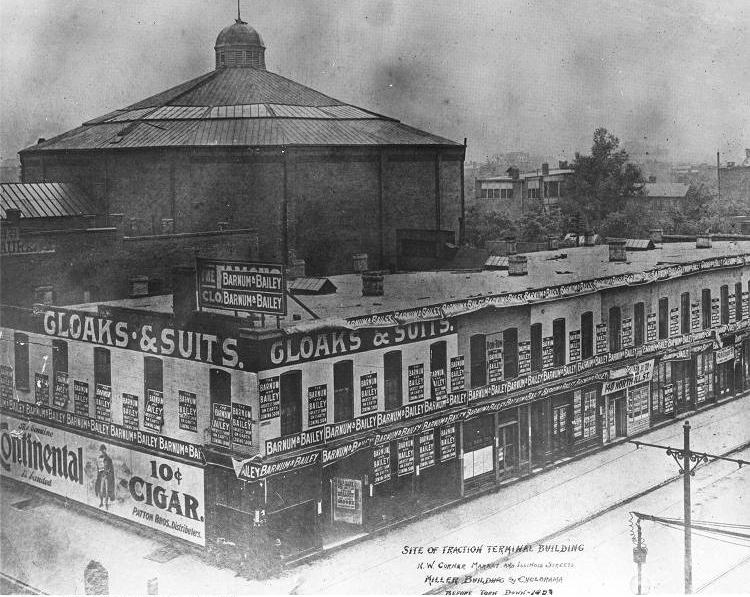
Cyclorama Located on the northside of Market Street just west of Illinois Street, the Cyclorama building exhibited life-size murals and served… Read More »Cyclorama
Dawnbury–Keystone Dawnbury–Keystone Neighborhood Preservation Association is a neighborhood organization bounded by 65th Street to the north, 62nd Street to the south,… Read More »Dawnbury–Keystone
Decatur Township Decatur Township is located in the southwestern part of Marion County and named for Stephen Decatur, a hero of the… Read More »Decatur Township
Delaware Trails Delaware Trails is a northside neighborhood that includes two neighborhood organizations: Delaware Trails North and Delaware Trails South. Delaware Trails… Read More »Delaware Trails
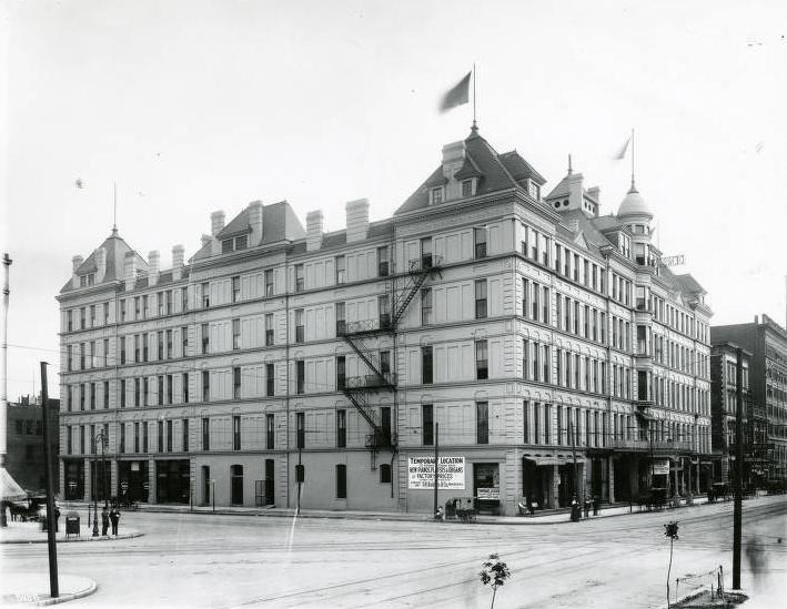
Denison Hotel The New-Denison Hotel, as it was originally known, was reportedly named for two of the investors, and a Cincinnati businessman… Read More »Denison Hotel
Devington Devington is a neighborhood bounded by 46th Street to the north, 38th Street to the south, Shadeland Avenue to the… Read More »Devington
Devon Devon is a neighborhood bounded by Fall Creek Drive to the north, 42nd Street to the south, Emerson Avenue to… Read More »Devon
Devonshire The Devonshire neighborhood is bounded by Binford Boulevard to the northwest, Fall Creek to the south, and Interstate 465 to… Read More »Devonshire