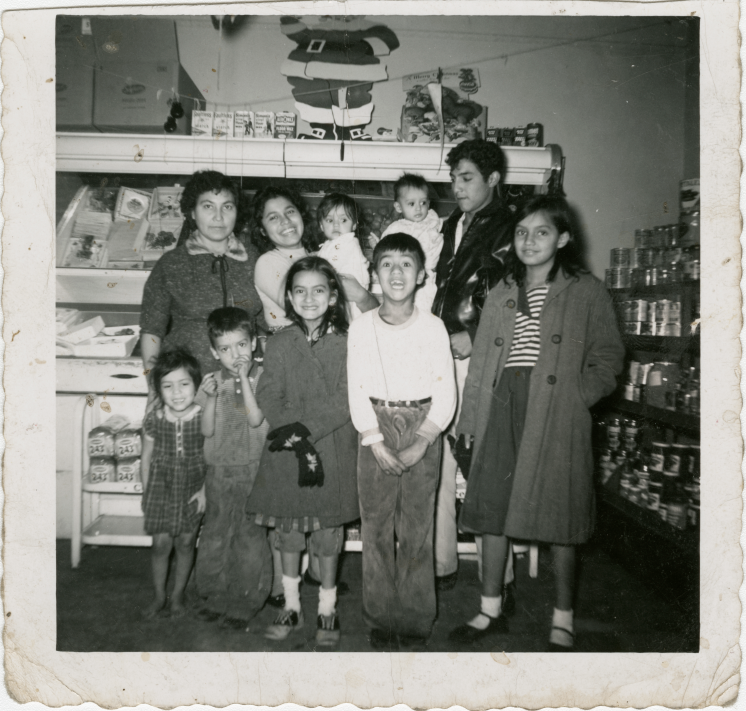
El Barrio Since the late 19th century, a small number of Latinos and Hispanics have called Indianapolis home—illustrated by National Origin numbers… Read More »El Barrio
Emerson Heights Emerson Heights is a neighborhood bounded by 10th Street to the north, Michigan Street to the south, Emerson Avenue to… Read More »Emerson Heights
Englewood Englewood Neighborhood Association is a neighborhood organization bounded by Michigan Street to the north, railroad tracks south of Washington Street… Read More »Englewood
Fairfax Fairfax Neighborhood Association is a neighborhood organization bounded by 10th Street to the north, Vermont Street to the south, Tibbs… Read More »Fairfax
Fairfields-Sylvan Neighborhood Association Fairfields-Sylvan Neighborhood Association is a neighborhood organization bounded by both sides of East 65th Street to the north, Kessler Boulevard… Read More »Fairfields-Sylvan Neighborhood Association
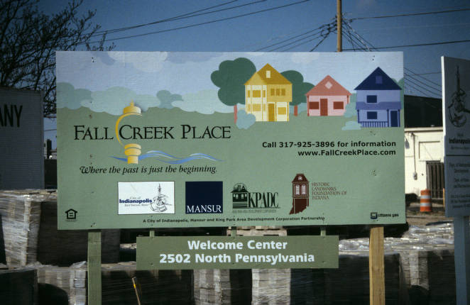
Fall Creek Place Located two miles north of Downtown between 22nd Street and Fall Creek, east of Pennsylvania Street and west of College… Read More »Fall Creek Place
Far Eastside Far Eastside Neighborhood Association is a neighborhood organization bounded by East 30th Street to the north, 10th Street to Post… Read More »Far Eastside
Farley / Westridge Farley, or Farley’s Addition, is a neighborhood east of Interstate 465 and south of the former B&O Railroad. The neighborhood… Read More »Farley / Westridge
Fayette Street Situated along the Indianapolis upper canal area, bounded by 9th , 10th , Martin Luther King Jr., and North Missouri… Read More »Fayette Street
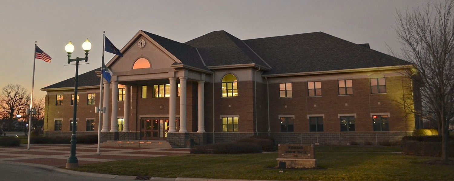
Fishers Since the early 1990s, the Hamilton County town of Fishers, centered between I-69/S.R. 37 and Allisonville Road northeast of Indianapolis,… Read More »Fishers