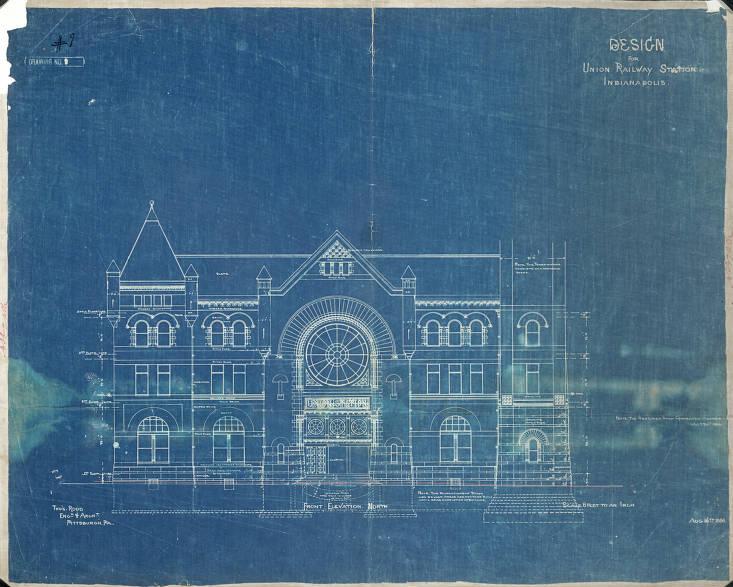
Union Station The country’s first “union station”—that is, a centralized station for the common use of passengers of independent rail lines—was constructed… Read More »Union Station
United Northwest Area The United Northwest Area (UNWA) is located in what was once a large, unincorporated area known as . It is… Read More »United Northwest Area
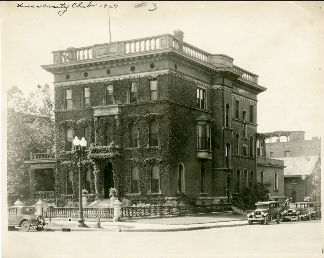
The University Club of Indianapolis The University Club of Indianapolis served as a private men’s social club for the city’s college-educated business leaders. The club… Read More »The University Club of Indianapolis
University Heights University Heights is a southside community roughly bordered by Hanna Avenue, State and Lawrence streets, and Madison Avenue. It began… Read More »University Heights
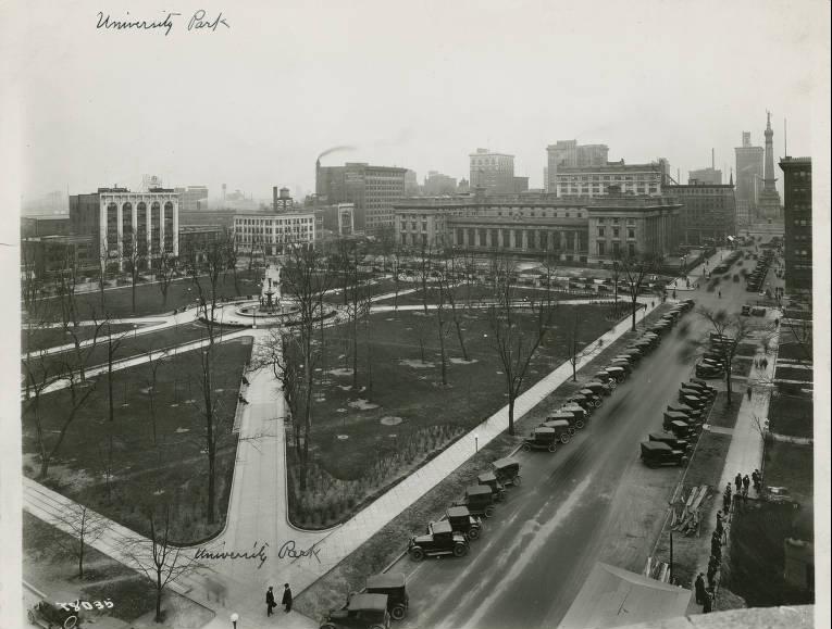
University Park Bounded by New York, Vermont, Pennsylvania, and Meridian streets, University Park is a site that has been reserved for public… Read More »University Park
Upper Canal Neighborhood Association Upper Canal Neighborhood Association is a neighborhood organization bounded by I-65 and 11th Street to the north, North Street to… Read More »Upper Canal Neighborhood Association
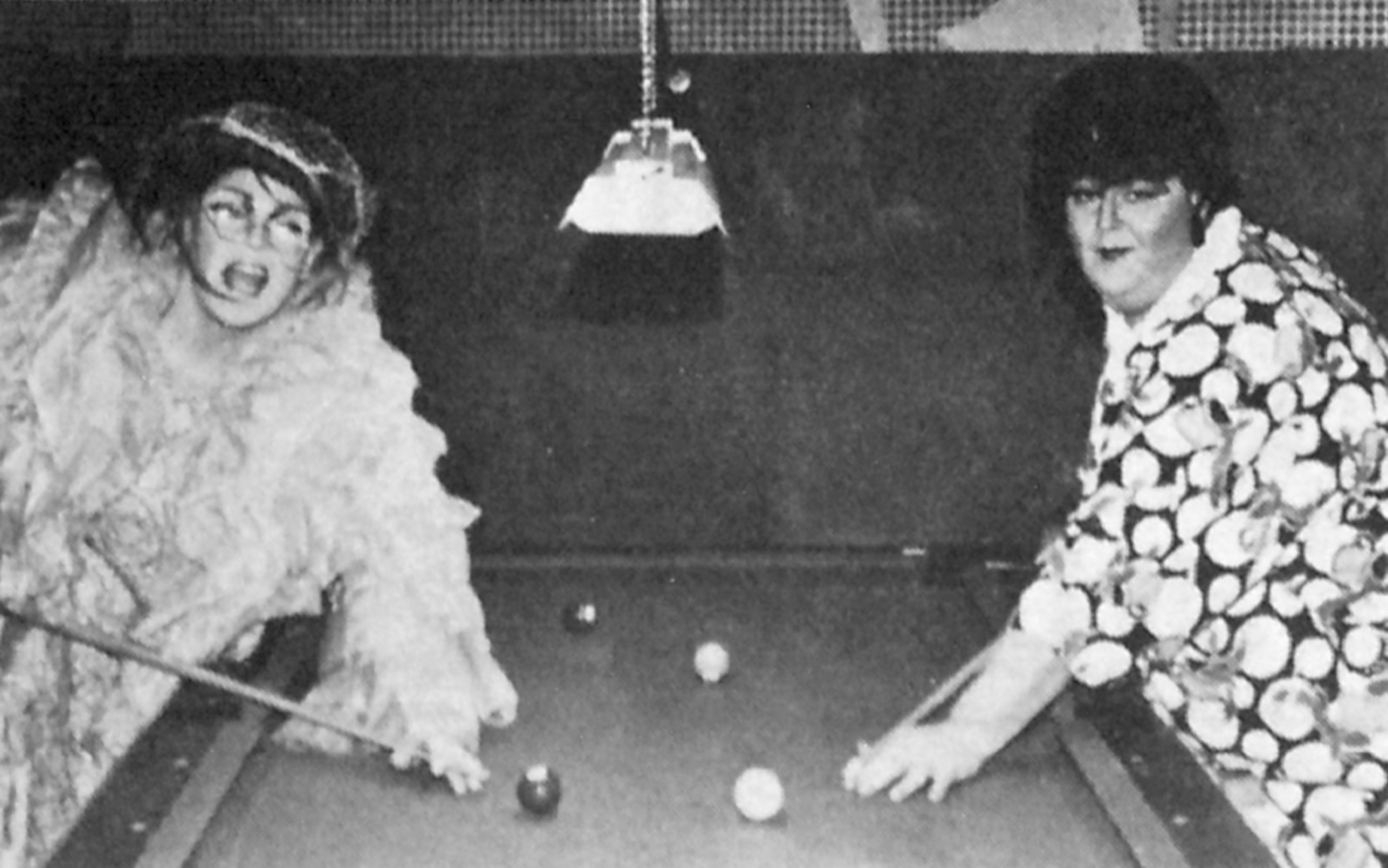
Uptown Connection The Uptown Connection bar and restaurant operated from October 1981 until 1989, serving primarily the LGBTQ+ community. A corporation of… Read More »Uptown Connection
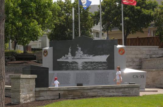
USS Indianapolis Memorial In 1930, construction began on a new heavy cruiser for the U.S. Navy. It was the second of four Navy… Read More »USS Indianapolis Memorial
The Valley The Valley is a neighborhood organization bounded by Washington Street to the north, Morris to the south, White River to… Read More »The Valley
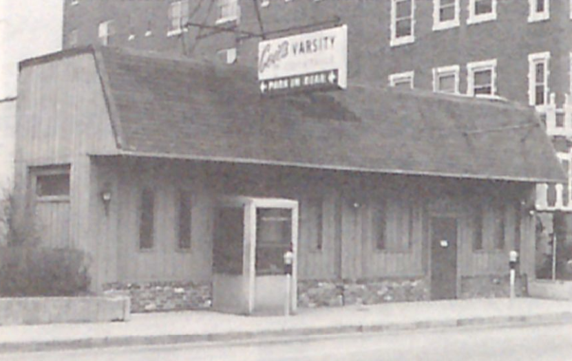
The Varsity Lounge The Varsity Lounge, located in Indianapolis’s historic neighborhood, is thought to be the city’s oldest gay bar and restaurant. Otto… Read More »The Varsity Lounge